Country:
 City:
City:


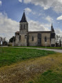
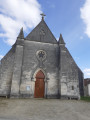
Start from the car park at the Mainxe village hall.
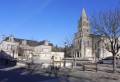
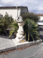
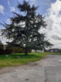
(S/E) Do not join the road; pass between the stone statue and the large cedar tree, walk past the church, leave the road on your right and continue straight ahead until you reach a fork at the village exit, in the left-hand bend.
(1) Take a small road straight ahead. Turn left onto a grassy track. Continue to the housing estate; at the T-junction, turn right onto a grassy track, leaving the road on your left.
Follow the track downhill for about 100 metres, then turn left onto the first grassy track just after the last house and just before the vineyards.
Head towards the houses; when you reach the road, follow it, keeping to the right. At the end of the road, at the T-junction, turn left. You’ll come to a crossroads (with a cross on the left behind the tree) at the D736.
(2) Cross it carefully and head straight on towards ‘Chez Chapron, Le Plantier’ along the road for about 350 m; at the 90° left-hand bend, leave the road by turning right onto the small path leading downhill. At the T-junction, turn left until you reach the next junction 150 m further on.
(3) Turn right onto the track, head towards a small copse, leave it on your right, and follow the track as it bends to the left, passing the end of a small orchard on your left. Continue and turn right at the first track, which is half stone and half grass.
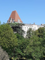
Head up towards the village of La Chaise (there’s a very beautiful water tower straight ahead of you). When you reach the village, carry on along the road. Continue to the main road, then keep left for 100 m.
(4) Before leaving the village, head due north and take the first path on the right, lined with trees.
Follow this path, which is grassy at the start and then formerly tarmacked. Continue to the road, then turn right to join the D10 at a crossroads.
(5) Cross the D10 with care and take the dead-end track opposite for 150 m. Turn right at the first track between the first and second vineyards. At the corner of the second vineyard, turn left and then right at the next track,
Carry on straight ahead until you reach the D736.
(6) Cross it carefully by first turning right then left, and take the small path into the woods. After about 75 m, take the path on the left and follow it, ignoring the small tracks to the right and left; keep as straight as possible. As you leave the woods, go straight on between the vineyard and the woods. Go round the Montagan house by turning right then left, and continue straight on along the small road until you reach a T-junction.
(7) Turn left and, at the next junction, turn right onto Route des Renardières until you reach a multi-way junction.
(8) Takethe second right along the road until you reach the T-junction at the D10.
(9) Turn left onto this road, taking great care for about 100 m, then turn right onto a wide, unpaved track. Pass to the left of the small copse and ignore the tracks on the right. Continue along the grassy track, which bends to the left and then almost immediately to the right; head towards the small copse, pass to its left and carry on straight ahead until you reach the road.
(10) Turn left, then immediately left again onto a small road, heading towards Chez Juillier. Turn right at the first road leading uphill towards the trees. Continue straight on to the village of Chez Bacou, which has a very beautiful dovecote. Pass it, keeping it on your right. You’ll reach a crossroads at Chez Moreau.
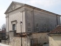
(11) Turn right and carry on straight along the path until you reach the road. Turn left onto this road and ignore two small roads on your right. Pass the football pitch and the cemetery on your right and carry on straight ahead. At the next crossroads, turn right, just after the temple, and head for the car park (S/E).


 Visorando Member
 Easy
Easy 
 Local authority