The Côt Route (short circular route)

Juillac-Le-Coq is crossed by the Mothe stream, a tributary of the Charente. The village has a population of around 667. Wine-growing is its main industry.

Details

406832
Creation:
Last update:
Last review:
  • Walking
    Activity: Walking
  • ↔
    Distance: 3.77 mi
  • ◔
    Average duration: 1h 45 
  • ▲
    Difficulty: Easy

  • ⚐
    Back to start: Yes
  • ↗
    Ascent: + 69 ft
  • ↘
    Descent: - 69 ft

  • ▲
    Highest point: 223 ft
  • ▼
    Lowest point: 138 ft

Description of the walk

Start at the boules court. Green signposting with alternative routes marked in yellow (24 km) and blue (9 km)

(S/E) Cross the road towards the church in the village centre. At the junction, cross the road and carry on straight ahead. Leave the church on your right, then turn left. At the end of the street, turn right, then immediately left. At the next junction, turn right and enter Le Foucaudat.

(1) Then turn left and, at the next junction, turn right. At the crossroads after the last houses, follow a limestone path to the left. Continue to the right. At the three-way junction, follow the path to the left for about a hundred metres.

(2) Then take the limestone track on your right and ignore a track on the right. At the next junction, turn right.

(3) At the next junction, turn right and follow the path for about 1 km, ignoring a turn-off to the right and then to the left.

(4) At the junction, turn left towards the houses, then turn left at the end of the road and continue for a few metres.

(5) Turn right onto the D44. Head towards the village and then retrace your steps to reach the boules court (S/E).


Waypoints

  1. S/E : mi 0 - alt. 194 ft - Boules court
  2. 1 : mi 0.54 - alt. 174 ft - Le Foucaudat, on the left
  3. 2 : mi 1.33 - alt. 203 ft - Crossroads (elevation 62)n, limestone path on the right
  4. 3 : mi 2.08 - alt. 138 ft - Crossroads (marker 41), turn right
  5. 4 : mi 2.95 - alt. 167 ft - Junction (marker 51), turn left
  6. 5 : mi 3.3 - alt. 144 ft - D44, turn right
  7. S/E : mi 3.77 - alt. 194 ft - Boules court

Notes

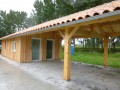
Picnic tables are available at the start.

Worth a visit

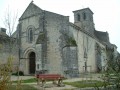
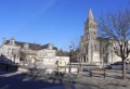
Places to see in the village: the Pigeonnier, Saint-Martin’s Church, the Hosanna Cross, Logis du Frêne.

Reviews and comments

3.8 / 5
Based on 3 reviews

Reliability of the description
3 / 5
Ease of following the route
4.3 / 5
Route interest
4 / 5
EtienneQR
EtienneQR

Overall rating : 4.7 / 5

Date of your route : Nov 04, 2018
Reliability of the description : ★★★★☆ Good
Ease of following the route : ★★★★★ Very good
Route interest : ★★★★★ Very good

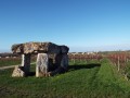
Autumnal light, a panoramic view of the vineyards, a mill in the middle of the vineyard, and such peace and quiet!

Machine-translated

bibi
bibi ★

Thank you for this feedback; the community of communes will no doubt respond. If you have any information or additional details that we could include in the description, we’d be grateful to hear them – it will help us.
Kind regards

Machine-translated

Lyra78
Lyra78

Overall rating : 3 / 5

Date of your route : Mar 18, 2018
Reliability of the description : ★★☆☆☆ Disappointing
Ease of following the route : ★★★★☆ Good
Route interest : ★★★☆☆ Average

A walk through the vineyards.
The route description isn’t detailed enough (plus the green signposts are no longer there), and it’s tricky to rely on the map when not all the existing paths are shown on it.
In short, we had to get the app out and turn on the GPS, which we followed the whole way to stay on course.

Machine-translated

josiane farchaud
josiane farchaud

Overall rating : 3.7 / 5

Date of your route : Feb 12, 2018
Reliability of the description : ★★★☆☆ Average
Ease of following the route : ★★★★☆ Good
Route interest : ★★★★☆ Good

THE GREEN ROAD MARKINGS NO LONGER EXIST AND THERE ARE JUNCTIONS WITHOUT ANY ROAD SIGNS;
Kind regards

Machine-translated

Other walks in the area

For more walks, use our search engine .

The GPS track and description are the property of this route's author. Please do not copy them without permission.