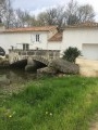
Malaville Fountains Trail

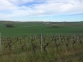
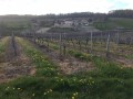
A route that follows the old railway line for part of the way and, for the rest, offers a walk through the vineyards with some very beautiful views.

Details

6512538
Creation:
Last update:
Last review:
  • Walking
    Activity: Walking
  • ↔
    Distance: 6.56 mi
  • ◔
    Average duration: 3h 20 
  • ▲
    Difficulty: Moderate

  • ⚐
    Back to start: Yes
  • ↗
    Ascent: + 364 ft
  • ↘
    Descent: - 371 ft

  • ▲
    Highest point: 430 ft
  • ▼
    Lowest point: 187 ft
  • ⚐ Country: France
  • ⚐ City: Malaville (16120)
  • ⚑
    Start/End: N 45.557996° / W 0.096849°
  • ❏
    IGN map(s): Ref. 1632SB
  • Hour-by-hour weather

Description of the walk

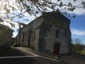
Start from the church square in Malaville.

(S/E) Head west-north-west and follow the road downhill, passing the church and then a tennis court on your left.

(1) After about a hundred metres, turn left, walk past the old railway station and follow the path, which is in fact the embankment of the old railway line. Follow this path straight on until you reach the hamlet of Chez Pillet.

(2) Turn right at the fountain, then left, walking alongside the vineyard. At the end of the vineyard, turn left to rejoin the old railway line. Turn right. Cross another road and take a left-right turn to follow the path on the other side, heading due south.

(3) After about 200 m, turn right onto a dirt track that climbs between plots of vineyards. You’ll come out onto a road; follow it to the left. At the junction that appears immediately, turn right to go round the hamlet of Audeville.

(4) When the road turns 90° to the left, turn right between two buildings. Pass further buildings on your right, then turn left to walk between two vineyard plots. Go round this hamlet and turn right. Further on, turn right to reach a ridge path (panoramic view).

(5) Then turn right and continue north-north-west through the vineyards, ignoring all side paths. Carry on along a dirt track, passing the hamlet of Chez Séville on your left. Shortly afterwards, just before a small copse, turn left. Ignore a path on the left and continue westwards through the vineyards.

(6) At the three-way junction, veer to the right and go straight on until you reach a small road. Then turn right through the vineyards. You’ll come out onto a road; follow it to the right and pass the hamlet of Le Broix.

(7) When the road bends to the right, carry on straight ahead (north) along a track, passing a house on your left. You’ll come to a road a little further on; follow it as it continues. At the T-junction that appears shortly afterwards, follow the road to the right for about fifty metres.

(8) Then take thefirst track on the left. About 200 metres further on, pass between two copses and turn right along the track. Pass the Fontaine du Breuil, turn right along the track and reach the hamlet of Le Breuil. Pass the first buildings on your left.

(9) When the road curves to the right, take a track on the left and walk alongside a small copse on your right. Immediately afterwards, first turn left then right to walk alongside another copse on your right. You’ll come out onto a small road; first turn right then left, passing a house on your left. At the corner, first turn right then left again and walk alongside a vineyard on your left.

(10) At the corner of the vineyard, turn right onto a path that leads into the woods (path not shown on the map). Head straight on (east), leave the woodland and join a road. Turn right and pass through the hamlet of Chez Gachet. When the road bends to the right, take a track on the left and continue straight on (east-southeast) between the vineyard plots.

(11) Turn right at the fork and join the D152 at the hamlet of La Tonnelle. Head down to the left towards the village of Malaville.

(1) Carry on straight ahead to the church (S/E).

Waypoints

  1. S/E : mi 0 - alt. 243 ft - Place de l’ - Église Saint-Saturnin (Malaville)
  2. 1 : mi 0.07 - alt. 230 ft - Crossroads marking the end of the circular loop
  3. 2 : mi 0.91 - alt. 207 ft - Chez Pillet
  4. 3 : mi 1.64 - alt. 187 ft - Junction
  5. 4 : mi 2.11 - alt. 253 ft - Audeville – T-junction
  6. 5 : mi 2.48 - alt. 279 ft - T-junction – Ridge path
  7. 6 : mi 3.32 - alt. 325 ft - Three-way junction
  8. 7 : mi 3.99 - alt. 243 ft - The Broix spring
  9. 8 : mi 4.72 - alt. 387 ft - Start of the path
  10. 9 : mi 5.4 - alt. 387 ft - Le Breuil – Start of the path on the left
  11. 10 : mi 5.67 - alt. 384 ft - The Breuil Wood
  12. 11 : mi 6.23 - alt. 312 ft - Junction
  13. S/E : mi 6.56 - alt. 243 ft - Place de l’ - Église Saint-Saturnin (Malaville)

Worth a visit

Fountains – Malaville washhouse – numerous panoramic views.

Reviews and comments

4.4 / 5
Based on 3 reviews

Reliability of the description
4.5 / 5
Ease of following the route
4.3 / 5
Route interest
4.3 / 5
BELLEVIGNE
BELLEVIGNE

Thank you for your feedback. You’re right, we should take another look at this timber.

Machine-translated

PRL
PRL

Overall rating : 4 / 5

Date of your route : Feb 22, 2024
Reliability of the description : Not used / Not applicable
Ease of following the route : ★★★★☆ Good
Route interest : ★★★★☆ Good
Very busy route : No

Walking through the woods, where there was no path to be seen either on the map or under our feet, was a bit of a gamble but great fun
Beautiful fountains and magnificent views

Machine-translated

jeanclaudelafon
jeanclaudelafon

Overall rating : 4.3 / 5

Date of your route : Nov 11, 2021
Reliability of the description : ★★★★☆ Good
Ease of following the route : ★★★★★ Very good
Route interest : ★★★★☆ Good
Very busy route : No

Part of the route (a former railway line at KM 2) is signposted as private but allows hikers to pass; motorised vehicles are prohibited: (the landowner has given permission for access.)
At KM 4, take the road on the right: do not go as far as the Bois du Côteau, as the path through the woods is no longer passable.

Machine-translated

BELLEVIGNE
BELLEVIGNE

Good evening. I’ve updated the route and the description. You’re right – at that point, you need to follow the green markings and climb a little further up through the vineyard before joining the old railway line a bit further on.
Apologies for the inconvenience, and I hope you enjoy your walks.

Machine-translated

Cmlv
Cmlv

Overall rating : 4.7 / 5

Date of your route : Jun 09, 2021
Reliability of the description : ★★★★★ Very good
Ease of following the route : ★★★★☆ Good
Route interest : ★★★★★ Very good
Very busy route : No

Hello, I ran into a problem at waypoint 2: the old railway line from that point now appears to be a private road (there’s a sign and a chain further on). I didn’t push on. So I turned back and made my way to waypoint 8 by taking a detour up the hill, through the vineyards, to make up for lost time and at least complete the circular part of the route. It’s a shame, as these little valleys are full of charm; it looked promising and was very peaceful.

Machine-translated

Other walks in the area

For more walks, use our search engine .

The GPS track and description are the property of this route's author. Please do not copy them without permission.