The Petaux Route (short circular route)

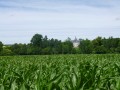
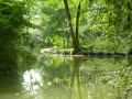
The Collinaud, a tributary of the Né, flows through the village. Whilst Ambleville is primarily focused on wine-growing, it also has fertile land suitable for growing cereals.

Details

385468
Creation:
Last update:
Last review:
  • Walking
    Activity: Walking
  • ↔
    Distance: 4.13 mi
  • ◔
    Average duration: 2h 05 
  • ▲
    Difficulty: Easy

  • ⚐
    Back to start: Yes
  • ↗
    Ascent: + 207 ft
  • ↘
    Descent: - 200 ft

  • ▲
    Highest point: 279 ft
  • ▼
    Lowest point: 154 ft
  • ⚐ Country: France
  • ⚐ City: Ambleville (16300)
  • ⚑
    Start/End: N 45.552516° / W 0.221623°
  • ❏
    IGN map(s): Ref. 1632SB
  • Hour-by-hour weather

Photos

Description of the walk

Blue signposting (alternative route: yellow signposting, 10.89 km)

(S/E) Start at Place de l’Église. Head towards the road in front of you and carry on straight ahead to the junction 250m away (RD 699). Cross over to the left-hand-most road, heading towards the village centre for about 150m. Before you reach the first houses, take the dirt track on your left to walk alongside the houses. Continue along this track, keeping straight on, until you reach the road after about 600m.

(1) Turn left onto this road and take the first limestone track on your right after about 100 metres, then carry on straight ahead. Turn left and continue to the tarmac road at the hamlet of Chez Philbert, about 350 metres away.

(2) Turn left, then right after 100 metres onto the first track, and carry on straight ahead until you reach the hamlet of La Rousselière, about 350 metres away. When you come to some trees, follow the track by turning right and carry on straight ahead until you reach a road

(3) Cross it and take the path directly in front of you. After about 200 metres, you’ll enter a wooded area; follow the path for about 150 metres.

(4) At the junction, turn right and carry on straight ahead for about 550 metres.

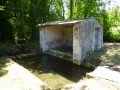
(5) Take the path on your left and ignore the path on your right (not shown on the IGN map) towards the La Voute washhouse, where you can make a return trip (directional arrow on site). Resume the route towards the hamlet of La Voute and take the first street on your right. Leave the hamlet and continue along the road to the left at the three-way junction. At the junction with the D49, head towards the path opposite and pass by the trees on the left.

(6) Turn right towards the woodland and turn left immediately after the tree. Turn right, then left to join the limestone path. Go round the edge of the woodland, continuing along the path. After a right-hand bend, turn left towards the houses.

(7) Turn left onto the RD49 and carry on towards Le Bourg. On your right, you’ll see the path you took on the way out. Cross the RD699 and take the road directly opposite you. Carry on straight ahead until you reach the starting point, Place de l’Église (S/E).

Waypoints

  1. S/E : mi 0 - alt. 157 ft - Place de l’Église
  2. 1 : mi 0.6 - alt. 164 ft - Turn left onto the road
  3. 2 : mi 0.9 - alt. 200 ft - A place known as ‘Chez Philbert’
  4. 3 : mi 1.69 - alt. 253 ft - Crossing a road
  5. 4 : mi 1.92 - alt. 243 ft - Turn right at the junction
  6. 5 : mi 2.26 - alt. 203 ft - Path on the left
  7. 6 : mi 3.05 - alt. 223 ft - On the right, towards the woods
  8. 7 : mi 3.69 - alt. 226 ft - Turn left onto the D49
  9. S/E : mi 4.13 - alt. 157 ft - Place de l’Église

Worth a visit

Reviews and comments

4 / 5
Based on 1 review

Reliability of the description
4 / 5
Ease of following the route
4 / 5
Route interest
4 / 5
MystiChou
MystiChou

Overall rating : 4 / 5

Date of your route : Mar 20, 2023
Reliability of the description : ★★★★☆ Good
Ease of following the route : ★★★★☆ Good
Route interest : ★★★★☆ Good
Very busy route : No

A nice little walk.

Machine-translated

Momo17
Momo17

Hello
We didn’t choose that particular route that day, as it was too far from Berneuil, where we were due to go next.
We went along the Chemin des ânes in VIVILLE.
We found this route pleasant, although the signposting was missing at a few key points (luckily, the YELLOW route ran very close by and was very well signposted).

  • Starting point: the Town Hall rather than the picnic area, which isn’t signposted
  • (2) All that remains of this solitary tree is a pitiful dead stump, which is likely to disappear under the weight of a tractor
  • (4) Change of direction before ‘Chez GADRAS’; a sign could be placed on the electricity pole pointing towards the woodland on the hillside
  • (5) There is no shortage of posts in the woodland where the yellow markers are affixed, but the red ones are missing, raising questions about whether the path continues as it should.

Thank you for all the work done and for ensuring the long-term preservation of the signposting.
Kind regards.
Maurice DOUTEAU

Machine-translated

Other walks in the area

For more walks, use our search engine .

The GPS track and description are the property of this route's author. Please do not copy them without permission.