


Refine your search for walks in Lucgarier
Lucgarier walks


 The Chemin Henri IV in Lucgarier
 Visorando Member
 4.34 mi
 +410 ft
 -397 ft
 2h 20
2h 20
 Easy
Easy
 Departure from Lucgarier (Pyrénées-Atlantiques)
A hilly route through the woods along the Chemin Henri IV. The second part is mainly on a gravel track. There is little tarmac.
In the footsteps of Henry IV from Soumoulou
 7.60 mi
+325 ft
-328 ft
3h 45
7.60 mi
+325 ft
-328 ft
3h 45
 Average
Departure from Soumoulou (Pyrénées-Atlantiques)
Average
Departure from Soumoulou (Pyrénées-Atlantiques)
A circular route around the lower part of the village of Soumoulou via Gomer, where you can discover part of Henri IV's trail, the GR® 782, in the hills. The village's central square offers easy parking.
Andoins from Soumoulou, the balcony of the Pyrenees
 9.40 mi
+400 ft
-417 ft
4h 40
Average
Departure from Soumoulou (Pyrénées-Atlantiques)
9.40 mi
+400 ft
-417 ft
4h 40
Average
Departure from Soumoulou (Pyrénées-Atlantiques)
An accessible and varied circular route on the balcony of the Pyrenees. Starting and ending in the centre of Soumoulou, this hike is appealing for its practicality: spacious car park, easy start and a circular route that avoids any complex logistics. The route alternates between quiet roads, country lanes and PR® footpaths, offering a gentle immersion in the contrasting landscapes of the Pyrenees and the Béarn plains.
Circular route from Nousty via La Houn de Moussu and Chemin Henri IV.
 8.70 mi
+492 ft
-495 ft
4h 25
Average
Departure from Nousty (Pyrénées-Atlantiques)
8.70 mi
+492 ft
-495 ft
4h 25
Average
Departure from Nousty (Pyrénées-Atlantiques)
Easy country hike around Nousty, starting from the village centre with its beautiful buildings and wash house.
On this very rural route, the Houn de Moussu is a local curiosity, a fountain providing water that is very good for your health, according to the elders. Legend has it that Henri IV drank from it when travelling from Pau to Coarraze.
There is a viewpoint shortly after the 419-metre altitude on the Chemin Henri IV.
The return through the fields, crossing fords, adds extra charm to the outing.
Between Saint-Vincent and Coarraze
14.44 mi
+1,709 ft
-1,732 ft
8h 10
Average
Departure from Saint-Vincent (Pyrénées-Atlantiques) (Pyrénées-Atlantiques)
A walk above the Nay plain, with panoramic views of the Pyrenees and the Piedmont!! Bring a picnic and enjoy the fresh air!!!
Rontignon ridge and hillside trail
 6.48 mi
+1,063 ft
-1,060 ft
3h 55
Average
Departure from Rontignon (Pyrénées-Atlantiques)
6.48 mi
+1,063 ft
-1,060 ft
3h 55
Average
Departure from Rontignon (Pyrénées-Atlantiques)
A beautiful route on the hillsides of Rontignon, a few kilometres from Pau. Several beautiful views of the ridges and the Pyrenees.
Piétat and its fountains
 5.89 mi
+518 ft
-541 ft
3h 10
Easy
Departure from Pardies-Piétat (Pyrénées-Atlantiques)
5.89 mi
+518 ft
-541 ft
3h 10
Easy
Departure from Pardies-Piétat (Pyrénées-Atlantiques)
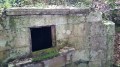
First, discover the site itself, the Sanctuary of Notre-Dame de Piétat, built in 1661 by the inhabitants of the farming community of Pardies. The region is rich in history! Next, enjoy the splendid view of the Nay valley to the south-east of Pau, and another beautiful panorama of the Pyrenees from the sanctuary's orientation table. Finally, you can have fun discovering the fountains and other springs hidden in the woods and hills of the site....
Mazeres-Assat circular loop via the Henri IV path
 15.36 mi
+292 ft
-282 ft
7h 20
15.36 mi
+292 ft
-282 ft
7h 20
 Difficult
Departure from Mazères-Lezons (Pyrénées-Atlantiques)
Difficult
Departure from Mazères-Lezons (Pyrénées-Atlantiques)
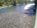
A circular loop of almost 25 kilometres taking you along the banks of the Gave, past the whitewater stadium, Franqueville Castle and part of the Henri IV path linking Pau to Lourdes. You will then return via Assat and the left bank of the Gave back to your starting point.
From Mazeres to Pardies Piétat
12.52 mi
+974 ft
-974 ft
6h 35
Difficult
Departure from Mazères-Lezons (Pyrénées-Atlantiques)
A lovely walk along roads and tracks, including a visit to the Piétat Sanctuary and a return route via the ridges of the Baliros and Narcastet hills, back to the starting point in Mazères.
The Menhir of the Ger Plateau
 7.30 mi
+538 ft
-538 ft
3h 50
Average
Departure from Ibos (Hautes-Pyrénées)
7.30 mi
+538 ft
-538 ft
3h 50
Average
Departure from Ibos (Hautes-Pyrénées)
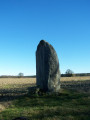
The route starts at the top of the Ger hill in Ibos and takes you to the Menhir on the Ger plateau. After entering the woods, the route becomes shaded and you will walk up the Géline. You will see a mini waterfall. You may even spot some deer...
Moderator's note : the slate bridge has been destroyed: see the notice dated 21/03/2022.
Crossing Pau and Bizanos via the Château de Franqueville
 7.50 mi
+187 ft
-207 ft
3h 35
Average
Departure from Pyrénées-Atlantiques
7.50 mi
+187 ft
-207 ft
3h 35
Average
Departure from Pyrénées-Atlantiques
A walk exploring the gardens, parks and squares of Pau and Bizanos, passing through the Ravin du Hédas, Pau Castle, the Eaux Vives Stadium and the hillside of Franqueville Castle; along the Gave de Pau, the Ousse, Bouries and Ariou Merdé streams; with magnificent views of the Jurançon hillsides and the Pyrenees, stretching from the Château de Pau to the heights of the Château de Franqueville.
The Mousqué plateau
 Tourist office
 2.79 mi
+568 ft
-564 ft
1h 45
Easy
Departure from Saint-Pé-de-Bigorre (Hautes-Pyrénées)
2.79 mi
+568 ft
-564 ft
1h 45
Easy
Departure from Saint-Pé-de-Bigorre (Hautes-Pyrénées)
This beautiful, accessible walk is steeped in history; it follows the old Pontacq road used by charcoal burners in days gone by. Once you arrive at the Mousqué plateau, you can enjoy a shaded picnic area at the foot of century-old oak trees. From there, admire the superb view of the Saint-Péen massif and its countryside, then the Nay plain stretching all the way to Pau.
Long circular from Le Mousqué to Saint-Pé-de-Bigorre
 4.68 mi
+896 ft
-902 ft
2h 55
Average
Departure from Saint-Pé-de-Bigorre (Hautes-Pyrénées)
4.68 mi
+896 ft
-902 ft
2h 55
Average
Departure from Saint-Pé-de-Bigorre (Hautes-Pyrénées)
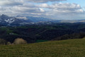
A must-visit spot for the locals of Saint-Pé and their friends, the peaks of Le Mousqué and La Tourette offer a change of scenery and magnificent panoramic views of the surroundings of Saint-Pé-de-Bigorre.Ideal at sunset in summer.
Around Saint-Pé-de-Bigorre
 4.35 mi
+512 ft
-538 ft
2h 25
Average
Departure from Saint-Pé-de-Bigorre (Hautes-Pyrénées)
4.35 mi
+512 ft
-538 ft
2h 25
Average
Departure from Saint-Pé-de-Bigorre (Hautes-Pyrénées)
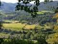
In the Hautes-Pyrénées, near Lourdes, Saint-Pé-de-Bigorre reveals some of its charms during this hike: architecture, limestone massif and caves (with views of the Gave de Pau and the surrounding mountains), and even its Devil's Bridge!
Prairie de la Cantilerie or Prairie du Lapin Qui Tricote
 2.38 mi
+200 ft
-217 ft
1h 15
Easy
Departure from Saint-Pé-de-Bigorre (Hautes-Pyrénées)
2.38 mi
+200 ft
-217 ft
1h 15
Easy
Departure from Saint-Pé-de-Bigorre (Hautes-Pyrénées)
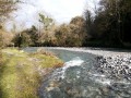
A few kilometres from the centre of Saint-Pé, a small pebble beach is the perfect spot for a refreshing dip in summer and a peaceful picnic break.
The knitting rabbit is hiding in the tall grass on the neighbouring property!
Montagnou de la Lit to Saint-Pé-de-Bigorre
 2.56 mi
+659 ft
-659 ft
1h 45
Average
Departure from Saint-Pé-de-Bigorre (Hautes-Pyrénées)
2.56 mi
+659 ft
-659 ft
1h 45
Average
Departure from Saint-Pé-de-Bigorre (Hautes-Pyrénées)
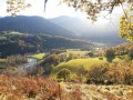
Starting from the Place des Arcades in Saint-Pé-de-Bigorre, enjoy a pleasant, peaceful walk to reach one of the hills sheltering the village, the “Montagnou de la Lit”, to the east. From up there, you can easily reach the entrance to the Grotte de la Résistance and, for the more adventurous, that of the Tute Faiouias.Magnificent views over the Gave de Pau valley and the ridges of the neighbouring peaks of the Saint-Pé massif.Return via the “Montagnou”, another hill above the village.
Grand tour of Saint-Pé-de-Bigorre via the hillsides
 6.40 mi
+597 ft
-584 ft
3h 30
Average
Departure from Saint-Pé-de-Bigorre (Hautes-Pyrénées)
6.40 mi
+597 ft
-584 ft
3h 30
Average
Departure from Saint-Pé-de-Bigorre (Hautes-Pyrénées)
On the hillsides of Saint-Pé-de-Bigorre, this 10 km route with an elevation gain of 180 m takes you through everything that makes the immediate surroundings of this village so beautiful: its small paths, meadows, woods, rivers and houses, in short, its rural heritage.Whether you're a regular walker or runner, a local or a visitor, you're sure to enjoy yourself here!
Le Montagnou de Saint-Pé
 1.03 mi
+236 ft
-213 ft
0h 40
Easy
Departure from Saint-Pé-de-Bigorre (Hautes-Pyrénées)
1.03 mi
+236 ft
-213 ft
0h 40
Easy
Departure from Saint-Pé-de-Bigorre (Hautes-Pyrénées)
A short walk in the hills above Saint-Pé-de-Bigorre offering breathtaking views of the village and its exceptional heritage: its 11th-century church, the former seminary and Catholic school, and the remarkable streets and houses dating from the 15th to the 18th centuries.There are also beautiful views of the mountain range to the south, including the Très-Croutz forest and the ridge of the Cirque de Bat dé Haü, stretching from the Toupiettes in the west to the Aülhet in the east.
Lengous and Montagnou
 3.34 mi
+433 ft
-440 ft
1h 55
Easy
Departure from Saint-Pé-de-Bigorre (Hautes-Pyrénées)
3.34 mi
+433 ft
-440 ft
1h 55
Easy
Departure from Saint-Pé-de-Bigorre (Hautes-Pyrénées)
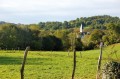
A pleasant walk through the woodland along the banks of the Gave de Pau, passing through Rieulhès, a typical Pyrenean hamlet. You’ll enjoy several remarkable views of the village of Saint-Pé-de-Bigorre.
A circular in the Morlaàs region
 4.16 mi
+364 ft
-361 ft
2h 15
Easy
Departure from Maucor (Pyrénées-Atlantiques)
4.16 mi
+364 ft
-361 ft
2h 15
Easy
Departure from Maucor (Pyrénées-Atlantiques)
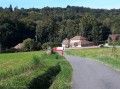
About fifteen kilometres north-east of Pau, the walk takes you through cornfields and oak and chestnut woods.
Meadows of Garrapit and Bénac on the slopes of the Araü
 5.24 mi
+1,903 ft
-1,903 ft
4h 05
Average
Departure from Saint-Pé-de-Bigorre (Hautes-Pyrénées)
5.24 mi
+1,903 ft
-1,903 ft
4h 05
Average
Departure from Saint-Pé-de-Bigorre (Hautes-Pyrénées)
On the forgotten trails of Saint-Pé-de-Bigorre No. 6
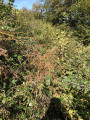
The Araü is the mountainous ridge jutting out from the Massif de Saint-Pé down to the Gave de Pau at the foot of the village. Its imposing, entirely wooded silhouette conceals pretty clearings, once meadows, some well-known paths and others forgotten, used only by hunters and hiking enthusiasts beneath the tall trees of the forest.
Its summit, towering arrogantly over the village, is the Soum de las Toupiettas (1,357m).
Montné Ridges and Col du Prat d’Aürelh circular loop via Le Pladi
 9.32 mi
+3,688 ft
-3,684 ft
7h 30
Difficult
Departure from Saint-Pé-de-Bigorre (Hautes-Pyrénées)
9.32 mi
+3,688 ft
-3,684 ft
7h 30
Difficult
Departure from Saint-Pé-de-Bigorre (Hautes-Pyrénées)
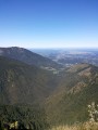
A beautiful, physically demanding day’s hike with several exposed sections along the ridges, taking you to the heights of the Saint-Pé-de-Bigorre massif, first to the east and then north-east, above the Génie Longue torrent.
Final stop at the Refuge du Col du Prat d’Aürelh (du Rey) and its summer pastures.
Magnificent scenery! Solitude guaranteed!
The Montagnou de la Pâle caves in the Très-Croutz Forest
 2.26 mi
+919 ft
-919 ft
1h 50
Easy
Departure from Saint-Pé-de-Bigorre (Hautes-Pyrénées)
2.26 mi
+919 ft
-919 ft
1h 50
Easy
Departure from Saint-Pé-de-Bigorre (Hautes-Pyrénées)
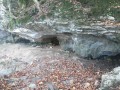
Just a stone’s throw from the village of Saint-Pé-de-Bigorre, this walk takes us along the trail of the massif’s caves, particularly those on a large hilltop, the Mountagnou de la Pale. The caves are dotted along this route as if laid out especially for the walker. We approach the gaping hole of the Gouffre du Hayau, whose unusual size and the draught of air coming in would surely draw you into its dark abyss, were you not careful...
This route was significantly altered in May 2024 by the creation of a new ‘karst trail’.
The Henri IV Trail
 20.70 mi
+732 ft
-1,421 ft
10h 10
Difficult
Departure from Lourdes (Hautes-Pyrénées)
20.70 mi
+732 ft
-1,421 ft
10h 10
Difficult
Departure from Lourdes (Hautes-Pyrénées)
A beautiful route linking Lourdes to Pau along an ancient Roman road steeped in history. The Henri IV trail stretches across the Hautes-Pyrénées and Pyrénées-Atlantiques departments, along the foothills of the Pyrenees.
Bois de Pau and Pont-Long plain
8.04 mi
+39 ft
-39 ft
3h 45
Average
Departure from Pyrénées-Atlantiques
An easy, flat walk, alternating between forest (the Bois de Pau or Forêt de Bastard) and cultivated plains.Suitable for walking or mountain biking.
Boucle du Béout
 2.65 mi
+1,280 ft
-1,276 ft
2h 20
Difficult
Departure from Lourdes (Hautes-Pyrénées)
2.65 mi
+1,280 ft
-1,276 ft
2h 20
Difficult
Departure from Lourdes (Hautes-Pyrénées)
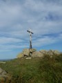
Tour of the Cité Saint-Pierre via the Béout ridge, passing by the summit cross and the old cable car station with views of Lourdes, the Gave de Pau and the start of the Vallée des Gaves.This hike in a wild area, with little or no signposting and trails that are difficult to see in summer and overgrown with ferns (especially on the descent), makes it accessible only to "adventurers" over the age of 10 who are not afraid of discovering this little summit!
Le Béout in the hills above Lourdes
 3.37 mi
+1,263 ft
-1,247 ft
2h 40
Average
Departure from Lourdes (Hautes-Pyrénées)
3.37 mi
+1,263 ft
-1,247 ft
2h 40
Average
Departure from Lourdes (Hautes-Pyrénées)
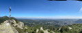
Short hike in the hills above Lourdes. The route is very quiet but well worth a look. It follows the northern ridge, which is the longest and has the greatest elevation gain.
From the main summit at 791m, where a cross has been erected, there is a 360° view of the Lourdes region.
From the second summit at 719m, there is a viewpoint with the old Béout cable car installation. A little further on is the entrance to the cave known as the "Gouffre de Lourdes", which is 82m deep.
Soum de Basta and Pic du Jer
 8.67 mi
+2,641 ft
-2,641 ft
6h 15
Average
Departure from Lourdes (Hautes-Pyrénées)
8.67 mi
+2,641 ft
-2,641 ft
6h 15
Average
Departure from Lourdes (Hautes-Pyrénées)
An off-the-beaten-track hike that takes you up two small peaks near Lourdes.A good sense of direction is required for the climb to the Pic du Jer. Do not attempt this hike in wet weather.
⚠️ User comment dated 8 March 2026 => There appears to be a serious access issue at the start due to the poor condition of the track. See alternative route in the practical information section.