


Refine your search for walks in Limey-Remenauville
Limey-Remenauville walks


 Explore the destroyed village of Remenauville and its surroundings
 Visorando Member
 6.70 mi
 +259 ft
 -289 ft
 3h 20
3h 20
 Moderate
 Departure from Limey-Remenauville (Meurthe-et-Moselle)
A walk to explore Remenauville, a village destroyed during the First World War, with an extension southwards along the edge of ‘Petite Suisse lorraine’ and through the fields.
Côte de Haye
 9.43 mi
+778 ft
-771 ft
5h 00
Moderate
Departure from Domèvre-en-Haye (Meurthe-et-Moselle)
9.43 mi
+778 ft
-771 ft
5h 00
Moderate
Departure from Domèvre-en-Haye (Meurthe-et-Moselle)
A pleasant little walk in the Haye region and Petite Suisse Lorraine, in the heart of the Lorraine Regional Park.
Jaulny and Jaunottes route
 7.35 mi
+761 ft
-774 ft
4h 00
Moderate
Departure from Jaulny (Meurthe-et-Moselle)
7.35 mi
+761 ft
-774 ft
4h 00
Moderate
Departure from Jaulny (Meurthe-et-Moselle)
An easy walk between Jaulny and its castle and Rembercourt-sur-Mad, through the surrounding forests and along the River Rupt de Mad.
Little Switzerland Lorraine.
 13.68 mi
+1,073 ft
-1,063 ft
7h 15
Moderate
Departure from Gézoncourt (Meurthe-et-Moselle)
13.68 mi
+1,073 ft
-1,063 ft
7h 15
Moderate
Departure from Gézoncourt (Meurthe-et-Moselle)
Little Switzerland Lorraine in the vicinity of Gézoncourt.
The Antonins’ Boundary Stones and the Pierre au Jô
 3.13 mi
+79 ft
-66 ft
1h 30
3.13 mi
+79 ft
-66 ft
1h 30
 Easy
Departure from Norroy-lès-Pont-à-Mousson (Meurthe-et-Moselle)
Easy
Departure from Norroy-lès-Pont-à-Mousson (Meurthe-et-Moselle)
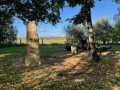
A lovely walk in the hills above Norroy-lès-Pont-à-Mousson, featuring the remains of a German First World War cemetery, boundary stones dating from Roman times in an enchanting forest, a cave, a blockhouse and the royal site of the Pierre au Jô.
La Croix Charbonnier
 8.69 mi
+817 ft
-830 ft
4h 45
Moderate
Departure from Jezainville (Meurthe-et-Moselle)
8.69 mi
+817 ft
-830 ft
4h 45
Moderate
Departure from Jezainville (Meurthe-et-Moselle)
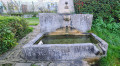
This is a pleasant route with no major difficulties, except perhaps at the end with a steep 400-metre climb.
Take care in hot weather as there are several sections without shade.
The Croix des Carmes via the German cemetery and the Pierre au Jô
 4.15 mi
+98 ft
-72 ft
2h 00
Easy
Departure from Norroy-lès-Pont-à-Mousson (Meurthe-et-Moselle)
4.15 mi
+98 ft
-72 ft
2h 00
Easy
Departure from Norroy-lès-Pont-à-Mousson (Meurthe-et-Moselle)
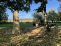
The Croix des Carmes via the German cemetery and back via the Pierre au Jô on the heights of Norroy-lès-Pont-à-Mousson.
Circular route between Maidières and Petite Suisse Lorraine
 19.96 mi
+1,663 ft
-1,654 ft
10h 40
19.96 mi
+1,663 ft
-1,654 ft
10h 40
 Difficult
Departure from Maidières (Meurthe-et-Moselle)
Difficult
Departure from Maidières (Meurthe-et-Moselle)
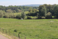
The Ruisseau d’Esch valley is known as ‘Little Lorraine’ due to its rolling terrain and bucolic landscapes combining forests and grazing meadows. The route is dotted with villages featuring typical Lorraine farmhouses and unassuming little monuments (churches, crosses and fountains).
Circular walk starting from Rembercourt-sur-Mad
 5.58 mi
+715 ft
-719 ft
3h 10
Moderate
Departure from Rembercourt-sur-Mad (Meurthe-et-Moselle)
5.58 mi
+715 ft
-719 ft
3h 10
Moderate
Departure from Rembercourt-sur-Mad (Meurthe-et-Moselle)
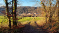
A circular route that follows open paths with views overlooking Rembercourt-sur-Mad, crosses the forests of the Villecey-sur-Mad communal woodland, runs alongside the Grand Fontaine stream with views of the old ponds, follows part of the Metz-Madine path and runs alongside old buried blockhouses.
Discovering Villers-sous-Prény
 5.50 mi
+614 ft
-604 ft
3h 05
Easy
Departure from Norroy-lès-Pont-à-Mousson (Meurthe-et-Moselle)
5.50 mi
+614 ft
-604 ft
3h 05
Easy
Departure from Norroy-lès-Pont-à-Mousson (Meurthe-et-Moselle)
A lovely walk on the Norroy-lès-Pont-à-Mousson plateau, exploring the village of Villers-sous-Prény.
In autumn and winter, there are a few muddy sections on the descent to Villers-sous-Prény; bring a walking stick. Moderate difficulty; return to the starting point; the A-road linking Villers-sous-Prény to Norroy-lès-Pont-à-Mousson offers a chance to explore the whole valley.
The Domaine les Gravières Nature Reserve in Pont-à-Mousson
 3.54 mi
+16 ft
-16 ft
1h 40
Easy
Departure from Pont-à-Mousson (Meurthe-et-Moselle)
3.54 mi
+16 ft
-16 ft
1h 40
Easy
Departure from Pont-à-Mousson (Meurthe-et-Moselle)
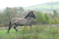
Gravel pit nature reserve: 200 plant species, 150 bird species, 6 bat species, 21 dragonfly species, 15 fish species, 13 bat species and wild Tarpans. These are small wild European horses.
An area dedicated to nature, so paths are not cleared; please check the notices
The Buttes de Mousson and Xon
 8.89 mi
+1,224 ft
-1,217 ft
5h 10
Moderate
Departure from Pont-à-Mousson (Meurthe-et-Moselle)
8.89 mi
+1,224 ft
-1,217 ft
5h 10
Moderate
Departure from Pont-à-Mousson (Meurthe-et-Moselle)
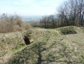
Pass by the summit of Butte de Mousson, with its castle ruins, and Butte de Xon, with its trenches dating from the First World War.
The Moselle hills starting from Prény
 8.29 mi
+879 ft
-873 ft
4h 35
Moderate
Departure from Prény (Meurthe-et-Moselle)
8.29 mi
+879 ft
-873 ft
4h 35
Moderate
Departure from Prény (Meurthe-et-Moselle)
A route in Lorraine which, starting from the pretty little picturesque village of Prény, offers all kinds of contrasts: valley and plateau, forest and vineyard, town and village, medieval castle and high-speed train line.
The Red Fountain and Mousson Castle
 3.18 mi
+643 ft
-620 ft
2h 00
Moderate
Departure from Pont-à-Mousson (Meurthe-et-Moselle)
3.18 mi
+643 ft
-620 ft
2h 00
Moderate
Departure from Pont-à-Mousson (Meurthe-et-Moselle)
Between the botanical trail and the old stones of Mousson Castle.
The Grand-Fontaine valley
 5.51 mi
+673 ft
-653 ft
3h 05
Easy
Departure from Villecey-sur-Mad (Meurthe-et-Moselle)
5.51 mi
+673 ft
-653 ft
3h 05
Easy
Departure from Villecey-sur-Mad (Meurthe-et-Moselle)
A walk that will take you through the Grandfontaine valley, a Sensitive Natural Area.
The route runs mainly through woodland and along the bottom of a cool valley with its distinctive flora. You’ll also come across a protohistoric rampart, a few blockhouses and a lovely walk through an arboretum.
 Tour of Lake Madine from Montsec
 14.76 mi
+233 ft
-253 ft
3 hrs
Moderate
Departure from Montsec (Meuse)
14.76 mi
+233 ft
-253 ft
3 hrs
Moderate
Departure from Montsec (Meuse)
This lake is a reserve with sensitive natural environments, home to a diverse range of flora and fauna.It is a wild environment except on its northern shore, where there are leisure centres that are very pleasant during the summer months, but don't be put off by the crowds and don't hesitate to pay for parking.
Little Switzerland in Lorraine
 13.27 mi
+906 ft
-876 ft
6h 55
Moderate
Departure from Dieulouard (Meurthe-et-Moselle)
13.27 mi
+906 ft
-876 ft
6h 55
Moderate
Departure from Dieulouard (Meurthe-et-Moselle)
A lovely walk to discover charming villages along the winding course of the Esch stream.
Dieulouard, Notre-Dame des Airs Chapel and Blénod Thermal Power Station
 6.03 mi
+476 ft
-476 ft
3h 10
Moderate
Departure from Dieulouard (Meurthe-et-Moselle)
6.03 mi
+476 ft
-476 ft
3h 10
Moderate
Departure from Dieulouard (Meurthe-et-Moselle)
Route through the forest offering beautiful views of the Esch Valley and the Moselle Valley.
The return trip along the canalised Moselle offers views of herons, cormorants and possibly deer in the plain.
Forêt de la Reine - Lorraine region
 10.16 mi
+52 ft
-52 ft
1.5 hrs
Easy
Departure from Broussey-Raulecourt (Meuse)
10.16 mi
+52 ft
-52 ft
1.5 hrs
Easy
Departure from Broussey-Raulecourt (Meuse)
A beautiful bike ride in the Lorraine Regional Nature Park and, more specifically, the superb Forêt Domaniale de la Reine, which straddles the departments of Meurthe-et-Moselle and Meuse.It is a so-called "wet" forest, containing more than a dozen natural ponds.
Single tracks towards Saizerais and the Ferme du Haras
 Tourism professional8.00 mi
+459 ft
-472 ft
1 hr
Easy
Departure from Saizerais (Meurthe-et-Moselle)
Tourism professional8.00 mi
+459 ft
-472 ft
1 hr
Easy
Departure from Saizerais (Meurthe-et-Moselle)
A short circular route featuring lovely single tracks for three-quarters of the route. An ideal route for learning to ride without getting too scared or getting your heart rate up too much. The return stretch, a gentle downhill towards Saizerais, is brilliant! It can also be tackled as a trail run for a relaxed little outing with hardly any elevation gain.
Single tracks towards Saizerais and Marbache
9.70 mi
+479 ft
-489 ft
1.5 hrs
Moderate
Departure from Saizerais (Meurthe-et-Moselle)
For mountain bike singletrack enthusiasts! A lovely, great-fun circular route with very little elevation gain. The route isn’t signposted in any way, so it’s important to download the GPX file onto your hiking app and follow the instructions in the route description.
This route can also be done as a trail run if you’re not looking for significant elevation gain.
The Bois Saint-Ignon
 4.34 mi
+213 ft
-207 ft
2h 10
Easy
Departure from Saizerais (Meurthe-et-Moselle)
4.34 mi
+213 ft
-207 ft
2h 10
Easy
Departure from Saizerais (Meurthe-et-Moselle)
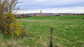
Woods and open terrain make this circular route varied.
It is a easy, smooth route for mountain bikes.
On horseback, it is pleasant terrain but involves a dangerous crossing of the D907 road.
The Grand Southern Loop of Saizerais
7.83 mi
+381 ft
-364 ft
3h 55
Moderate
Departure from Saizerais (Meurthe-et-Moselle)
This circular walk, starting from Saizerais Town Hall, has been signposted by the Oxygène association. It follows three signposted walks in succession: the Bois Saint-Ignon, the connecting path and then the Cense Saint-Paul.
La Cense Saint-Paul in Saizerais
 3.87 mi
+190 ft
-194 ft
1h 55
Easy
Departure from Saizerais (Meurthe-et-Moselle)
3.87 mi
+190 ft
-194 ft
1h 55
Easy
Departure from Saizerais (Meurthe-et-Moselle)
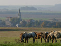
La Cense Saint-Paul was a very old farm. The word ‘Cense’ comes from the Latin ‘censa’, meaning ‘farm rent’. In Lucien Geindre’s history of Liverdun, we learn that this farm had a large dovecote containing 857 nests!La Cense Saint-Paul appears on the Cassini Map, but it seems to have disappeared after the Revolution. Until a few years ago, the remains of an old cellar were still visible.
Twisted beech trees around Pagny-sur-Moselle
 9.45 mi
+725 ft
-728 ft
5h 00
Moderate
Departure from Arnaville (Meurthe-et-Moselle)
9.45 mi
+725 ft
-728 ft
5h 00
Moderate
Departure from Arnaville (Meurthe-et-Moselle)
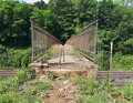
From the banks of the Moselle to the "twisted beech trees" over a hundred years old.
The Arry coast and its limestone grasslands
 6.11 mi
+699 ft
-679 ft
3h 25
Moderate
Departure from Arry (Moselle)
6.11 mi
+699 ft
-679 ft
3h 25
Moderate
Departure from Arry (Moselle)
Hike between Arry, Mardigny and Lorry-Mardigny to visit their forests, limestone grasslands and local buildings. The Arry hillside offers panoramic views of the Moselle valley, the Rupt de Mad and the Seille valley. Flora: several species of orchids, aster amelle, stinking hellebore, meadow sage, crane's bill, viper's bugloss... Fauna: peacock butterflies and green hairstreak butterflies, whinchat birds, yellowhammer, linnet, thrush, finch, chiffchaff, smooth snake, birds of prey...
Rudemont Pass
 3.44 mi
+394 ft
-394 ft
1h 55
Easy
Departure from Arnaville (Meurthe-et-Moselle)
3.44 mi
+394 ft
-394 ft
1h 55
Easy
Departure from Arnaville (Meurthe-et-Moselle)
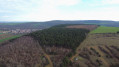
A beautiful walk in the heart of an environment protected by the Conservatoire des Sites Lorrains (limestone grasslands) with a magnificent view of the Moselle and Rupt de Mad valleys.
Rupt de Mad valley and Rudemont tower
 8.13 mi
+863 ft
-860 ft
4h 30
Easy
Departure from Arnaville (Meurthe-et-Moselle)
8.13 mi
+863 ft
-860 ft
4h 30
Easy
Departure from Arnaville (Meurthe-et-Moselle)
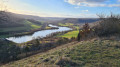
This route will take you through part of the Rupt de Mad valley before the river flows into the Moselle, and to one of its typical villages, Bayonville. Discover the Rudemont plateau via a route that takes you off the beaten track.
The Terrouin Valley in Villey-Saint-Étienne
 5.33 mi
+217 ft
-207 ft
2h 40
Easy
Departure from Villey-Saint-Étienne (Meurthe-et-Moselle)
5.33 mi
+217 ft
-207 ft
2h 40
Easy
Departure from Villey-Saint-Étienne (Meurthe-et-Moselle)
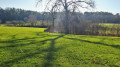
An easy walk from the banks of the majestic Moselle at this point, with views of the Toulois hills and, further away, the Meuse hills and finally the meadows and forests around the loops of the Terrouin.
Terrouin Valley Discovery Trail
 5.12 mi
+243 ft
-230 ft
2h 35
Easy
Departure from Villey-Saint-Étienne (Meurthe-et-Moselle)
5.12 mi
+243 ft
-230 ft
2h 35
Easy
Departure from Villey-Saint-Étienne (Meurthe-et-Moselle)
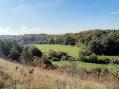
An easy, idyllic walk. The trail offers a lovely view over the heights of the Terrouin Valley and takes you to the former Villey-Saint-Étienne quarry, designated a Sensitive Natural Area, where nature has reclaimed its rightful place. You’ll wind your way through meadows and woods and cross the stream via a footbridge.
Lachaussée Pond and its satellite lakes
 8.99 mi
+30 ft
-30 ft
4h 10
Moderate
Departure from Lachaussée (Meuse)
8.99 mi
+30 ft
-30 ft
4h 10
Moderate
Departure from Lachaussée (Meuse)
Listed as a Regional Nature Reserve, the Lachaussée pond has remained in its natural state. Many birds have made their home there or stop off during their migration. It is a haven of peace for flora and fauna.Please note: it is forbidden to stray from the existing paths, particularly around the ponds, otherwise you may be liable for a hefty fine.
Natrou Grand Circular Route
6.65 mi
+449 ft
-436 ft
3h 25
Moderate
Departure from Liverdun (Meurthe-et-Moselle)
This route forms part of a network of 12 ‘Au cœur des Boucles’ trails around Liverdun, offering 80 km of footpaths signposted with the oak leaf, the town’s emblem. They allow you to choose a suitable walk – short, medium or longer – or to create a route combining any of the four circular loops. These circular loops will introduce you to the old village, whose history is linked to the Moselle, and allow you to enjoy a varied array of woodland settings and sensitive natural areas. As you wander, you’ll discover breathtaking views of the Moselle valley and the medieval village.
Mazagran farm - Arnaville limestone grassland (Rudemont)
 6.62 mi
+748 ft
-741 ft
3h 40
Moderate
Departure from Novéant-sur-Moselle (Moselle)
6.62 mi
+748 ft
-741 ft
3h 40
Moderate
Departure from Novéant-sur-Moselle (Moselle)
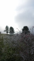
Observe the Gorzia valley, cross the Bayonville woods to the Mazagran farm, and admire the Rupt de Mad and Moselle valleys from the top of the Rudemont hill.
Between Novéant and Gorze
 8.04 mi
+725 ft
-722 ft
4h 20
Moderate
Departure from Novéant-sur-Moselle (Moselle)
8.04 mi
+725 ft
-722 ft
4h 20
Moderate
Departure from Novéant-sur-Moselle (Moselle)
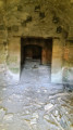
Most of the route is through forest. Ideal for a sunny day. The outward journey follows the old tramway line, and the return journey follows theGR®5.
Circular Novéant via Gorze and Rochers de la Fraze
 9.15 mi
+1,198 ft
-1,168 ft
5h 15
Moderate
Departure from Novéant-sur-Moselle (Moselle)
9.15 mi
+1,198 ft
-1,168 ft
5h 15
Moderate
Departure from Novéant-sur-Moselle (Moselle)
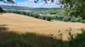
Most of the route follows dirt tracks and paths through or along the edge of the forest, avoiding tarmac roads as much as possible.
The towns of Novéant and Gorze reveal beautiful old stones, evidence of the presence of builders since time immemorial.
Route de découverte de Liverdun
3.64 mi
+397 ft
-371 ft
2h 00
Easy
Departure from Liverdun (Meurthe-et-Moselle)
Liverdun is a small medieval village situated on the banks of the Moselle, 30 minutes from Nancy. It has a charming atmosphere with medieval houses, narrow, picturesque streets and views over the circular bends of the Moselle. It is therefore easy and pleasant to spend several hours strolling through this charming town. Highlights of the route include Château Corbin and its grounds, the Esplanade du Moulin, Saint-Pierre Church, and the short round trip to the Roche Barbotte cave. Of course, before you leave, don’t forget to buy the famous Liverdun madeleines.
Circular route around Novéant-sur-Moselle
 8.16 mi
+640 ft
-643 ft
4h 20
Easy
Departure from Novéant-sur-Moselle (Moselle)
8.16 mi
+640 ft
-643 ft
4h 20
Easy
Departure from Novéant-sur-Moselle (Moselle)
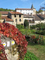
Circular route running alongside the Moselle, the old canal and the Rupt du Mad, passing through the villages of Novéant, Arnaville and Dornot, with a walk through the Dornot woods via La Fraze and La Croix Saint-Clément
1940-1944 Smugglers' Walk between Novéant and Arnaville
4.82 mi
+105 ft
-138 ft
2h 20
Easy
Departure from Novéant-sur-Moselle (Moselle)
A route commemorating the contemporary history of these places between Novéant and Arnaville. Between 1940 and 1944, volunteer smugglers helped men hunted by the invaders to regain their freedom and resume the fight for the liberation of their battered homeland.
The Greater Nancy area from Liverdun to the Bois des Hospices de Pompey
 10.29 mi
+945 ft
-928 ft
5h 35
Moderate
Departure from Liverdun (Meurthe-et-Moselle)
10.29 mi
+945 ft
-928 ft
5h 35
Moderate
Departure from Liverdun (Meurthe-et-Moselle)
On the ‘Tour du Grand Nancy’ route, a circular stage between Liverdun and the Bois des Hospices de Pompey, passing through the village of Saizerais.
The walk is mainly through woodland, along wide paths.
Visit to the village of Saizerais.
A tour of part of the town of Liverdun, passing, at the entrance, by the old canal which flows beneath the town, then through a cave and back via the old town and its significant heritage.
The Chênot Hazotte circular loop
 4.17 mi
+469 ft
-472 ft
2h 20
Easy
Departure from Liverdun (Meurthe-et-Moselle)
4.17 mi
+469 ft
-472 ft
2h 20
Easy
Departure from Liverdun (Meurthe-et-Moselle)
This route forms part of a network of 12 trails known as ‘Au cœur des Boucles’ around Liverdun, offering 80 km of footpaths marked with the oak leaf, the town’s emblem. This circular route runs mainly through woodland. It is suitable for mountain biking, but the section between (1) and (2) is difficult. This long circular route is signposted with an orange “oak leaf” symbol, the emblem of the town of Liverdun. The long circular route is marked with three horizontal lines, but it is possible to shorten the walk by taking the medium circular route (two horizontal lines) or even the short circular route (one horizontal line). All this is explained on this page of the Liverdun town website.
Grande Boucle Villageoise in Liverdun
 5.62 mi
+371 ft
-344 ft
2h 55
Moderate
Departure from Liverdun (Meurthe-et-Moselle)
5.62 mi
+371 ft
-344 ft
2h 55
Moderate
Departure from Liverdun (Meurthe-et-Moselle)
This route forms part of a network of 12 ‘Au cœur des Boucles’ trails around Liverdun, offering 80 km of footpaths marked with the town’s emblem, the oak leaf. They allow you to choose a suitable walk – short, medium or long – or to create your own route combining any of the four circular loops. These circular loops will introduce you to the old village, whose history is linked to the Moselle, and allow you to enjoy a varied array of woodland settings and sensitive natural areas. As you wander, you’ll discover breathtaking views of the Moselle valley and the medieval village.
 Corny – Metz by bike
 16.73 mi
+23 ft
-23 ft
3 hrs
Moderate
Departure from Corny-sur-Moselle (Moselle)
16.73 mi
+23 ft
-23 ft
3 hrs
Moderate
Departure from Corny-sur-Moselle (Moselle)
This lovely cycle ride (suitable for all types of bikes, except after a spell of rain) takes you round the southern suburbs of Metz and allows you to discover the area from a very different perspective to the usual road routes.
The Fourasse Circular Loop
 6.82 mi
+722 ft
-712 ft
3h 45
Moderate
Departure from Liverdun (Meurthe-et-Moselle)
6.82 mi
+722 ft
-712 ft
3h 45
Moderate
Departure from Liverdun (Meurthe-et-Moselle)
This route forms part of a network of 12 ‘Au cœur des Boucles’ trails around Liverdun, offering 80 km of footpaths marked with the oak leaf, the town’s emblem. They allow you to choose a walk to suit you – short, medium or longer – or to create your own route combining any of the four circular loops. These circular loops will introduce you to the old village, whose history is linked to the Moselle, and allow you to enjoy a varied array of woodland settings and sensitive natural areas. As you wander, you’ll discover breathtaking views of the Moselle valley and the medieval village.The long Fourasse circular hike (marked with three green stripes) is a 4½-hour hike. This woodland trail takes you through a variety of forest habitats (coppice, high forest, wetland, deciduous and coniferous woodland). It is possible to complete the route by mountain bike; it’s very easy going apart from the lower section of the descent just before reaching the viewpoint (4).
Circular of the Moselle between Liverdun and Lock No. 5 at Aingeray.
 7.43 mi
+387 ft
-387 ft
3h 45
Moderate
Departure from Liverdun (Meurthe-et-Moselle)
7.43 mi
+387 ft
-387 ft
3h 45
Moderate
Departure from Liverdun (Meurthe-et-Moselle)
A circular route starting from Liverdun, passing through the communal woods of La Fourasse, then in front of Château de la Flie, continuing along the Moselle to Aingeray Lock No. 5. Crossing the Moselle and returning via a cycle path along the river.