The Croix des Carmes via the German cemetery and the Pierre au Jô

The Croix des Carmes via the German cemetery and back via the Pierre au Jô on the heights of Norroy-lès-Pont-à-Mousson.

Details

27669537
Creation:
Last update:
Last review:
  • Walking
    Activity: Walking
  • ↔
    Distance: 4.15 mi
  • ◔
    Average duration: 2h 00 
  • ▲
    Difficulty: Easy

  • ⚐
    Back to start: Yes
  • ↗
    Ascent: + 98 ft
  • ↘
    Descent: - 72 ft

  • ▲
    Highest point: 1,224 ft
  • ▼
    Lowest point: 1,145 ft

Photos

Description of the walk

Park in the football ground car park.

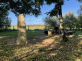
(S/E) From the car park, walk alongside the sports ground and continue along the Route Forestière de Norroy until you reach the crossroads near the German cemetery.

(1) Turn left onto the Piste des Carmes (where you can sit down or have a picnic) and carry on until the first fork on the right.

(2) Turn right into the Norroy-lès-Pont-à-Mousson Communal Wood. Continue straight on, cutting across the cross paths.

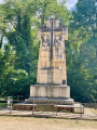
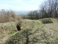
(3) Pass, on your right, by shell craters and trenches dating from the First World War. Further on, turn left and arrive at the Tranchée des Carmes. Turn right to reach the Croix des Carmes Monument (you can visit the trenches behind this monument. Information boards are located before the monument.

(4) Just after this, turn right onto the forest track until you reach the next crossroads.

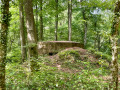
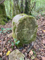
(5) Turn right onto the track, where you can see some old forest boundary markers. You’ll come to a relatively well-preserved blockhouse on the left.

(6) Turn right, then immediately left, and join a wider track. Follow it to the left until you reach a major crossroads, where there used to be a huge, hundred-year-old oak tree with a mass of mistletoe, which was felled a few years ago.

(8) Turn right and follow this forest track to the crossroads near the German cemetery, which you passed on the way out.

(1) Turn right and, almost immediately, turn left onto a path leading to the Pierre au Jô, where you can stop for a picnic.

(9) Carry on, then turn left and walk round the football pitch to return to the car park (S/E).

Waypoints

  1. S/E : mi 0 - alt. 1,152 ft - Football stadium car park
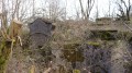
  2. 1 : mi 0.6 - alt. 1,161 ft - German cemetery. Junction at the end of the circular route
  3. 2 : mi 0.77 - alt. 1,181 ft - Junction
  4. 3 : mi 1.68 - alt. 1,181 ft - Shell craters and trenches
  5. 4 : mi 2 - alt. 1,224 ft - Monument de la Croix des Carmes (Montauville)
  6. 5 : mi 2.23 - alt. 1,165 ft - Junction
  7. 6 : mi 2.5 - alt. 1,158 ft - Blockhouse
  8. 7 : mi 2.55 - alt. 1,168 ft - Junction
  9. 8 : mi 2.79 - alt. 1,175 ft - Carrefour de la Boule de Gui (Norroy-lès-Pont-à-Mousson)
  10. 9 : mi 3.74 - alt. 1,178 ft - La Pierre au Jô
  11. S/E : mi 4.15 - alt. 1,152 ft - Football pitch car park

Notes

An easy walk, with no particular difficulties and plenty of shade.

Worth a visit

Reviews and comments

4.5 / 5
Based on 2 reviews

Reliability of the description
4.5 / 5
Ease of following the route
4.5 / 5
Route interest
4.5 / 5
elicec1
elicec1

Overall rating : 5 / 5

Date of your route : May 09, 2024
Reliability of the description : ★★★★★ Very good
Ease of following the route : ★★★★★ Very good
Route interest : ★★★★★ Very good
Very busy route : No

A really lovely walk, which was quite moving because of the trenches forming a veritable labyrinth, and the shell craters all along the way. The forest paths were muddy and at times difficult to navigate due to the rain over the last few months, so it’s best done in really dry weather, and there was forestry work going on. But I loved it!

Machine-translated

EKE
EKE

Overall rating : 4 / 5

Date of your route : May 13, 2024
Reliability of the description : ★★★★☆ Good
Ease of following the route : ★★★★☆ Good
Route interest : ★★★★☆ Good
Very busy route : No

Nice walks. Very wooded. You can see the First World War trenches there. Some paths are difficult to walk on after it has rained (large puddles blocking the way, ruts left by forestry vehicles, mud, etc.)

Machine-translated

Other walks in the area

For more walks, use our search engine .

The GPS track and description are the property of this route's author. Please do not copy them without permission.