The Antonins’ Boundary Stones and the Pierre au Jô

A lovely walk in the hills above Norroy-lès-Pont-à-Mousson, featuring the remains of a German First World War cemetery, boundary stones dating from Roman times in an enchanting forest, a cave, a blockhouse and the royal site of the Pierre au Jô.

Details

n°27524631
Creation:
Last update:
Last review:
  • Walking
    Activity: Walking
  • ↔
    Distance: 3.13 mi
  • ◔
    Average duration: 1h 30 
  • ▲
    Difficulty: Easy

  • ⚐
    Back to start: Yes
  • ↗
    Ascent: + 79 ft
  • ↘
    Descent: - 66 ft

  • ▲
    Highest point: 1,224 ft
  • ▼
    Lowest point: 1,158 ft

Photos

Description of the walk

Access to the start of the walk by car. Park in an unmarked car park at the Norroy football ground.

(S/E) With the stadium on your left, follow the forest track that runs alongside the limestone plateau.

(1) At the cross in the German cemetery, turn left and follow the path. When you reach the junction where several paths meet, take thesecond on the left.

(2) At signpost no. 4 ‘Aller/retour bornes’, turn left.

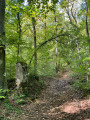
(3) Pass the first Antonins marker.

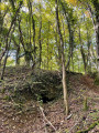
(4) Look out for the Trou de la Guetton (cave) on your left and follow the winding path, which has many bends; towards the end, over the last 100 metres, the path is a little difficult to find.

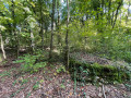
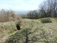
(5) At the tunnel on your right, turn left onto the Tranchée des Carrières and follow this lovely, straight path. Walk past a blockhouse on your left and continue to the Pierre au Jô (menhir).

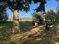
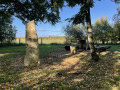
(6) There’s a picnic spot here, with a tree trunk to sit on and a table. Turn right onto the path that runs alongside the meadow, then turn left to walk past the football ground and reach the car park on the right (S/E).


Waypoints

  1. S/E : mi 0 - alt. 1,158 ft - Football ground car park
  2. 1 : mi 0.58 - alt. 1,161 ft - Cross – German cemetery
  3. 2 : mi 1.65 - alt. 1,171 ft - Signpost no. 4
  4. 3 : mi 1.76 - alt. 1,184 ft - Antonins boundary stone
  5. 4 : mi 1.87 - alt. 1,204 ft - Trou de la Guetton
  6. 5 : mi 2.14 - alt. 1,224 ft - Sape
  7. 6 : mi 2.75 - alt. 1,178 ft - La Pierre au Jô
  8. S/E : mi 3.13 - alt. 1,158 ft - Football ground car park

Worth a visit

Reviews and comments

3.8 / 5
Based on 2 reviews

Reliability of the description
3.5 / 5
Ease of following the route
3.5 / 5
Route interest
4.5 / 5
Ted973
Ted973

Thank you for your comment
There is a third terminal (see this link)

https://data.datatourisme.fr/10/162fa681...

On this 4 km 600 route, you’ll discover French shelters and machine-gun posts, and pass through the Bois de l’Hôpital, which was demarcated by the Antonists or Antonines at the request of Stanislas, Duke of Lorraine. There are several boundary stones to discover, including a rather imposing one dating from 1740, engraved with a Cross of Lorraine, the Antonists’ ‘T’ (Tau) and the Old Testament Star of David at its summit. The second, much smaller one, is situated further north. Then, as you make your way to the Maison du Père Hilarion, you will find a third boundary stone on the path that crosses the water catchment area (a reservoir dating from 1909) which supplied the town of Pont-à-Mousson (now the Fischer factory). The Antonists had their convent at the former Lycée Bardot on Place Saint-Antoine, and their church was Saint Martin’s.

Machine-translated

kuumiut
kuumiut

Overall rating : 4.3 / 5

Date of your route : Dec 16, 2024
Reliability of the description : ★★★★☆ Good
Ease of following the route : ★★★★☆ Good
Route interest : ★★★★★ Very good
Very busy route : No

A lovely walk, with the two Antonine boundary stones and the quarry area being of particular interest… and, of course, the menhir. Thank you for sharing. Are there any other Antonine boundary stones to be seen elsewhere?

Machine-translated

Ted973
Ted973

That’s right, the path isn’t very visible; you just need to follow the top of the ridges for about a hundred metres – as it’s a little-used path – and then you’ll come across the wider path that mountain bikers use. It takes a bit of courage.

Machine-translated

sebge54
sebge54

Overall rating : 3.3 / 5

Date of your route : Nov 07, 2022
Reliability of the description : ★★★☆☆ Average
Ease of following the route : ★★★☆☆ Average
Route interest : ★★★★☆ Good
Very busy route : No

A pleasant walk overall, but the path is very difficult to find between the Trou de la Guetton (4) and La Sape (5). A GPS and/or compass are recommended.

Machine-translated

Ted973
Ted973

The place is magical and peaceful, with no noise pollution, and relatively easy to walk, except perhaps towards the end. You half expect to see Merlin the Enchanter near the Roman milestones.
Enjoy your walk.

Machine-translated

jlmfox
jlmfox

Hello, I haven’t done this walk yet, but I’ve looked into it in detail with a view to perhaps taking a group there.
As for this walk, it seems easy to me, not too far from our starting point, and interesting because of what there’ll be to discover.
Generally speaking, I often map out walks after I’ve done them, to record the actual distance and elevation gain, but I wouldn’t suggest them to everyone because of the noise pollution: the Ochey airfield, the military firing range near Pierre-la-Treiche during the week, and in Maron at the weekend. This makes this valley of the Moselle, as well as the ones leading into it, sometimes far too noisy; yet there are plenty of places to discover that are beautiful and secluded.
Anyway, I’m pleased with your website, even if I don’t use it quite as much as you’d like me to.
Keep it up!
JLM

Machine-translated

Other walks in the area

For more walks, use our search engine .

The GPS track and description are the property of this route's author. Please do not copy them without permission.