Circular walk starting from Rembercourt-sur-Mad

A circular route that follows open paths with views overlooking Rembercourt-sur-Mad, crosses the forests of the Villecey-sur-Mad communal woodland, runs alongside the Grand Fontaine stream with views of the old ponds, follows part of the Metz-Madine path and runs alongside old buried blockhouses.

Details

17889058
Creation:
Last update:
Last review:
  • Walking
    Activity: Walking
  • ↔
    Distance: 5.58 mi
  • ◔
    Average duration: 3h 10 
  • ▲
    Difficulty: Moderate

  • ⚐
    Back to start: Yes
  • ↗
    Ascent: + 715 ft
  • ↘
    Descent: - 719 ft

  • ▲
    Highest point: 1,063 ft
  • ▼
    Lowest point: 643 ft

Photos

Description of the walk

Park in the small car park on the outskirts of Rembercourt-sur-Mad, heading towards Jaulny.

(S/E) Follow the D 28 towards Jaulny for a few metres, then turn left onto the wide track and join theGRP® Entre Côtes de Moselle et Côtes de Meuse.

(1) Turn right onto this path and follow the red and yellow markings. Enter a wood and you’ll soon come to another crossroads.

(2) Leave theGRP® here, turn left and follow the ‘Sentier du Tacot’ trail. After a descent, you’ll reach a crossroads with several routes at a place called La Petite Corvée.

(3) Turn left onto the path at the bottom of the valley and continue down a gentle slope to reach the junction by the pumping station.

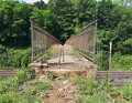
(4) Turn left and walk alongside the Grand Fontaine stream and the ponds to reach the entrance to the hamlet of Buret before the railway bridge. Here, rejoin the GRP®.

(5) Turn left onto this path – this is also the Metz-Madine trail. Begin the ascent, following the red and yellow markings. You’ll reach the highest point at a crossroads with several routes.

(6) Leave theGRP® here and turn right to reach an old blockhouse.

(7) Follow the path to the left and you’ll reach the edge of the woods.

(8) Turn right, then head down the path that crosses the fields towards Rembercourt-sur-Mad. At the entrance to the village, at the Jardins Moutardes, take the street on the left and you’ll soon reach the car park at Rembercourt-sur-Mad (S/E).


Waypoints

  1. S/E : mi 0 - alt. 682 ft - Rembercourt-sur-Mad car park - Rupt de Mad
  2. 1 : mi 0.69 - alt. 965 ft - GRP junction
  3. 2 : mi 1.25 - alt. 1,007 ft - The Tacot Trail
  4. 3 : mi 1.55 - alt. 886 ft - Valley Trail
  5. 4 : mi 2.44 - alt. 738 ft - Crossroads at the pumping station
  6. 5 : mi 3.63 - alt. 643 ft - GRP signpost
  7. 6 : mi 4.68 - alt. 1,056 ft - Crossroads of the 4 paths
  8. 7 : mi 4.9 - alt. 968 ft - Blockhouse
  9. 8 : mi 5.28 - alt. 820 ft - Edge of the woods
  10. S/E : mi 5.58 - alt. 679 ft - Rembercourt-sur-Mad car park

Notes

This 2½-hour walk alternates between ascents and descents, which require a good level of fitness.

Worth a visit

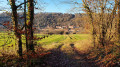
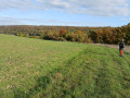
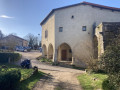
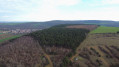
View of the village of Rembercourt-sur-Mad.
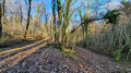
The woods of the Villecey-sur-Mad communal forest.
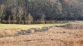
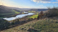
Between (4) and (5): the Grand Fontaine stream with a view of the old ponds.
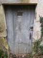
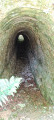
Buried blockhouses.

Reviews and comments

3.9 / 5
Based on 4 reviews

Reliability of the description
4 / 5
Ease of following the route
4.3 / 5
Route interest
3.5 / 5
ACKET
ACKET

Overall rating : 2.7 / 5

Date of your route : Sep 22, 2024
Reliability of the description : ★★★☆☆ Average
Ease of following the route : ★★★☆☆ Average
Route interest : ★★☆☆☆ Disappointing
Very busy route : No

Route completed on 21 September 2024.
This walk is of little interest (mostly through woodland with few unobstructed views). Despite there having been no rain during the previous week, the section between 3 and 4 is rather difficult to navigate (ruts, mud, etc.). Between 4 and 5, the path becomes more pleasant, but the stream and pond are hidden by vegetation. Please note that the path between 7 and 8 does not exist; you must therefore turn back towards 6 and take the first path on the right (GPS is very useful).

Machine-translated

Christecol
Christecol

Overall rating : 4 / 5

Date of your route : Feb 23, 2024
Reliability of the description : Not used / Not applicable
Ease of following the route : ★★★★☆ Good
Route interest : ★★★★☆ Good
Very busy route : No

A lovely afternoon stroll, finally enjoying a bit of sunshine and the sound of birdsong. I thought I’d see the Grand-Fontaine pond, but it’s no longer there! In its place, there are only bushes and tall grass – yet on the IGN map it’s clearly marked as a pond? The bunkers are barely visible: be careful…
this forest is designated as a ‘Natura 2000’ site.
Wikipedia: The Natura 2000 network brings together natural or semi-natural sites across the European Union that are of great heritage value due to the exceptional flora and fauna they contain.
The aim of establishing the Natura 2000 network is to maintain the biological diversity of habitats, whilst taking into account economic, social, cultural and regional requirements within a framework of sustainable development, and recognising that the conservation of protected areas and biodiversity also presents long-term economic benefits.

Machine-translated

raymondos57
raymondos57

Overall rating : 4.7 / 5

Date of your route : Sep 25, 2023
Reliability of the description : ★★★★★ Very good
Ease of following the route : ★★★★★ Very good
Route interest : ★★★★☆ Good
Very busy route : No

A lovely walk in the woods
A slight hiccup at point 7 – you need to follow the path downhill, which takes you back to the trail in 5 minutes!
🙏

Machine-translated

MKIS
MKIS

Thank you for your review, which will be helpful to future walkers.

Machine-translated

nolive73
nolive73

Overall rating : 4.5 / 5

Date of your route : Jan 02, 2022
Reliability of the description : Not used / Not applicable
Ease of following the route : ★★★★★ Very good
Route interest : ★★★★☆ Good
Very busy route : No

A very pleasant walk, with no difficulties apart from the slightly steep slope between (DA) and (1), and then between (5) and (6), but these are only short stretches.
Please note: once I reached (7), I couldn’t find the path on the left leading to (8). I had to retrace my steps for 100 metres, then take a more visible path further up, head back down, and make my way to (7) in the direction (8) → (7) (I hope that’s clear...)
The path does indeed exist at (7), on the left, but it’s not very visible; you have to venture on for about a hundred metres before you can see it clearly.
There are some beautiful, ancient beech trees in this area...
Thank you for sharing this

Machine-translated

Other walks in the area

For more walks, use our search engine .

The GPS track and description are the property of this route's author. Please do not copy them without permission.