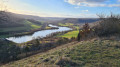
Country:
 City:
City:


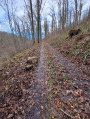
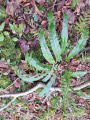
A few parking spaces are available at the side of the track, before the ONF barrier.
(S/E) Follow this track for about 300 m.
(1) Take the path leading down to the right. This path soon becomes a narrow, inconspicuous track leading down towards a large clearing.
(2) Head down this wide, clear clearing to the right.
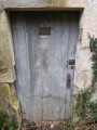
(3) Turn left onto the path marked ‘Blue Circle’. Continue along the main track, ignoring the new ‘Blue Circle’ route. This easy track is a former railway line from the First World War, as evidenced by the fragments of ballast visible here and there. Also note the two blockhouses on the left-hand side of the track.
(4) Head down the track on the right, which leads to a hunting lodge (which is open and can be used as a shelter). Then take the track on the right that runs alongside the pumping station.
(5) Head uphill, following the track to the left. The yellow tags on the trees mark reference trees that are regularly monitored by the Lorraine Regional National Park as part of its study of this Natura 2000 site.
(6) Ignore the path branching off to the right. Continue straight ahead, ignoring the various logging clearings. You will reach the protohistoric rampart that once defended access to this enclosed spur, a defensive site. It is followed by a deep ditch. A second rampart is visible about a hundred metres further on, also flanked by a ditch.
(7) Stay on the main path.
(8) At the junction, turn right. The path winds its way down to the bottom of the valley; follow it to the right to emerge, further on, into the Grand-Fontaine valley.
(9) Stay on the main track, keeping to the right.
(5) Continue to the left, skirting the site of old ponds that no longer exist (see the link in the introduction to the walk). (Along the route, an open hunting lodge on the right can be used as a shelter or a place for a picnic.)
(10) Return to the route and turn right.
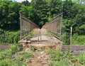
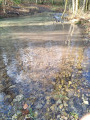
(11) Turn right and cross the ford. Depending on the water level, crossing it may prove tricky. Then head straight up the slope.
(3) Follow the route you took on the way there, but in the opposite direction.
(2) Stay in the wide gully to reach the plateau and the Masson Fontaine Forest Road.
(12) Follow this to the left and carry on until you are about fifty metres from the fork where you started.
(13) Turn right to complete the arboretum route, then turn right again to return to the car park (S/E).


 Visorando Member
 Moderate