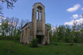
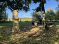
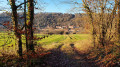
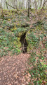
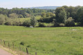
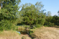
Explore the destroyed village of Remenauville and its surroundings

A walk to explore Remenauville, a village destroyed during the First World War, with an extension southwards along the edge of ‘Petite Suisse lorraine’ and through the fields.

Details

49574863
Creation:
Last update:
Last review:
  • Walking
    Activity: Walking
  • ↔
    Distance: 6.70 mi
  • ◔
    Average duration: 3h 20 
  • ▲
    Difficulty: Moderate

  • ⚐
    Back to start: Yes
  • ↗
    Ascent: + 259 ft
  • ↘
    Descent: - 289 ft

  • ▲
    Highest point: 1,017 ft
  • ▼
    Lowest point: 794 ft

Photos

Description of the walk

The walk starts at the entrance to the destroyed village; parking is easy.

(S/E) Visit the village and return to the car park. Turn left onto the D75 as you leave the village and follow the road.

(1) Continue straight on along the D75.

(2) Turn right onto the next gravel farm track (marked by a large, centuries-old tree). Further on, the track runs along the edge of a woodland.

(3) Underneath the power line, the track enters the Bois de Chambrotte. Further on, it turns south.

(4) Pass under the bridge on the D958 and continue along the forest track which runs along the valley floor.

(5) At the junction of two paths (one of which crosses the river), turn right onto an uphill forest track.

(6) Further up, the track turns north-west. Stay on it, ignoring any side tracks.

(7) At the junction of the tracks, carry on straight ahead. Further on, the track turns north and joins the D958.

(8) Cross carefully to take the track opposite, slightly to the left.

(9) At the junction of four farm tracks, under the power line, take the one turning left.

(10) A little further on, take the track branching off to the right, which climbs slightly.

(11) At the junction of farm tracks, head left and return to the junction where the circular track begins.

(1) Turn left onto the D75 to return to the car park (S/E).

Waypoints

  1. S/E : mi 0 - alt. 1,017 ft - Remenauville (village détruit)
  2. 1 : mi 0.26 - alt. 971 ft - Crossroads of the circular loop
  3. 2 : mi 0.49 - alt. 935 ft - Crossroads, large tree
  4. 3 : mi 1.13 - alt. 906 ft - Entering the forest
  5. 4 : mi 2.14 - alt. 850 ft - Under the bridge
  6. 5 : mi 3.29 - alt. 794 ft - Uphill forest track
  7. 6 : mi 3.49 - alt. 915 ft - Change of direction.
  8. 7 : mi 4.21 - alt. 984 ft - Junction, farm track
  9. 8 : mi 4.83 - alt. 919 ft - Crossing the D958
  10. 9 : mi 5.04 - alt. 919 ft - Junction, farm track
  11. 10 : mi 5.45 - alt. 899 ft - Junction, farm track
  12. 11 : mi 6.08 - alt. 1,004 ft - Junction, farm track
  13. S/E : mi 6.7 - alt. 1,017 ft - Remenauville (village détruit)

Notes

GPS or the Visorando app is recommended as there is very little signposting.

Allow an extra 1 hour 30 minutes on top of the stated duration to enjoy the village and the ‘Little Swiss’ region of Lorraine.

Hike adapted from the one proposed by the Mad & Moselle Community of Communes: Haye Plateau Route

Worth a visit

Along the way: you can explore the various information and commemorative panels, followed by the pleasant surroundings of ‘Little Lorraine Switzerland’.
Nearby: other villages destroyed during the First World War.

Reviews and comments

4.4 / 5
Based on 3 reviews

Reliability of the description
4.5 / 5
Ease of following the route
4.3 / 5
Route interest
4.3 / 5
CHRISTIANRANDO2017
CHRISTIANRANDO2017

Overall rating : 3.7 / 5

Date of your route : Apr 03, 2026
Reliability of the description : ★★★★☆ Good
Ease of following the route : ★★★☆☆ Average
Route interest : ★★★★☆ Good
Very busy route : No

It would seem wiser, to avoid part of the route, to take the path leading to the STE BARBE farm via the main street of the ruined village, then turn right towards the D75 and rejoin the path of the ball-shaped lime tree.
Otherwise, you risk taking the return path (first farm track (1)).
At point 9, we are not under the HIGH-VOLTAGE POWER LINE. This is further to the right.
A lovely, easy historical walk through the forest and fields. I highly recommend it.

Machine-translated

jojo54
jojo54

Overall rating : 4.7 / 5

Date of your route : Feb 09, 2026
Reliability of the description : ★★★★★ Very good
Ease of following the route : ★★★★★ Very good
Route interest : ★★★★☆ Good
Very busy route : No

No problem

Machine-translated

Christecol
Christecol

Overall rating : 5 / 5

Date of your route : May 30, 2025
Reliability of the description : Not used / Not applicable
Ease of following the route : ★★★★★ Very good
Route interest : ★★★★★ Very good
Very busy route : No

A lovely walk, which I didn’t hesitate to extend considerably (by 7 km) from waypoint no. 5 towards the St Jacques farm and then up through the wide valley of the Bois de Bouchot to waypoint no. 7. It’s absolutely enchanting at the moment, with lots of songbirds. It’s impossible to get lost – the GR 5 runs through here.

Machine-translated

Other walks in the area

For more walks, use our search engine .

The GPS track and description are the property of this route's author. Please do not copy them without permission.