


Refine your search for walks in Ger (Pyrénées-Atlantiques)
Ger (Pyrénées-Atlantiques) walks
 On the Plateau de Ger via the Menhir de Roye
 Visorando Member
 6.12 mi
 +141 ft
 -148 ft
 2h 55
 Easy
 Departure from Ibos (Hautes-Pyrénées)
An ideal route for Nordic walking in winter as it is in very open countryside; pleasant in fine weather with magnificent views of the Pyrenees. You’ll pass the menhir on the Plateau de Ger, as well as numerous roe deer, a few does and wild boar. This route takes less than two hours to complete at a brisk pace using Nordic walking poles. Allow three hours for a leisurely walk.
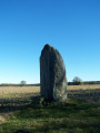
The Menhir of the Ger Plateau
 7.30 mi
+538 ft
-538 ft
3h 50
 Moderate
Departure from Ibos (Hautes-Pyrénées)
The route starts at the top of the Ger hill in Ibos and takes you to the Menhir on the Ger plateau. After entering the woods, the route becomes shaded and you will walk up the Géline. You will see a mini waterfall. You may even spot some deer...
Moderator's note : the slate bridge has been destroyed: see the notice dated 21/03/2022.
Around the Souy at Bois du Commandeur
5.87 mi
+89 ft
-89 ft
2h 45
Easy
Departure from Ibos (Hautes-Pyrénées)
Hike in the Bois du Commandeur in Ibos and Bordères-sur-l'Échez along the Souy river.The route is located between the D817 road from Pau and the D2 road from Bordères to Pintac, mainly using forest paths and trails. However, there are some short sections on roads.
⚠️ Read the comments on this hike.
Circular route around La Géline
9.37 mi
+1,112 ft
-1,115 ft
5h 15
Moderate
Departure from Oursbelille (Hautes-Pyrénées)
A pleasant circular walk through the woodland around La Géline. You’ll pass through La Montjoie, follow theGR® 101 and one of its variants, and walk past Tarasteix Abbey. Descend back towards La Géline, then climb back up via Sarluzen. Another descent and ascent to visit Castet Crabé, followed by a final kilometre to wind down gently. It’s also an ideal route for a 3 h 30 min to 3 h 45 min Nordic walking session.
Andoins from Soumoulou, the balcony of the Pyrenees
 9.40 mi
+400 ft
-417 ft
4h 40
Moderate
Departure from Soumoulou (Pyrénées-Atlantiques)
An accessible and varied circular route on the balcony of the Pyrenees. Starting and ending in the centre of Soumoulou, this hike is appealing for its practicality: spacious car park, easy start and a circular route that avoids any complex logistics. The route alternates between quiet roads, country lanes and PR® footpaths, offering a gentle immersion in the contrasting landscapes of the Pyrenees and the Béarn plains.
In the footsteps of Henry IV from Soumoulou
 7.60 mi
+325 ft
-328 ft
3h 45
Moderate
Departure from Soumoulou (Pyrénées-Atlantiques)
A circular route around the lower part of the village of Soumoulou via Gomer, where you can discover part of Henri IV's trail, the GR® 782, in the hills. The village's central square offers easy parking.
Between Saint-Vincent and Coarraze
14.44 mi
+1,709 ft
-1,732 ft
8h 10
Moderate
Departure from Saint-Vincent (Pyrénées-Atlantiques) (Pyrénées-Atlantiques)
A walk above the Nay plain, with panoramic views of the Pyrenees and the Piedmont!! Bring a picnic and enjoy the fresh air!!!
The Chemin Henri IV in Lucgarier
4.34 mi
+410 ft
-397 ft
2h 20
Easy
Departure from Lucgarier (Pyrénées-Atlantiques)
A hilly route through the woods along the Chemin Henri IV. The second part is mainly on a gravel track. There is little tarmac.
Exploring South Tarbes: Aerodrome, Courte Boule, Gespe and Odos Nord
4.68 mi
+30 ft
-30 ft
2h 10
Easy
Departure from Tarbes (Hautes-Pyrénées)
A winter training route in the city to prepare for the walking season as soon as the warmer weather arrives. This route is suitable for city dwellers who wish to explore some of Tarbes’ neighbourhoods.
The Lapassade route
7.16 mi
+430 ft
-417 ft
3h 40
Moderate
Departure from Odos (Hautes-Pyrénées)
A circular route through the woods of Odos. Of the 11.5 km of this route, only 2.5 km are on roads. You will set off from the Esplanade du Château car park in Odos. You will pass successively through Le Bouscarou, Château de la Passade, Le Turon du Balabay, Les Vignettes, and the ridge path above Hibarette. The return descent takes you through Biouès, La Passade, the path from Odos to Louey and the Beyrède path. A final short stretch of road before arriving back at the château.
A pleasant route to tackle by Nordic walking in 2½ hours for the fitter or by mountain bike in 1½ hours.
Exploring Tarbes
5.70 mi
+36 ft
-36 ft
2h 40
Easy
Departure from Tarbes (Hautes-Pyrénées)
An urban walking tour allowing you to explore the city whilst discovering the main points of interest.
Circular route from Nousty via La Houn de Moussu and Chemin Henri IV.
 8.70 mi
+492 ft
-495 ft
4h 25
Moderate
Departure from Nousty (Pyrénées-Atlantiques)
Easy country hike around Nousty, starting from the village centre with its beautiful buildings and wash house.
On this very rural route, the Houn de Moussu is a local curiosity, a fountain providing water that is very good for your health, according to the elders. Legend has it that Henri IV drank from it when travelling from Pau to Coarraze.
There is a viewpoint shortly after the 419-metre altitude on the Chemin Henri IV.
The return through the fields, crossing fords, adds extra charm to the outing.
Les Noyers and the Pierre du Diable in two circular loops from Bénac
8.31 mi
+896 ft
-896 ft
4h 35
Moderate
Departure from Bénac (Hautes-Pyrénées) (Hautes-Pyrénées)
A half-day hike through meadows and fields, from Bénac to Hibarette, then through the wooded hillsides from Bénac to Layrisse.The two circular loops link up easily, taking 3½ hours for hikers and 4 hours for families. This route is well suited to Nordic walking and can be completed in 2½ to 3 hours.The second section is well suited for some short interval training, with three hills of 1 km each.
In the footsteps of Gaston Fébus in Montaner
 6.68 mi
+797 ft
-778 ft
3h 45
Moderate
Departure from Montaner (Pyrénées-Atlantiques)
This walk takes you past the unmissable medieval castle of Gaston Fébus, built entirely of brick, and explores the countryside around the village of Montaner.
The 4 churches route
 Tourist office
 8.00 mi
+879 ft
-863 ft
4h 25
Moderate
Departure from Montaner (Pyrénées-Atlantiques)
This walk will take you to the four churches of Montaner, through forests and, from the plateaus, to vast panoramas with the castle tower as your anchor point.
The Henri IV Trail
 20.70 mi
+732 ft
-1,421 ft
10h 10
 Difficult
Departure from Lourdes (Hautes-Pyrénées)
A beautiful route linking Lourdes to Pau along an ancient Roman road steeped in history. The Henri IV trail stretches across the Hautes-Pyrénées and Pyrénées-Atlantiques departments, along the foothills of the Pyrenees.
Tour of Lake Lourdes
3.73 mi
+203 ft
-207 ft
1h 55
Easy
Departure from Lourdes (Hautes-Pyrénées)
Just a few kilometres from the centre of Lourdes, without ever really straying far from the town, Lake Lourdes looks like something straight out of a postcard. Formed by a glacier and nestled in the foothills of the Pyrenees, it offers a circular route of around six kilometres where calm waters, forests and clearings alternate at every bend. Along the way: a remarkable peat bog designated as a Natura 2000 site, unobtrusive yet very much present flora and fauna, and, in fine weather, the Pyrenees mountain range stretching out on the horizon. No daunting climbs, no technical difficulties: simply the pleasure of walking at your own pace alongside tranquil waters, just a stone’s throw from the hustle and bustle of the Marian city. A walk accessible to all, to be enjoyed with the family or on your own, and which holds a few surprises for the observant walker.
The paths of Loucrup
 5.83 mi
+630 ft
-636 ft
3h 15
Easy
Departure from Orincles (Hautes-Pyrénées)
Observe the traditional architecture of the Bigourdan houses in Orincles and their pebble walls along an easy route, which can be enjoyed by the whole family over half a day while strolling. From the top of the hills, you can enjoy a beautiful view of the Pyrenees.
This walk can be done in just under two hours at a brisk pace.
Tour of Caster Bern in the Lourdes Forest
 3.03 mi
+180 ft
-174 ft
1h 35
Easy
Departure from Lourdes (Hautes-Pyrénées)
On the outskirts of Lourdes, the Bois de Subercarrère stretches out over four hundred hectares of shade and coolness. The Castet Bern trail winds its way peacefully through the deciduous trees and undergrowth: 3.9 km, 54 m elevation gain – perfect for a leisurely family walk.The town fades from view. You walk to the sound of birdsong, on the lookout for a roe deer, a great spotted woodpecker or a red squirrel. Fun information boards and a game booklet spark the curiosity of the youngest visitors and turn the walk into a land of discovery. But the woodland also holds its secrets: a name meaning ‘above the road’, legends that storytellers still bring to life, centuries of forestry history and, nearby, the route taken by pilgrims on the Way of St James. A breath of fresh air in the countryside, a real forest bath, within everyone’s reach.
The Grand Béout circular route via Cité Saint-Pierre and La Citoyenne
 2.65 mi
+1,280 ft
-1,276 ft
2h 20
Difficult
Departure from Lourdes (Hautes-Pyrénées)
Tour of the Cité Saint-Pierre via the Béout ridge, passing by the summit cross and the old cable car station with views of Lourdes, the Gave de Pau and the start of the Vallée des Gaves.This hike in a wild area, with little or no signposting and trails that are difficult to see in summer and overgrown with ferns (especially on the descent), makes it accessible only to "adventurers" over the age of 10 who are not afraid of discovering this little summit!
A circular loop around Le Béout on the hills above Lourdes via the Cité Saint-Pierre
 3.37 mi
+1,263 ft
-1,247 ft
2h 40
Moderate
Departure from Lourdes (Hautes-Pyrénées)
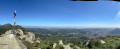
A short hike in the hills above Lourdes. The route is rarely used but well worth a look. It follows the northern ridge, which is the longest and has the greatest elevation gain.From the main summit at 791m, where a cross stands, there is a 360° view over the Lourdes region.From the second summit at 719 m, there is a viewpoint overlooking the old Béout cable car station (sic). A little further on is the entrance to the cave known as the ‘Gouffre de Lourdes’, which is 82 m deep.
On the slopes of the Béout, via the Mouniquet farm and the Cité Saint-Pierre
1.75 mi
+466 ft
-466 ft
1h 15
Moderate
Departure from Lourdes (Hautes-Pyrénées)
This route offers a lovely walk along the wooded slopes of the Béout and ends by passing through the Mouniquet farm – with its remarkably peaceful meadows – and the magnificent grounds of the Cité Saint-Pierre.
The Mousqué plateau
 2.79 mi
+568 ft
-564 ft
1h 45
Easy
Departure from Saint-Pé-de-Bigorre (Hautes-Pyrénées)
This beautiful, accessible walk is steeped in history; it follows the old Pontacq road used by charcoal burners in days gone by. Once you arrive at the Mousqué plateau, you can enjoy a shaded picnic area at the foot of century-old oak trees. From there, admire the superb view of the Saint-Péen massif and its countryside, then the Nay plain stretching all the way to Pau.
Long circular from Le Mousqué to Saint-Pé-de-Bigorre
 4.68 mi
+896 ft
-902 ft
2h 55
Moderate
Departure from Saint-Pé-de-Bigorre (Hautes-Pyrénées)
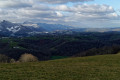
A must-visit spot for the locals of Saint-Pé and their friends, the peaks of Le Mousqué and La Tourette offer a change of scenery and magnificent panoramic views of the surroundings of Saint-Pé-de-Bigorre.Ideal at sunset in summer.
 The Marbrières de la Génie Longue in Peyras
 4.95 mi
+351 ft
-381 ft
1.5 hrs
Easy
Departure from Saint-Pé-de-Bigorre (Hautes-Pyrénées)
A short cycle ride along the banks of the Génie Longue torrent in the Saint Pé-de-Bigorre massif, where the forest of the same name begins, or the Très-Croutz (Trois-Croix in the Bigourdan dialect).
You’ll discover a cluster of buildings, completely overgrown by lush vegetation, which see very little sunlight.
This deeply mysterious forest and these abandoned buildings from the early 20th-century marble industry transport us into the land of the genies...
Montagnou de la Lit to Saint-Pé-de-Bigorre
 2.56 mi
+659 ft
-659 ft
1h 45
Moderate
Departure from Saint-Pé-de-Bigorre (Hautes-Pyrénées)
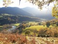
Starting from the Place des Arcades in Saint-Pé-de-Bigorre, enjoy a pleasant, peaceful walk to reach one of the hills sheltering the village, the “Montagnou de la Lit”, to the east. From up there, you can easily reach the entrance to the Grotte de la Résistance and, for the more adventurous, that of the Tute Faiouias.Magnificent views over the Gave de Pau valley and the ridges of the neighbouring peaks of the Saint-Pé massif.Return via the “Montagnou”, another hill above the village.
Prairie de la Cantilerie or Prairie du Lapin Qui Tricote
 2.38 mi
+200 ft
-217 ft
1h 15
Easy
Departure from Saint-Pé-de-Bigorre (Hautes-Pyrénées)
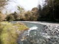
A few kilometres from the centre of Saint-Pé, a small pebble beach is the perfect spot for a refreshing dip in summer and a peaceful picnic break.
The knitting rabbit is hiding in the tall grass on the neighbouring property!
Around Saint-Pé-de-Bigorre
 4.35 mi
+512 ft
-538 ft
2h 25
Moderate
Departure from Saint-Pé-de-Bigorre (Hautes-Pyrénées)
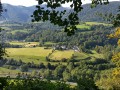
In the Hautes-Pyrénées, near Lourdes, Saint-Pé-de-Bigorre reveals some of its charms during this hike: architecture, limestone massif and caves (with views of the Gave de Pau and the surrounding mountains), and even its Devil's Bridge!
Grand tour of Saint-Pé-de-Bigorre via the hillsides
 6.40 mi
+597 ft
-584 ft
3h 30
Moderate
Departure from Saint-Pé-de-Bigorre (Hautes-Pyrénées)
On the hillsides of Saint-Pé-de-Bigorre, this 10 km route with an elevation gain of 180 m takes you through everything that makes the immediate surroundings of this village so beautiful: its small paths, meadows, woods, rivers and houses, in short, its rural heritage.Whether you're a regular walker or runner, a local or a visitor, you're sure to enjoy yourself here!
Le Montagnou de Saint-Pé
 1.03 mi
+236 ft
-213 ft
0h 40
Easy
Departure from Saint-Pé-de-Bigorre (Hautes-Pyrénées)
A short walk in the hills above Saint-Pé-de-Bigorre offering breathtaking views of the village and its exceptional heritage: its 11th-century church, the former seminary and Catholic school, and the remarkable streets and houses dating from the 15th to the 18th centuries.There are also beautiful views of the mountain range to the south, including the Très-Croutz forest and the ridge of the Cirque de Bat dé Haü, stretching from the Toupiettes in the west to the Aülhet in the east.
Soum de Basta and Pic du Jer
 8.67 mi
+2,641 ft
-2,641 ft
6h 15
Moderate
Departure from Lourdes (Hautes-Pyrénées)
An off-the-beaten-track hike that takes you up two small peaks near Lourdes.A good sense of direction is required for the climb to the Pic du Jer. Do not attempt this hike in wet weather.
⚠️ User comment dated 8 March 2026 => There appears to be a serious access issue at the start due to the poor condition of the track. See alternative route in the practical information section.
The hillsides of Saint-Lézer
7.40 mi
+545 ft
-545 ft
3h 55
Moderate
Departure from Saint-Lézer (Hautes-Pyrénées)
On the wooded hillsides to the west of the Val d'Adour, this route starting from the Gallo-Roman site of Saint-Lézer offers a magnificent view of the Pyrenees.
Lengous and Montagnou
 3.34 mi
+433 ft
-440 ft
1h 55
Easy
Departure from Saint-Pé-de-Bigorre (Hautes-Pyrénées)
A pleasant walk through the woodland along the banks of the Gave de Pau, passing through Rieulhès, a typical Pyrenean hamlet. You’ll enjoy several remarkable views of the village of Saint-Pé-de-Bigorre.
Montné Ridges and Col du Prat d’Aürelh circular loop via Le Pladi
 9.32 mi
+3,688 ft
-3,684 ft
7h 30
Difficult
Departure from Saint-Pé-de-Bigorre (Hautes-Pyrénées)
A beautiful, physically demanding day’s hike with several exposed sections along the ridges, taking you to the heights of the Saint-Pé-de-Bigorre massif, first to the east and then north-east, above the Génie Longue torrent.
Final stop at the Refuge du Col du Prat d’Aürelh (du Rey) and its summer pastures.
Magnificent scenery! Solitude guaranteed!
The Montagnou de la Pâle caves in the Très-Croutz Forest
 2.26 mi
+919 ft
-919 ft
1h 50
Easy
Departure from Saint-Pé-de-Bigorre (Hautes-Pyrénées)
Just a stone’s throw from the village of Saint-Pé-de-Bigorre, this walk takes us along the trail of the massif’s caves, particularly those on a large hilltop, the Mountagnou de la Pale. The caves are dotted along this route as if laid out especially for the walker. We approach the gaping hole of the Gouffre du Hayau, whose unusual size and the draught of air coming in would surely draw you into its dark abyss, were you not careful...
This route was significantly altered in May 2024 by the creation of a new ‘karst trail’.
Meadows of Garrapit and Bénac on the slopes of the Araü
 5.24 mi
+1,903 ft
-1,903 ft
4h 05
Moderate
Departure from Saint-Pé-de-Bigorre (Hautes-Pyrénées)
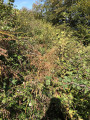
On the forgotten trails of Saint-Pé-de-Bigorre No. 6
The Araü is the mountainous ridge jutting out from the Massif de Saint-Pé down to the Gave de Pau at the foot of the village. Its imposing, entirely wooded silhouette conceals pretty clearings, once meadows, some well-known paths and others forgotten, used only by hunters and hiking enthusiasts beneath the tall trees of the forest.
Its summit, towering arrogantly over the village, is the Soum de las Toupiettas (1,357m).
Aubuchous circular loop
 1.96 mi
+427 ft
-417 ft
1h 15
Easy
Departure from Gez-ez-Angles (Hautes-Pyrénées)
A beautiful, easy circular path near the small village of Gez-ez-Angles, located a few kilometres from Lourdes. You will walk along an open ridge to the small summit of Aubuchous, where you can enjoy a wide panorama of the foothills and the Pyrenees mountain range, before returning to the village via a more wooded path.
Très-Crouts Forest – Saint-Pé-de-Bigorre – Ridge Route
 8.64 mi
+3,868 ft
-3,822 ft
7h 20
Moderate
Departure from Asson (Pyrénées-Atlantiques)
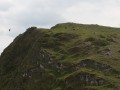
This beautiful mid-mountain hike, suitable for experienced walkers, offers the chance to admire astonishing biodiversity and 360° panoramic views over the Piedmont plain and the main range of the Pyrenees.
After a strenuous climb, the route takes you across the mountain pastures on the Plateau de l’Isarce and along a stunning ridge – straddling the Hautes-Pyrénées and Pyrénées-Atlantiques departments – to the modest summit of the Soum de la Génie Braque. Well known to locals, this route offers a guaranteed change of scenery!
Route des Puyolles
 3.06 mi
+535 ft
-531 ft
1h 50
Easy
Departure from Montgaillard (Hautes-Pyrénées) (Hautes-Pyrénées)
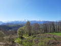
This is a beautiful family circular on the heights of the village of Montgaillard. It will allow you to discover beautiful views of the Tarbes plain and the Haut-Adour valley, with the Pic du Midi de Bigorre and Montaigu as a backdrop!
As you climb up to an ancient Roman oppidum, follow historic paths or stroll through the village streets, you will also get a glimpse of the region's past.
More walks in Ger (Pyrénées-Atlantiques)
Select a point of interest below: