


Refine your search for walks in Étobon
Étobon walks


 Walk around the woods of the former medieval castle of Étobon
 Visorando Member
 4.05 mi
 +472 ft
 -456 ft
 2h 15
2h 15
 Easy
Easy
 Departure from Étobon (Haute-Saône)
Étobon is a charming little village (known for its martyrs) in Haute-Saône, set in a heavily wooded area.
It is situated at the foot of the Vosges Regional Nature Park in the Chérimont massif, where many streams and ponds converge. It also has a feudal history linked to various princely families.
La Tête du Cheval at Clairegoutte
 2.91 mi
+308 ft
-285 ft
1h 35
Easy
Departure from Clairegoutte (Haute-Saône)
2.91 mi
+308 ft
-285 ft
1h 35
Easy
Departure from Clairegoutte (Haute-Saône)
A short family walk with views of the Alps and Ronchamp Chapel.
Tour of the ponds and fountains in Chenebier
 5.94 mi
+420 ft
-413 ft
3h 05
Easy
Departure from Chenebier (Haute-Saône)
5.94 mi
+420 ft
-413 ft
3h 05
Easy
Departure from Chenebier (Haute-Saône)
You may be surprised by the siren that, according to legend, haunts the ponds along this route.
A superb hike 15 km from Belfort and 10 km from Héricourt.
You will also discover a pretty village with its church and temple, beautiful countryside and forest landscapes with numerous ponds.
Along the route, information boards describe part of the history of this region and the legend of the mermaid.
The Champagney Canal
 4.34 mi
+453 ft
-459 ft
2h 25
4.34 mi
+453 ft
-459 ft
2h 25
 Moderate
Departure from Champagney (Haute-Saône) (Haute-Saône)
Moderate
Departure from Champagney (Haute-Saône) (Haute-Saône)
Explore a section of the Champagney Canal, work on which began in 1884 and was halted in 1909.
The old Haute-Saône Canal from Frahier to Ronchamp
5.40 mi
+574 ft
-577 ft
3h 00
Moderate
Departure from Champagney (Haute-Saône) (Haute-Saône)
A pleasant walk through the Chérimont Forest. You’ll discover the old Haute-Saône Canal, which was intended to link Frahier to Ronchamp. In winter, the trees have shed their leaves, offering a clearer view of the landscape. As the route runs mainly through woodland, the temperature remains cool and pleasant in summer. A short round trip takes you to the Chérimont Underground Passage.
The walk is signposted.
Circular Échavanne-Frahier route via the canal, the woods and Frahier harbour
7.55 mi
+407 ft
-387 ft
3h 50
Moderate
Departure from Échavanne (Haute-Saône)
A pleasant walk through woodland and along the canal, covering two distinct sections. Best undertaken in dry weather or when the ground is well-drained. This walk can be shortened: see details in the description.
The Chérimont and Chatelaye ponds and the canal lock
5.35 mi
+591 ft
-594 ft
3h 00
Moderate
Departure from Champagney (Haute-Saône) (Haute-Saône)
(2) A pleasant walk, mostly through the woods along forest tracks. In wet weather, some sections between (2) and (3) and between (6) and (7) are a little more difficult (muddy), especially in winter when there are leaves on the ground.
Around Frahier via Les Grands Hauts
3.80 mi
+246 ft
-269 ft
2h 00
Easy
Departure from Frahier-et-Chatebier (Haute-Saône)
Walk around Frahier, passing the Les Rouges Vis botanical garden then through Les Grands Hauts with views of the Vosges mountains.
Les Grands Hauts from the Port de Frahier
3.28 mi
+171 ft
-171 ft
1h 40
Easy
Departure from Frahier-et-Chatebier (Haute-Saône)
From the port of Frahier, stroll along the old canal, then discover the Grands Hauts and the panoramic view of
the Ballon d'Alsace and the Planche des Belles Filles.
The Champagney Basin Tour
 4.94 mi
+203 ft
-203 ft
2h 25
Easy
Departure from Champagney (Haute-Saône) (Haute-Saône)
4.94 mi
+203 ft
-203 ft
2h 25
Easy
Departure from Champagney (Haute-Saône) (Haute-Saône)
Easy hike along the edge of the Champagney basin.
Marie des Geais et Pierre Saint Desle
 3.42 mi
+433 ft
-430 ft
1h 55
Easy
Departure from Frahier-et-Chatebier (Haute-Saône)
3.42 mi
+433 ft
-430 ft
1h 55
Easy
Departure from Frahier-et-Chatebier (Haute-Saône)
Cette jolie balade forestière offre de belles ambiances et vous permettra de découvrir un petit oratoire en sous-bois, non loin d'une borne de l'ancienne principauté de Lure, portant des croix de Templier.
Walk south of Frahier and Chatebier
6.79 mi
+377 ft
-367 ft
3h 25
Easy
Departure from Frahier-et-Chatebier (Haute-Saône)
A lovely walk starting from Frahier et Chatebier, 10 km west of Belfort.
This walk takes you through lovely countryside and woodland scenery. On the way back, it follows the old Haute-Saône Canal.
La Blanche Pierre in Éboulet
 Association / Club / Walk leader4.27 mi
+554 ft
-571 ft
2h 25
Easy
Departure from Champagney (Haute-Saône) (Haute-Saône)
Association / Club / Walk leader4.27 mi
+554 ft
-571 ft
2h 25
Easy
Departure from Champagney (Haute-Saône) (Haute-Saône)
Close to Champagney and Ronchamp, this route will introduce you to the geology, forest, flora and local history.
La Diaichotte route in Chagey
 3.09 mi
+315 ft
-322 ft
1h 40
Easy
Departure from Chagey (Haute-Saône)
3.09 mi
+315 ft
-322 ft
1h 40
Easy
Departure from Chagey (Haute-Saône)
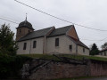
This short country walk takes you through the village of Chagey with its temple, church and war memorial to the 1870-71 war: the Diaichotte. During the walk, you will discover a rolling landscape with crops, livestock and a beautiful forest. You will also discover the Virgin Mary of the Geais and, next to it, a menhir or Pierre de Saint-Desle.
The route is signposted.
Circular route around Frahier-et-Chatebier
 6.50 mi
+243 ft
-236 ft
3h 10
Moderate
Departure from Frahier-et-Chatebier (Haute-Saône)
6.50 mi
+243 ft
-236 ft
3h 10
Moderate
Departure from Frahier-et-Chatebier (Haute-Saône)
Discover the surroundings of Frahier via the Haute-Saône canal, the forest tunnel towards Châlonvillars, the Grosjean district, Le Thiamont (commune of Évette-Salbert) with a view of the Vosges Saônoise. For the return journey, walk through Les Grands Hauts, the old port of Frahier via the canal and the village centre.
 A short cycle route around Frahier and Chatebier
10.00 mi
+551 ft
-548 ft
2 hrs
Easy
Departure from Frahier-et-Chatebier (Haute-Saône)
This short cycle ride around Frahier and the neighbouring villages will allow you to discover the region’s varied landscapes: its woods, rolling meadows, streams and brooks, fountains and wash houses, ponds, hills and the old canal.
Through the Bois des Époisses
 3.07 mi
+52 ft
-52 ft
1h 30
Easy
Departure from Champagney (Haute-Saône) (Haute-Saône)
3.07 mi
+52 ft
-52 ft
1h 30
Easy
Departure from Champagney (Haute-Saône) (Haute-Saône)
A lovely walk, almost entirely through woodland and without any difficulty, offering the chance to discover traces of the 19th-century mining history of this area of Champagney (mine shafts, slag heap, railway line, mining towns). Ideal for families; children can try out some of the exercises on the fitness trail.
Please note that this route is not affected by the Champagney municipal by-law prohibiting access to communal forests from 31 July to 23 August 2026.
The Bois de La Rochotte
7.47 mi
+1,024 ft
-1,004 ft
4h 20
Moderate
Departure from Champagney (Haute-Saône) (Haute-Saône)
A woodland walk that, as it winds through the clearings, offers beautiful views of Champagney, its vast basin and the Rahin valley. Numerous streams sing their way through the undergrowth.
Route of discovery of the centre of Ronchamp
2.19 mi
+82 ft
-82 ft
1h 05
Easy
Departure from Ronchamp (Haute-Saône)
Most people come to Ronchamp to see the Notre-Dame-du-Haut Chapel. However, there are a few other places of interest to discover in the village centre and surrounding area, such as the Ronchamp spinning mill, the Mining Museum, the Sainte-Marie Well and Ronchamp Church. This is a completely urban circular route designed to showcase Ronchamp's heritage. It is of course possible to combine this visit with another hike.
La Ronde du Paquis in Mandrevillars and Échenans-Sous-Mont-Vaudois
 4.03 mi
+203 ft
-187 ft
2h 00
Easy
Departure from Mandrevillars (Haute-Saône)
4.03 mi
+203 ft
-187 ft
2h 00
Easy
Departure from Mandrevillars (Haute-Saône)
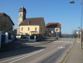
A very pleasant 7 km hike north of Héricourt and 15 km south-west of Belfort.
Superb countryside, beautiful forests and the pretty villages of Mandrevillars and Échenans-sous-Mont-Vaudois.
The route is signposted.
Route du Bois des Gouttes in Chalonvillars and Evette-Salbert
 5.46 mi
+502 ft
-502 ft
2h 55
Easy
Departure from Châlonvillars (Haute-Saône)
5.46 mi
+502 ft
-502 ft
2h 55
Easy
Departure from Châlonvillars (Haute-Saône)
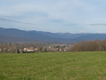
A pleasant walk just a stone's throw from Belfort, in the vicinity of Châlonvillars and Evette-Salbert.
You can discover beautiful countryside and forest landscapes, as well as the village of Châlonvillars with its church and beautiful wash house. Along the way, you will have superb views of the Southern Vosges with the Planche des Belles Filles and the Ballon d'Alsace.
The Fort du Salbert as seen from Châlonvillars
 4.78 mi
+978 ft
-951 ft
3h 05
Easy
Departure from Châlonvillars (Haute-Saône)
4.78 mi
+978 ft
-951 ft
3h 05
Easy
Departure from Châlonvillars (Haute-Saône)
A short walk offering a chance to see structures dating from the late 19th century: an old lock, followed by Fort Salbert and its gun batteries, all set amongst meadows and pretty woodlands without any particular difficulties. Recommended as a way to get back into walking after the winter break or as a family outing to fill an afternoon.
Fort du Mont Vaudois trail near Héricourt
 4.39 mi
+633 ft
-630 ft
2h 35
Easy
Departure from Échenans-sous-Mont-Vaudois (Haute-Saône)
4.39 mi
+633 ft
-630 ft
2h 35
Easy
Departure from Échenans-sous-Mont-Vaudois (Haute-Saône)
Hike in the Héricourt area. You can explore the Fort du Mont Vaudois and its defences. You will descend the inclined plane that was used to build the fort.
You will continue through an unusual landscape of old abandoned orchards along the Bois du Mont Vaudois with some very pretty views.
Circular walk starting from Héricourt via La Pierre Plate
7.88 mi
+909 ft
-902 ft
4h 25
Moderate
Departure from Héricourt (Haute-Saône) (Haute-Saône)
A lovely walk in the Héricourt area. Along this route, you’ll discover beautiful buildings in Héricourt town centre, lovely scenery along the Lizaine, forests and the countryside.
You’ll pass through the villages of Verlans and Tavey.
You’ll also come across the Pierre Plate, an outcrop of limestone in the Grand Bois.
This walk follows part of the Grand Bois discovery route.
The villages of Tavey and Vyans-le-Val, starting from Héricourt
 8.83 mi
+755 ft
-741 ft
4h 45
Moderate
Departure from Héricourt (Haute-Saône) (Haute-Saône)
8.83 mi
+755 ft
-741 ft
4h 45
Moderate
Departure from Héricourt (Haute-Saône) (Haute-Saône)
A lovely walk in the Héricourt area. Along this route, you’ll discover beautiful buildings in Héricourt town centre, lovely scenery along the Lizaine, forests and the countryside. You’ll also pass through the villages of Tavey and Vyans-le-Val.
.
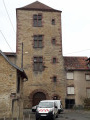
A circular walk from Héricourt to the Source de la Charmille
 8.00 mi
+728 ft
-728 ft
4h 20
Moderate
Departure from Héricourt (Haute-Saône) (Haute-Saône)
8.00 mi
+728 ft
-728 ft
4h 20
Moderate
Departure from Héricourt (Haute-Saône) (Haute-Saône)
A lovely walk where you’ll discover a landscape of forests and countryside.
You’ll be able to admire Héricourt town centre, with its church and temple.
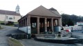
You’ll pass through Brevilliers with its temple and its very traditional wash house.
You’ll continue through an unusual landscape of old, abandoned orchards along the Bois du Mont Vaudois, with some lovely views.
Brevilliers dolmen
 5.20 mi
+371 ft
-351 ft
2h 45
Easy
Departure from Brevilliers (Haute-Saône)
5.20 mi
+371 ft
-351 ft
2h 45
Easy
Departure from Brevilliers (Haute-Saône)
A short, easy country walk for the whole family with views of the Lomont wind turbines, the Chasseral massif in Switzerland (on a clear day) and a visit to the Brevilliers dolmen.
The Forts of Haut Bois and Bois d'Oye
 10.60 mi
+784 ft
-784 ft
5h 35
Moderate
Departure from Brevilliers (Haute-Saône)
10.60 mi
+784 ft
-784 ft
5h 35
Moderate
Departure from Brevilliers (Haute-Saône)
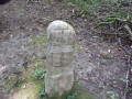
A walk starting from Brévilliers that will take you past various military structures, including the Fort du Bois d'Oye built in 1883, the Fort du Haut Bois (cave shelter), the Banvillars Battery, and the Verpillères fortification. These structures were part of the Belfort stronghold. You’ll return via the path marked by the boundary stones that once separated France from the Principality of Montbéliard. On the way back, as on the way out, you can take a short detour to see the Brévilliers dolmen.
Difficulties encountered previously (3), see reviews for suggestions
Short circular loop in Vyans-le-Val
 2.43 mi
+210 ft
-223 ft
1h 20
Easy
Departure from Vyans-le-Val (Haute-Saône)
2.43 mi
+210 ft
-223 ft
1h 20
Easy
Departure from Vyans-le-Val (Haute-Saône)
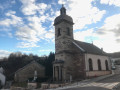
A short, easy and accessible circular walk around Vyans-le-Val, a pretty little village in Haute-Saône.
Circular route around Vyans-le-Val
 5.91 mi
+620 ft
-623 ft
3h 15
Easy
Departure from Vyans-le-Val (Haute-Saône)
5.91 mi
+620 ft
-623 ft
3h 15
Easy
Departure from Vyans-le-Val (Haute-Saône)
Circular walk, starting from the cemetery in Vyans-le-Val.
The circular Mont Corron in Auxelles-Bas
 Local authority
 6.34 mi
+705 ft
-712 ft
3h 30
6.34 mi
+705 ft
-712 ft
3h 30
 Difficult
Departure from Auxelles-Bas (Territoire-de-Belfort)
Difficult
Departure from Auxelles-Bas (Territoire-de-Belfort)
This family-friendly route, starting from the charming mountain village of Auxelles-Bas, alternates between river, countryside and woodland.The route is signposted.
From Auxelles-Haut to the Rahin Valley
 3.63 mi
+1,119 ft
-1,109 ft
2h 40
Easy
Departure from Auxelles-Haut (Territoire-de-Belfort)
3.63 mi
+1,119 ft
-1,109 ft
2h 40
Easy
Departure from Auxelles-Haut (Territoire-de-Belfort)
This walk offers a panoramic view of the northern part of the Territoire de Belfort, then of the village of Plancher-les-Mines and, beyond that, the Vosges Saônoises.
Circular forest above Auxelles Haut
 5.53 mi
+1,677 ft
-1,677 ft
4h 00
Moderate
Departure from Auxelles-Haut (Territoire-de-Belfort)
5.53 mi
+1,677 ft
-1,677 ft
4h 00
Moderate
Departure from Auxelles-Haut (Territoire-de-Belfort)
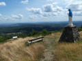
The hike begins with a forgotten path that deserves to be preserved. Access to the Querty grassland is very regular in a magnificent forest. Climb towards La Planche des Belles Filles then descend to Auxelles via the superb panorama of Mont Ménard.
Béthoncourt circular route and mine shaft route
 5.71 mi
+305 ft
-335 ft
2h 55
Easy
Departure from Héricourt (Haute-Saône) (Haute-Saône)
5.71 mi
+305 ft
-335 ft
2h 55
Easy
Departure from Héricourt (Haute-Saône) (Haute-Saône)
A relatively easy circular route starting from Bussurel, returning via the Bethoncourt mine shaft route.
Planche des Belles Filles
 11.50 mi
+2,477 ft
-2,461 ft
7h 25
Difficult
Departure from Auxelles-Haut (Territoire-de-Belfort)
11.50 mi
+2,477 ft
-2,461 ft
7h 25
Difficult
Departure from Auxelles-Haut (Territoire-de-Belfort)
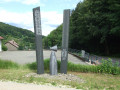
This day-long hike combines the best of the hikes already offered in this area, including the mines, the Belles Filles pond, Le Querty, the summit of La Planche, the shelter and statue of the Virgin Mary at Mont Ménard, and memorial sites (steles and monuments).
Circular from Planche des Belles Filles and Chaume du Querty from Auxelles-Haut
 5.56 mi
+1,893 ft
-1,893 ft
4h 10
Moderate
Departure from Auxelles-Haut (Territoire-de-Belfort)
5.56 mi
+1,893 ft
-1,893 ft
4h 10
Moderate
Departure from Auxelles-Haut (Territoire-de-Belfort)
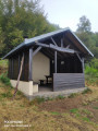
This beautiful walk will take you from the charming village of Auxelles-Haut to the summit of the Planche des Belles Filles. You will cross the vast moorland of Mont Ménard with its statue of the Virgin Mary, protector of the village, and the thatched roof of the Querty. Several beautiful viewpoints punctuate a walk offering beautiful forest scenery.
Mont Ordon-Verrier circular loop
 5.04 mi
+965 ft
-971 ft
3h 10
Easy
Departure from Auxelles-Haut (Territoire-de-Belfort)
5.04 mi
+965 ft
-971 ft
3h 10
Easy
Departure from Auxelles-Haut (Territoire-de-Belfort)
An easy circular walk starting from the very pretty mountain village of Auxelles-Haut, which follows sections of the Sentier du Souvenir and the Sentier des Mines. Stunning panoramic views over Auxelles and Mont Ménard, Malsaucy, Véronne, Salbert and the valley leading down to Plancher-Bas. The route passes through a magnificent forest.
Memorial trail in Auxelles-Haut
 7.65 mi
+1,949 ft
-1,949 ft
5h 15
Difficult
Departure from Auxelles-Haut (Territoire-de-Belfort)
7.65 mi
+1,949 ft
-1,949 ft
5h 15
Difficult
Departure from Auxelles-Haut (Territoire-de-Belfort)
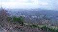
The legacy of the Chemin de la Mémoire, in association with the Association du Souvenir Français.You will find monuments, memorial stones and information boards commemorating the sacrifice of the Resistance fighters in 1944.You’ll discover a wide variety of landscapes: the village of Auxelles-Haut, the forest, the Chaume du Querty, the Planche des Belles Filles ski resort and a superb view of the Haute-Saône mountains, the Vosges, the Jura and the Alps.The walk is signposted.