Country:
 City:
City:


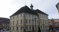
Start at Héricourt Town Hall.
At the start, the route is marked by a Yellow Triangle
(S/E) Turn right onto Rue du Général de Gaulle and follow it for about 500 metres.
(1) Turn right onto Avenue Pierre Bérégovoy and continue for 500 metres until you reach the roundabout. Carry on straight ahead towards the level crossing.
(2) Cross the level crossing and carry on straight ahead along the forest track which climbs into the woods.
At the top, there is a picnic table. Turn right, following the Yellow Triangle signposting, and head back down the other side of the hill. Cross a small river, the Charmille.
(3) Turn left, pass under the high-voltage power line and arrive in Brevilliers. Follow Rue des Chalets, Rue de la Mairie and Rue de l’École.
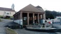
(4) Take a moment to admire the temple, the wash house, the war memorial and the school. Turn left onto Rue de la Barrière. The signposting changes. The route now follows the ‘Green Ring’ signposting. Continue straight on, cross the railway line and the D683, then carry on straight ahead along Rue des Combes. The Source de la Charmille is 500 m away on the left. There is no path leading to it.
(5) At the top of the hill, cross over the E54/N19 motorway. Continue along the path lined with crops and enter the Bois des Ordons.
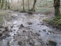
(6) Turn left. The signposting changes. The route now follows the Yellow Rectangle markings as well as the Way of St James signposting. The path descends, crosses a river and climbs again, winding round four bends. Reach the road and follow it for 50 m to the left.
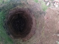
Note: the river continues for 500 metres before disappearing into a ‘blind spot’. Experienced walkers may follow the river on foot as far as the blind spot. Please note that the route is difficult as there is no path.
(7) At this junction, take the second right, heading towards the recycling centre, following the Yellow Rectangle signposting. Pass a path on the left and another on the right.
(8) Continue straight on, following the Yellow Rectangle markings. At the next junction, continue straight on, following the markings.
(9) Turn right onto Chemin du Sacy. The signposting changes; now follow the Blue Triangle signs. Pass three paths on your right. At the next junction, turn right onto Chemin du Télégraphe and then right again onto Chemin du Roublot.
(10) You’ll arrive near the recycling centre; walk alongside it and carefully cross the Route de Luze (D16) just before the roundabout. Continue along the path opposite. This is also a cycle path. The signposting changes; follow the Red Triangle. The path runs alongside the N54-N19 expressway
(11) The path passes under the expressway and emerges on the other side, running alongside the Lizaine. The signposting changes; follow the Green Ring. On the other side of the river is the Chevrets Business Park.
Continue along the cycle path alongside the river. Pass under the D483. At the next junction, carry straight on along the Chemin du Tramway (on your right you can see the pumping station). The signposting changes; follow the Yellow Diamond: Sentier des Ducs. Follow it for about 300 m.
(12) Leave the cycle path and turn onto the track on the left. Marked with a Yellow Diamond and a Yellow Rectangle (GR®5–GR®59link). Walk past the cemetery and turn left immediately afterwards.
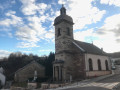
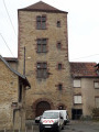
(13) Turn right onto Rue Georges Marconnet. At the roundabout, turn left onto Rue du Docteur Gaulier, then take the second left onto Rue André Launay, left onto Rue de la Voute (extended section) and then head down to the right onto Rue de l’Église (admire the church, the temple and, at the top, the remains of the castle). This will take you to Héricourt Town Hall (S/E).

 Visorando Member

 Easy
Easy