La Tête du Cheval at Clairegoutte

A short family walk with views of the Alps and Ronchamp Chapel.

Details

516992
Creation:
Last update:
Last review:
  • Walking
    Activity: Walking
  • ↔
    Distance: 2.91 mi
  • ◔
    Average duration: 1h 35 
  • ▲
    Difficulty: Easy

  • ⚐
    Back to start: Yes
  • ↗
    Ascent: + 308 ft
  • ↘
    Descent: - 285 ft

  • ▲
    Highest point: 1,926 ft
  • ▼
    Lowest point: 1,647 ft
  • ⚐ Country: France
  • ⚐ City: Clairegoutte (70200)
  • ⚑
    Start/End: N 47.663034° / E 6.65645°
  • ❏
    IGN map(s): Ref. 3520ET, 3521O, 3621OT
  • Hour-by-hour weather

Photos

Description of the walk

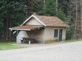
Coming from Héricourt, take the E54 towards Lure. Take the Frédéric-Fontaine / Clairegoutte exit. 20 metres on the right after the give-way sign, take the forest track to the hunters’ hut. Park there.

(S/E) The route starts opposite the hut; take the Chemin de la Tête du Cheval. At the top of the climb, you’ll reach a crossroads of tracks.

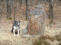
(1) Turn right and follow the stony path. You’ll reach the memorial stone commemorating the 60 people who were shot.

(2) Continue to a turning area.

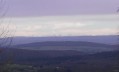
(3) Take the path on the left. Reach the ridge to enjoy a beautiful view of the Alps. Carry on straight ahead, ignoring the other paths. You’ll arrive below the Chérimont.

(4) Walk round it to reach a crossroads of paths.

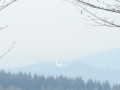
(5) Enjoy the view of the Ronchamp chapel. Carry on to return to the first junction.

(1) Follow the route you took on the way there to return to the car park (S/E).
Waypoints

  1. S/E : mi 0 - alt. 1,647 ft - Hunters’ Lodge car park
  2. 1 : mi 0.44 - alt. 1,818 ft - Crossroads: Chemin de la Tête du Cheval
  3. 2 : mi 0.81 - alt. 1,860 ft - Memorial to the 60 people who were shot
  4. 3 : mi 1.36 - alt. 1,850 ft - Turning area
  5. 4 : mi 1.95 - alt. 1,926 ft - Below the Chérimont
  6. 5 : mi 2.35 - alt. 1,821 ft - Viewpoint at Ronchamp Chapel
  7. S/E : mi 2.91 - alt. 1,647 ft - Hunters’ Lodge car park

Notes

(S/E) Shelter for a snack at the hunters’ hut.

Worth a visit

(2) Memorial stone in memory of those who were shot.
Between (3 and 4) View of the Alps.
(5) View of Ronchamp Chapel.

Reviews and comments

3.9 / 5
Based on 4 reviews

Reliability of the description
4 / 5
Ease of following the route
4.5 / 5
Route interest
3.3 / 5
Pierrot DAVID
Pierrot DAVID
• Edited:

One option for this walk is to start at the junction at elevation 474, above Frédéric Fontaine. Access is via Rue de la Fontaine au Prince and Route d’Etobon.
Head towards Etobon for 50 metres and turn left onto the GR59 (red and white markings) to reach point 2. On your return, take the road, which is now completely quiet as it is closed to traffic. This adds a little to the distance: 7 km with 120 m of elevation gain.

Machine-translated

jadesuzhou
jadesuzhou

I can confirm the information regarding access to the start of the walk: the road is closed to traffic. What a shame.

Machine-translated

Pierrot DAVID
Pierrot DAVID

Overall rating : 4.3 / 5

Date of your route : May 19, 2021
Reliability of the description : ★★★★☆ Good
Ease of following the route : ★★★★★ Very good
Route interest : ★★★★☆ Good
Very busy route : No

If you plan to visit this area regularly, there are two points worth noting:
- Avoid hiking at weekends and on public holidays during the hunting season, as the state-owned forest you will be crossing is a private hunting ground.
- From 1 May 2021, the road leading to the starting point will be closed to traffic (fine: €135).

Machine-translated

azor
azor

Overall rating : 4 / 5

Date of your route : Feb 18, 2019
Reliability of the description : ★★★★☆ Good
Ease of following the route : ★★★★★ Very good
Route interest : ★★★☆☆ Average

A lovely, easy walk, surrounded by nature.
Out of season, when the trees are bare, you can actually see the snow-capped Alps from several spots… it’s worth noting that it’s quite a walk to get to the hunters’ hut.

Machine-translated

Claudine Veillet
Claudine Veillet

Overall rating : 4 / 5

Date of your route : Oct 10, 2018
Reliability of the description : ★★★★☆ Good
Ease of following the route : ★★★★☆ Good
Route interest : ★★★★☆ Good

Nice, but I have the same comments as the hiker who posted on 4 September: the trees now block the views. There aren’t many unobstructed views.

Machine-translated

sylvierando64
sylvierando64

Overall rating : 3.3 / 5

Date of your route : Aug 11, 2017
Reliability of the description : ★★★★☆ Good
Ease of following the route : ★★★★☆ Good
Route interest : ★★☆☆☆ Disappointing

The promised view of the Alps – never found. The walk goes on, but there are very few clear views, as the trees block most of the scenery

Machine-translated

Other walks in the area

For more walks, use our search engine .

The GPS track and description are the property of this route's author. Please do not copy them without permission.