From Auxelles-Haut to the Rahin Valley

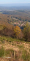
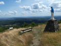
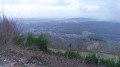
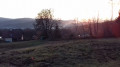
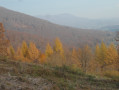
This walk offers a panoramic view of the northern part of the Territoire de Belfort, then of the village of Plancher-les-Mines and, beyond that, the Vosges Saônoises.

Details

n°16079101
Creation:
Last update:
Last review:
  • Walking
    Activity: Walking
  • ↔
    Distance: 3.63 mi
  • ◔
    Average duration: 2h 40 
  • ▲
    Difficulty: Easy

  • ⚐
    Back to start: Yes
  • ↗
    Ascent: + 1,119 ft
  • ↘
    Descent: - 1,109 ft

  • ▲
    Highest point: 2,969 ft
  • ▼
    Lowest point: 2,096 ft

Photos

Description of the walk

Car park to the north-west at the end of the village of Auxelles-Haut, Rue Saint-Jean.

(S/E) Stay on the forest track marked with a Green Rectangle for 500 m, then turn right through the woods to rejoin it further up. Cross the road and climb up opposite (slightly to the left), still following theGR® marked with a Green Rectangle.

(1) Turn right onto a wide path, leaving theGR® on your left.
Walk 900 m to a crossroads, turn left and climb for 90 m to rejoin theGR® marked with a Green Rectangle.

(2) Turn right, then, a few dozen metres further on, turn left at a 90° angle onto a path that descends, leaving theGR® and the ridge path leading to the Tête des Cèpes on your right. Join a forest track (less than 900 m away).

(3) Turn left onto this forest road and walk for about 1.5 km.

(4) Turn left onto thePR® marked with a Yellow Rectangle and reach the ridge, where you turn left, following the same PR®.

(5) Turn right onto theGR® trail, marked with a Green Rectangle, to head back down to the village of Auxelles-Haut.

(1) Follow the route back down the way you came to return to the forest track and reach the car park (S/E).

Waypoints

  1. S/E : mi 0 - alt. 2,096 ft - Car park, Rue Saint-Jean
  2. 1 : mi 0.46 - alt. 2,425 ft - Leave the GR°°®°°, turning right
  3. 2 : mi 1.09 - alt. 2,920 ft - Return via the GR°°®°°, on the right
  4. 3 : mi 1.67 - alt. 2,897 ft - Forest track
  5. 4 : mi 2.58 - alt. 2,575 ft - PR°°®°°, on the left
  6. 5 : mi 2.83 - alt. 2,825 ft - GR°°®°°, on the left
  7. S/E : mi 3.63 - alt. 2,106 ft - Car park on Rue Saint-Jean

Notes

There is another car park near the cemetery 200 m further on.

Always be cautious and plan ahead when you're outdoors. Visorando and the author of this route cannot be held responsible for any accidents occurring on this route.

The GR® and PR® markings are the intellectual property of the Fédération Française de Randonnée Pédestre.

Reviews and comments

4.2 / 5
Based on 2 reviews

Reliability of the description
4 / 5
Ease of following the route
3.5 / 5
Route interest
5 / 5
bouledjouidja rabah
bouledjouidja rabah

Hello
I’m glad you enjoyed this walk.
A lovely, accessible area…
All the best with your future walks

Machine-translated

BASSIER Laurent
BASSIER Laurent

Overall rating : 4 / 5

Date of your route : Apr 07, 2024
Reliability of the description : ★★★★☆ Good
Ease of following the route : ★★★☆☆ Average
Route interest : ★★★★★ Very good
Very busy route : Yes

A really nice route – make sure you look around you and behind you for signposts, but otherwise it’s a really cool ride

Machine-translated

bouledjouidja rabah
bouledjouidja rabah

Hello, hello
Thanks for the post
I’ve added a few details about the walk…
(did you spot the old mine between point 2 and point 3???) .
All the best with your forestry work.

Machine-translated

maraicher69
maraicher69

Overall rating : 4.3 / 5

Date of your route : Oct 24, 2021
Reliability of the description : ★★★★☆ Good
Ease of following the route : ★★★★☆ Good
Route interest : ★★★★★ Very good
Very busy route : No

A lovely, shaded route – very pleasant – but watch out at point 1, as the description says to turn right, whereas you actually need to go straight on after a short left-hand bend.

Machine-translated

Other walks in the area

For more walks, use our search engine .

The GPS track and description are the property of this route's author. Please do not copy them without permission.