The Champagney Canal

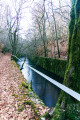
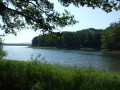
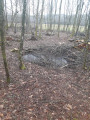
Explore a section of the Champagney Canal, work on which began in 1884 and was halted in 1909.

Details

533527
Creation:
Last update:
Last review:
  • Walking
    Activity: Walking
  • ↔
    Distance: 4.34 mi
  • ◔
    Average duration: 2h 25 
  • ▲
    Difficulty: Moderate

  • ⚐
    Back to start: Yes
  • ↗
    Ascent: + 453 ft
  • ↘
    Descent: - 459 ft

  • ▲
    Highest point: 1,499 ft
  • ▼
    Lowest point: 1,227 ft

Photos

Description of the walk

From the N19, now known as the D619, head towards Étobon via the D127.
Park in the car park on the right-hand side of the road, about 500 m after the previous junction.

(S/E) The start of the walk is marked by the Yellow Ring sign. After a long descent, pass over the lock, then keep to the left and reach a cross-track after the lock bridge.

(1) At the end of the bridge, turn left and walk alongside the Étang Déchaudey. Next, a section of the canal that is not very visible leads up to the road (D127).

(2) Cross the road and take the path directly opposite, leading you to one of the ventilation shafts for the tunnel.

(3) Continue down the path to a bridge spanning the canal.
(4) Cross the bridge, then, a few metres further on, turn left and continue until you reach a wide track.

(5) Follow it until you reach the road (D127), then follow the road to the left to return to the nearby car park (S/E).

Waypoints

  1. S/E : mi 0 - alt. 1,499 ft - Car park alongside the D127
  2. 1 : mi 0.89 - alt. 1,237 ft - Lock bridge, on the left
  3. 2 : mi 1.72 - alt. 1,470 ft - D127, opposite
  4. 3 : mi 1.94 - alt. 1,453 ft - Ventilation shaft. Towards the bridge at - Canal de Montbéliard à la Haute-Saône
  5. 4 : mi 2.98 - alt. 1,247 ft - Shelter – Old – Near the - Lizaine (rivière)
  6. 5 : mi 3.51 - alt. 1,365 ft - Track
  7. S/E : mi 4.34 - alt. 1,496 ft - Car park alongside the D127

Reviews and comments

4.5 / 5
Based on 21 reviews

Reliability of the description
4.6 / 5
Ease of following the route
4.5 / 5
Route interest
4.4 / 5
Pierrot DAVID
Pierrot DAVID

Please note that the municipality of Champagney has, by municipal decree, prohibited access to communal and private woods and forests from 31 July to 23 August
Therefore, the route is currently inaccessible

Machine-translated

Denis26
Denis26 ★

Thank you for your comments; I’ve just amended the itinerary accordingly.

Machine-translated

claudie90
claudie90

Overall rating : 3 / 5

Date of your route : Jul 27, 2026
Reliability of the description : ★★★☆☆ Average
Ease of following the route : ★★★☆☆ Average
Route interest : ★★★☆☆ Average
Very busy route : No

The route has been diverted… from point 4… the route shown on the app is incorrect; you need to follow the path marked out on the ground… Very well signposted… no chance of getting it wrong…

Machine-translated

fredmotard
fredmotard

Overall rating : 4.7 / 5

Date of your route : Aug 19, 2024
Reliability of the description : ★★★★★ Very good
Ease of following the route : ★★★★★ Very good
Route interest : ★★★★☆ Good
Very busy route : No

Route change due to construction work

Machine-translated

Phi70
Phi70

Overall rating : 4.7 / 5

Date of your route : Jun 23, 2024
Reliability of the description : ★★★★★ Very good
Ease of following the route : ★★★★★ Very good
Route interest : ★★★★☆ Good
Very busy route : No

A lovely walk through the forest and the remains of the old canal lock, bridge and ventilation shaft.
A few climbs, fortunately in the shade

Machine-translated

G Tartar
G Tartar

Overall rating : 3.3 / 5

Date of your route : Jul 03, 2023
Reliability of the description : ★★★★☆ Good
Ease of following the route : ★★★★☆ Good
Route interest : ★★☆☆☆ Disappointing
Very busy route : No

A long descent, a bit of flat ground, then a long climb!
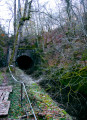
You can see the ventilation shafts of the canal tunnel, the abandoned canal and the entrance to the tunnel, which is off-limits (dangerous).
So, a very difficult walk with no tourist or cultural interest!

Machine-translated

Semeur
Semeur
• Edited:

Overall rating : 4 / 5

Date of your route : Jun 19, 2023
Reliability of the description : ★★★★☆ Good
Ease of following the route : ★★★★☆ Good
Route interest : ★★★★☆ Good
Very busy route : No

Enjoy your walk in the shade of the well-maintained and signposted trees.

Machine-translated

Pierrot DAVID
Pierrot DAVID

Overall rating : 4 / 5

Date of your route : Mar 28, 2023
Reliability of the description : ★★★★☆ Good
Ease of following the route : ★★★★☆ Good
Route interest : ★★★★☆ Good
Very busy route : No

Just a quick note to say that section: point 4, point 5, junction 431, which passes through the eastern entrance to the tunnel (yellow triangle on the map), is now closed for safety reasons (risk of collapse of the towpath). However, we recommend visiting the tunnel entrance and making a return trip from junction 431.

Machine-translated

Nathetad25
Nathetad25

Overall rating : 5 / 5

Date of your route : Feb 09, 2023
Reliability of the description : ★★★★★ Very good
Ease of following the route : ★★★★★ Very good
Route interest : ★★★★★ Very good
Very busy route : No

A beautiful hike offering very unusual landscapes with its unfinished canal and ventilation shafts. Nature is gradually reclaiming its rights, leaving behind some very unusual places A fairly easy hike with a few ascents and descents in a magnificent forest. We did this hike in winter, which gave it a very special atmosphere. We'll be going back this summer to compare!

Machine-translated

vero4400
vero4400

Overall rating : 5 / 5

Date of your route : Jan 05, 2023
Reliability of the description : ★★★★★ Very good
Ease of following the route : ★★★★★ Very good
Route interest : ★★★★★ Very good
Very busy route : Yes

a beautiful walk around the unfinished Champagney Canal. There are a series of climbs and descents. Make sure you wear good walking shoes. Thank you

Machine-translated

Nathmamara
Nathmamara

Overall rating : 5 / 5

Date of your route : Aug 27, 2022
Reliability of the description : ★★★★★ Very good
Ease of following the route : ★★★★★ Very good
Route interest : ★★★★★ Very good
Very busy route : No

Beautiful, well-marked hike. Car park at the start and information board. Very steep descent shortly after the start but not very long; the climb is more gradual on the other side. On the trail, 3/6 ventilation shafts are visible and their access is marked by green triangles. Small, well-maintained and clean hut with a guest book at the bridge. The rest of the towpath is interesting for this structure from another era that has been left abandoned (a shame!), confirming that caution is required (collapses in the retaining walls are visible). At the tunnel entrance, you can see a light at the end (ventilation shaft or end of the 1,330-metre tunnel?) and a metal staircase allows you to climb back up. Then return to the car park. A lovely little morning or afternoon walk.

Machine-translated

Lolo3970
Lolo3970

Overall rating : 5 / 5

Date of your route : May 11, 2022
Reliability of the description : ★★★★★ Very good
Ease of following the route : ★★★★★ Very good
Route interest : ★★★★★ Very good
Very busy route : No

A very beautiful hike – it's incredible to discover this canal and its lock in the middle of the forest.
Best done in hot weather as you're in the forest
A good descent and a good climb (inevitably) make the hike enjoyable, but I recommend it
Thank you for this wonderful discovery

Machine-translated

lataupe91
lataupe91

Overall rating : 4.7 / 5

Date of your route : Mar 28, 2022
Reliability of the description : ★★★★★ Very good
Ease of following the route : ★★★★☆ Good
Route interest : ★★★★★ Very good
Very busy route : No

Lovely walk in the forest. Interesting discovery of a forgotten canal and its tunnel

Machine-translated

Egon
Egon

Overall rating : 4 / 5

Date of your route : Aug 11, 2021
Reliability of the description : ★★★★☆ Good
Ease of following the route : ★★★☆☆ Average
Route interest : ★★★★★ Very good
Very busy route : No

The route is accurate, but on a map with little detail. The description is correct. The route is genuinely interesting. However, as you approach the tunnel, the path is in fairly poor condition. It is also lined with barrier tape.

Machine-translated

Pierrot DAVID
Pierrot DAVID

Overall rating : 4.7 / 5

Date of your route : Feb 18, 2021
Reliability of the description : ★★★★☆ Good
Ease of following the route : ★★★★★ Very good
Route interest : ★★★★★ Very good
Very busy route : No

A lovely little hike full of historical memories relating to the construction of the canal from Montbéliard to Haute-Saône. Who would expect to find a lock in the middle of the woods? An educational experience for younger visitors. An ideal route in summer to enjoy the coolness of the water and the tree canopy.
However, take care along the towpath before reaching the tunnel entrance.

Machine-translated

Other walks in the area

For more walks, use our search engine .

The GPS track and description are the property of this route's author. Please do not copy them without permission.