Country:
 City:
City:



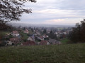

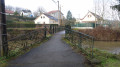
Park near Héricourt Town Hall. At the start, the route is signposted with a Green Triangle.
(S/E) Turn left (westwards) onto Rue du Général de Gaulle
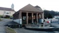
(1) Turn right onto Rue du Docteur Pavillard. Admire the Savourot washhouse with its beautiful columns. Walk past the old tram station, which is beautifully decorated, and turn left immediately afterwards. A sign reads: Tavey 2.8 km. Cross the Lizaine.
(2) Take a sharp left onto Avenue Saint-Valbert. 200 m further on, turn right onto Rue Charles Canel, then immediately follow a path on the left which leads into the woods. Continue straight on, ignoring a track on the left, and follow the fitness trail.
(3) Cross the Faubourg de Besançon (D683) with care and follow it to the right. Just before the roundabout, take the path on the left which passes under the D438 main road. Continue on to Rue Marcel Durry (D683) at the entrance to Tavey. Carry on to the left until you reach the centre.
(4) Turn left onto Rue de Charbonnière. The signposting changes and you must now follow the Green Ring route.
At the end of the street, there are two paths: take the one on the left and head into the forest. At the end of the climb, pass a path on your left.
(5) Turn right when you reach the LGV (High-Speed Line), walk for about 300 m, then turn left to cross the footbridge. Immediately afterwards, veer left and, 200 m further on, look out for the signpost and turn right into the woodland. Continue along the path to reach Laire via Rue des Crêts.
(6) Turn left onto Rue du Grand Bois. Turn right just before the cemetery and continue up the forest track. The ‘Green Ring’ signposting is very helpful in this forest, where there are numerous paths. You’ll reach the road at the entrance to Vyans-le-Val.
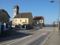
(7) Turn right onto Rue des Pins, then continue left onto Rue des Dandeligeons. At the town hall, turn right onto Rue du Lavoir, then left onto Rue du Noyeu. Walk past the school and arrive at the church.
(8) Turn left onto Rue de Laire and follow it to the edge of the village, where you’ll find a forest gate.
(9) A sign indicates a short detour to the right to visit Tante Airie’s cave. A lovely 100-metre climb that’s well worth the effort.
(10) Turn back.
(9) Continue to the right along the forest track.
(11) Follow the Green Ring markings carefully to turn right onto a path which curves naturally to the right a little further on. Turn left 50 metres after this and enter the forest.
(12) 50 metres past the edge of the woodland, leave the path marked with a Green Ring and turn left onto a route marked with a Blue Triangle. Pass under the high-speed rail line at the Épenottes viaduct; further on, leave the path on your left and continue straight ahead.
At the next junction, turn right onto the path running alongside the D438D and you’ll arrive at the supermarket.
(13) Turn left and carefully cross the D438D just before the roundabout, using the pedestrian crossings. Continue along the path opposite and then head left onto the Faubourg de Montbéliard.
(14) Turn right onto Rue Ambroise Croizat, then leave this street shortly afterwards and carry straight on along the Chemin de Ronde. At the end, continue along the footpath which first turns right then left and runs alongside a factory. Turn right and follow Rue du 47th Artillery Regiment for about 150 metres.
(15) Turn left onto a path that crosses the Lizaine and then joins Rue des Prés. Carry straight on, following the Lizaine. Cross Rue du 11 Novembre and follow Rue de l’École opposite. After 50 metres, turn right onto Rue des Fossés, then left onto Rue de la Planchette to reach the town hall at the starting point (S/E).

 Visorando Member

 Easy
Easy