Country:
 City:
City:


Park near Héricourt Town Hall. At the start, the route is marked with a Red Triangle.
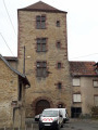
(S/E) Set off opposite the town hall onto Rue de l’Église; a sign reads ‘Tour du Château’. Admire the temple, then the church and, in the background, the castle tower.
Just past the temple, turn left into Rue André Launay, cross Rue de la Voûte and continue straight on. Then turn right into Rue du Docteur Gaulier, which is a main road with heavy traffic.
Walk past the Bretegnier Rehabilitation Centre.
(1) At the roundabout, take the third road on the right, Rue Georges Marconnet. Before the cemetery, turn left and continue along the path at the end of the cul-de-sac. Turn right onto Rue Georges Bretegnier and follow the path that runs alongside the cemetery. Cross a stream and join the cycle path.
(2) Turn right. 500 m further on, at the crossroads, turn left. Pass the pumping station and cross the bridge over the Lizaine. From this point onwards, the route is signposted with a ‘Green Ring’.
Turn right after the bridge, taking a short horseshoe-shaped detour to pass under the D483 road.
(3) Just as you reach the Eurofa business park, turn left and enter the forest via the path that climbs steeply up Mont Girard and goes round a beautiful old estate. You’ll come out onto the Route de Couthenans.
(4) Opposite, there are two paths. Follow the one on the left, which climbs steeply and leads to the nature route. Take a look at the information board for the Grand Bois nature route. The path runs along the ridge, featuring several very interesting information boards. Enjoy the view over Couthenans and Luze.
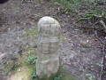
Pass a path on your left and arrive at the Pierre Plate. A very interesting information board provides detailed information about the site. Then turn left onto the path to reach a crossroads.
(5) Note: the nature trail branches off to the left. You can follow it for a round trip of 3 km in total.
Alternatively, carry on straight ahead along the path which descends and then turns right. Ignore the numerous side paths to the right and left and continue along the main path until you reach the road.
(6) Turn left and follow it to the village of Verlans. Take the second street on the right, Rue des Beuges.
(7) Turn left onto the main road, Rue Nicolas Lalouette, and follow it to the town hall. Then turn right onto Chemin du Sarey. Admire the wash house with its lime tree dating from the Revolution, then, a little further on, the distillery building. An information board provides the history of the village.
Pass to the right of the cemetery and continue uphill along the path until you reach a crossroads at the edge of the woods.
Take the hairpin bend to the left and continue uphill. At the top, ignore a path on the right and head back down the main track, which takes a hairpin bend to the left and then another to the right before reaching the Route de Tavey.
(8) Turn right and follow it to the village of Tavey.
(9) Turn left onto the main road, Rue Durry (D683). The signposting changes. You must now follow the Green Triangle until the end of the walk.
Follow the main road out of the village, then turn right at the last houses onto the path that runs alongside the main road.
(10) Pass under the D438 next to the roundabout and join the D683 opposite. Leave Rue du Haut Bois on your right, cross the D683 carefully and walk alongside it on the right for about fifty metres. Then turn left onto the path that leads into and climbs through the forest. Continue straight ahead, leaving the fitness trail on your right.
(11) At the road, take the sharp left-hand bend onto Avenue de Saint-Valbert.
100 metres further on, turn right at the second street: Rue Noblot. Cross the Lizaine. The street changes its name to Rue Pavillard.
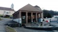
Then, turn right and continue along Rue Pavillard. Admire the old tram station, which is beautifully decorated. At the end of the street, admire the Savourot wash house with its fine columns.
(12) Turn left onto the main road and return to the starting point: the car park at Héricourt Town Hall (S/E).

 Visorando Member

 Easy
Easy