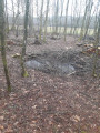
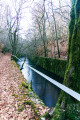
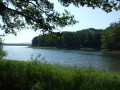
The Chérimont and Chatelaye ponds and the canal lock

(2) A pleasant walk, mostly through the woods along forest tracks. In wet weather, some sections between (2) and (3) and between (6) and (7) are a little more difficult (muddy), especially in winter when there are leaves on the ground.

Details

n°42492945
Creation:
Last update:
Last review:
  • Walking
    Activity: Walking
  • ↔
    Distance: 5.35 mi
  • ◔
    Average duration: 3h 00 
  • ▲
    Difficulty: Moderate

  • ⚐
    Back to start: Yes
  • ↗
    Ascent: + 591 ft
  • ↘
    Descent: - 594 ft

  • ▲
    Highest point: 1,604 ft
  • ▼
    Lowest point: 1,152 ft

Description of the walk

The start and finish are almost at the end of Rue du Beuveroux, on a small gravel square next to a water pumping station.

(S/E) From the car park, take the path opposite the start of the street. Walk alongside a wetland area on your left, bordering the Ruisseau du Beuveroux. Continue along the path until you reach the pond.

(1) With the pond in front of you, turn right. If you walk a few metres into the copse on your right, you can see the slab marking ‘the Tonnet mine shaft’, also known as ‘shaft number 9’: this shaft is included in the Blanche Pierre route. Continue along this path, cross two streams that flow into the ponds and look out for a path on the left.

(2) Turn onto this path, marked with a Yellow Circle, and follow it to the next Fork in the road.

(3) Leave the marked trail and take a hairpin bend to the right, walk alongside several ponds and arrive at a three-way junction.

(4) Take the path that veers slightly to the right and runs alongside the D127, Chemin d’Étobon.

(5) Turn onto the path leading uphill opposite you, veering slightly to the left, and follow it north-westwards until you reach a track on the right between two clearings.

(6) Take this path, which descends towards the lock. Be careful, as the path is barely visible. When passing under the high-voltage power line, go straight on to rejoin the path that emerges near Étang Déchaudey.

(7) Turn left – but not before taking a quick look at the Beuveroux Lock – and carry on straight ahead to reach the junction from the outward journey.

(1) Carry on straight ahead to reach the small gravel area next to a water pumping station (S/E).


Waypoints

  1. S/E : mi 0 - alt. 1,158 ft - Gravel area – water pumping station
  2. 1 : mi 0.46 - alt. 1,171 ft - Junction before the ponds - Puits du Tonnet
  3. 2 : mi 1.28 - alt. 1,398 ft - Junction with the Yellow Circle trail
  4. 3 : mi 1.58 - alt. 1,230 ft - Forest track
  5. 4 : mi 2.38 - alt. 1,283 ft - Small three-way junction
  6. 5 : mi 3 - alt. 1,509 ft - Passage near the D127
  7. 6 : mi 3.88 - alt. 1,352 ft - Junction
  8. 7 : mi 4.26 - alt. 1,237 ft - Junction near the pond - Canal de Montbéliard à la Haute-Saône
  9. S/E : mi 5.35 - alt. 1,158 ft - Gravel area – water pumping station

Notes

Possible shortcuts:
A – 3.7 km route with an elevation gain of approximately 72 m.
At point (3), continue to the left, then complete the route as described above.

B – Route of approximately 6 km (possible route but not verified).
At point (4), at the small three-way junction in the path, take the path leading off to the left. Go round the ponds and complete the route as described above.

C – Route of approximately 8 km (possible route but not officially approved).
At point (6), carry straight on, then complete the route as described above.

Worth a visit

The Beuveroux Lock forms part of the Montbéliard to Haute-Saône Canal, built after the 1870 war. Construction was halted at the start of the First World War. It was never put into service.
See also the Canal route on Visorando.

Reviews and comments

3.8 / 5
Based on 3 reviews

Reliability of the description
4.3 / 5
Ease of following the route
4 / 5
Route interest
3 / 5
User 31218767

Overall rating : 3 / 5

Date of your route : Sep 23, 2026
Reliability of the description : ★★★★☆ Good
Ease of following the route : ★★★★☆ Good
Route interest : ★☆☆☆☆ Very disappointing
Very busy route : No

I was pleased to have found this forest walk after visiting Le Corbusier’s chapel in Ronchamp, but I was very disappointed. The forest we walked through had been far too badly damaged by human activity. There were cleared sections where only a few scattered trees remained (mainly between points 1 and 3), numerous fences – particularly around the ponds – and, finally, the route hardly ever strays from the forest tracks. Honestly, I found this route to be of very little interest...

Machine-translated

Pierrot DAVID
Pierrot DAVID

Please note that access to forests and woodland within the municipality of Champagney is prohibited by a municipal by-law for the period from 31 July to 23 August 2026.

Machine-translated

User 10048162

Overall rating : 4 / 5

Date of your route : Aug 24, 2025
Reliability of the description : ★★★★☆ Good
Ease of following the route : ★★★★☆ Good
Route interest : ★★★★☆ Good
Very busy route : No

An easy, well-shaded route.
Very few people, which is very pleasant.
Worth repeating.

Machine-translated

jmpmf
jmpmf

Overall rating : 4.3 / 5

Date of your route : Jul 22, 2024
Reliability of the description : ★★★★★ Very good
Ease of following the route : ★★★★☆ Good
Route interest : ★★★★☆ Good
Very busy route : No

A very well-designed route. Partly shaded with plenty of woodland sections; not very busy but very pleasant for its peace and quiet.
I recommend it

Machine-translated

Other walks in the area

For more walks, use our search engine .

The GPS track and description are the property of this route's author. Please do not copy them without permission.