


Refine your search for walks in Druyes-les-Belles-Fontaines
Druyes-les-Belles-Fontaines walks


 The tour of the fortified castle...without taking your eyes off it
 Visorando Member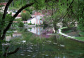
 4.11 mi
 +249 ft
 -243 ft
 2h 05
2h 05
 Easy
Easy
 Departure from Druyes-les-Belles-Fontaines (Yonne)
Medieval castle, viaduct, springs, washhouses and heritage, something to enjoy with the family !
If that's not enough, a little bungee jump to get the adrenaline pumping ?
Druyes-les-Belles-Fontaines is classified in the villages "Cities of character of Bourgogne-Franche-Comté".
Blin Farm – Druyes Valley
 6.50 mi
+554 ft
-551 ft
3h 30
6.50 mi
+554 ft
-551 ft
3h 30
 Moderate
Departure from Druyes-les-Belles-Fontaines (Yonne)
Moderate
Departure from Druyes-les-Belles-Fontaines (Yonne)
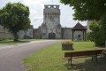
Marked hike N°51.
From the old medieval castle, discover a village built between an old, partly dried-up marsh and a cliff. Druyes Valley offers a green setting that contrasts with the chalky rocks that support the ruined building.
The Andryes' Marsh path
 2.40 mi
+20 ft
-20 ft
1h 05
Easy
Departure from Andryes (Yonne)
2.40 mi
+20 ft
-20 ft
1h 05
Easy
Departure from Andryes (Yonne)
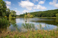
Marked hike n°62.
This site located in the void diagonal, as some like to say, conceals many assets.
If, with the help of agricultural machinery, the search for productivity was the goal in the middle of the 20th century, it has not led to the expected results. Today, it is towards a restoration of biodiversity that we are moving. The fauna and flora are gradually returning.
Discovering this heritage also helps to educate children.
Superb educational walk!
Basseville Rocks in Surgy
5.92 mi
+410 ft
-427 ft
3h 05
Easy
Departure from Andryes (Yonne)
This walk offers the chance to observe a rich variety of flora and fauna. You’ll be able to see the Basseville Rocks and walk alongside the Andryes stream during this walk.
Early in the morning or late in the day, you can spot larks in the fields.
Route around the marshes of Druyes-les-Belles-Fontaines
7.82 mi
+456 ft
-456 ft
4h 00
Moderate
Departure from Andryes (Yonne)
This hike allows you to observe a rich variety of flora and fauna, with numerous wild flowers and many birds in the Druyes Marsh Observatory, as well as beautiful landscapes in the forest.
Fougilet wash house and leisure trail
4.21 mi
+226 ft
-249 ft
2h 10
Easy
Departure from Sougères-en-Puisaye (Yonne)
Route closed by municipal order of 9 July 2021.
A short family walk featuring a few pieces of play equipment along the leisure trail. A really enjoyable outing for everyone.
The leisure trail along the old tracks
8.08 mi
+371 ft
-390 ft
4h 00
Moderate
Departure from Sougères-en-Puisaye (Yonne)
Route closed by municipal order dated 9 July 2026.
Marked walk No. 12.A route themed around recreational sport, following a section of an old railway line and a section of an ancient Roman road, with some wonderful heritage sites to discover.
The Druyes Viaduct and the Panama Valley
10.00 mi
+341 ft
-358 ft
4h 55
Moderate
Departure from Sougères-en-Puisaye (Yonne)
Marked route No. 11.
This route takes you to the small village of Druyes-les-Belles-Fontaines, passing through wooded areas and farmland. The return journey follows an old railway line. Between Les Roches and Pesselière, you can admire the cedars of La Lavière, and in Pesselières, the Sully tree as well as the ruins of the old castle.
From the Church to Le Sully via the Cèdres de la Lavière
 8.21 mi
+404 ft
-417 ft
4h 05
Moderate
Departure from Sougères-en-Puisaye (Yonne)
8.21 mi
+404 ft
-417 ft
4h 05
Moderate
Departure from Sougères-en-Puisaye (Yonne)
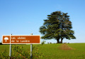
Marked trail No. 10.
Discover the local heritage: ponds and old drinking troughs, crosses and calvaries, the Sully lime tree, and the cedars of La Lavière. Beautiful views of varied, rolling countryside punctuate this route, the length of which can be adapted to suit.
Although classified as a walking route, this route is also one of the most beautiful routes for mountain biking, hybrid cycling and horse riding.
Around the village of Sougères-en-Puisaye
 4.64 mi
+305 ft
-295 ft
2h 25
Easy
Departure from Sougères-en-Puisaye (Yonne)
4.64 mi
+305 ft
-295 ft
2h 25
Easy
Departure from Sougères-en-Puisaye (Yonne)
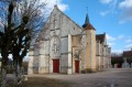
Explore the hamlets on the outskirts of the village of Sougères-en-Puisaye.
The Montagne des Alouettes as seen from Etais-la-Sauvin
 8.33 mi
+492 ft
-499 ft
4h 15
Moderate
Departure from Étais-la-Sauvin (Yonne)
8.33 mi
+492 ft
-499 ft
4h 15
Moderate
Departure from Étais-la-Sauvin (Yonne)
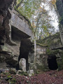
A very pleasant walk in all seasons across the plain and through the woods, climbing to the region’s highest point (363 m). Along the ancient Roman road, discover the old underground limestone quarries, which were used to build the region’s houses and bridges. Magnificent panoramic views stretch out on either side of this road, which once linked Auxerre to Nevers, with Entrains-sur-Nohain as its main junction.
Chemin du Puits
 4.62 mi
+102 ft
-102 ft
2h 15
Easy
Departure from Étais-la-Sauvin (Yonne)
4.62 mi
+102 ft
-102 ft
2h 15
Easy
Departure from Étais-la-Sauvin (Yonne)
Marked trail No. 29.
A pleasant walk or mountain bike ride in all weathers.
This route has been surveyed and marked out by members of the local association À Travers Champs. It is fully signposted with yellow signs, black lettering and yellow arrows on a red background.
Chemin des Plots
 4.05 mi
+121 ft
-125 ft
2h 00
Easy
Departure from Étais-la-Sauvin (Yonne)
4.05 mi
+121 ft
-125 ft
2h 00
Easy
Departure from Étais-la-Sauvin (Yonne)
Marked walk No. 27.
A short, family-friendly walking or mountain-biking route that is enjoyable and accessible all year round.
This route has been surveyed and marked out by members of the local association A Travers Champs. It is fully signposted with yellow signs, black lettering and yellow arrows on a red background.
The Vassy Valley
8.05 mi
+577 ft
-584 ft
4h 10
Moderate
Departure from Taingy (Yonne)
Marked route No. 56.
The Hauts-de-Forterre plateau offers some stunning views and a charming heritage, highlighted by the orientation table and the route of old trade signs dotted around the village.
On the road between Coulanges-sur-Yonne and Lucy-sur-Yonne
 6.94 mi
+269 ft
-259 ft
3h 25
Moderate
Departure from Coulanges-sur-Yonne (Yonne)
6.94 mi
+269 ft
-259 ft
3h 25
Moderate
Departure from Coulanges-sur-Yonne (Yonne)
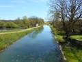
Walk along the banks of the Yonne and the canal. Beautiful views of Lucy-sur-Yonne and the castle from the film La Grande Vadrouille.
Bois de la Faine
 Association / Club / Walk leader7.01 mi
+449 ft
-446 ft
3h 35
Moderate
Departure from Courson-les-Carrières (Yonne)
Association / Club / Walk leader7.01 mi
+449 ft
-446 ft
3h 35
Moderate
Departure from Courson-les-Carrières (Yonne)
Marked route No. 48.A lovely forest walk on this limestone plateau, although at the start you’ll need to follow a short stretch of minor road to reach the Bois de la Faine and the woods beyond. The forest you’ll be walking through is rich in different tree species, including fine specimens of oak and beech, and is every bit as impressive as the nearby Frétoy Forest.
Chemin de la Romance
10.99 mi
+719 ft
-748 ft
5h 40
Moderate
Departure from Lain (Yonne)
Marked walk No. 58.
This circular route takes you along old tracks to discover the different aspects of the Forterre, a land of arable farming dotted with woods.
The Test-Milon hill
5.75 mi
+390 ft
-367 ft
3h 00
Moderate
Departure from Lain (Yonne)
Marked walk No. 59.
Route from Lain around Test-Milon, including a section along the Roman road.
Source de l’Oisy, near Fondelin
7.02 mi
+433 ft
-453 ft
3h 35
Easy
Departure from Billy-sur-Oisy (Nièvre)
A lovely, relaxing walk along pleasant paths. Along the route, you’ll find a pretty well-and-washhouse and the La Motte washhouse, fed by the River Oisy. A shaded stretch through part of the Trucy Forest.
Wash houses and the Sainte-Geneviève Spring
 8.45 mi
+594 ft
-568 ft
4h 25
Moderate
Departure from Sementron (Yonne)
8.45 mi
+594 ft
-568 ft
4h 25
Moderate
Departure from Sementron (Yonne)
Marked trail No. 54.
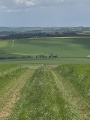
This walk is a real surprise! Set off from the village church, then head to a hamlet to find the town hall, before wandering through the rugged, limestone terrain of La Forterre to discover isolated hamlets and farms. On the way back, enjoy a lovely view from the plateau over the woods and landscapes of the Poyau region.
The banks of the Yonne in Clamecy
4.62 mi
+167 ft
-161 ft
2h 15
Easy
Departure from Clamecy (Nièvre) (Nièvre)
A lovely walk along the banks of the Yonne, the canal and the surroundings of Clamecy.This walk is based on the "Water and Wind Route" but is slightly shorter.
Between the Yonne and the Canal du Nivernais in Clamecy
6.21 mi
+282 ft
-282 ft
3h 05
Easy
Departure from Clamecy (Nièvre) (Nièvre)
A peaceful walk between the Yonne and the canal, featuring two lovely wash houses.
The Water and Wind Route in Clamecy
6.66 mi
+420 ft
-427 ft
3h 25
Easy
Departure from Clamecy (Nièvre) (Nièvre)
In Clamecy, explore medieval houses, the Nivernais Canal, the River Yonne and more recent developments, such as the wind turbines.
"Romain Rolland" Writers’ Trail
 Tourist office6.16 mi
+472 ft
-459 ft
3h 15
Easy
Departure from Clamecy (Nièvre) (Nièvre)
Tourist office6.16 mi
+472 ft
-459 ft
3h 15
Easy
Departure from Clamecy (Nièvre) (Nièvre)
Head up to the hills above Clamecy to discover another vantage point over the ‘Little Venice of the Nièvre’, as Romain Rolland liked to describe it.
Your gaze will first be drawn to the River Yonne, the statue of the raftsman and the Church of Notre-Dame-de-Bethléem, a reminder of the bishopric, which was exiled to Clamecy in the 13th century.
From Sembert, Clamecy and its medieval historic centre seem nestled amidst lush countryside, traversed by the River Yonne and the Nivernais Canal, one of the most beautiful canals in Europe.
More walks in Druyes-les-Belles-Fontaines
Select a point of interest below: