Source de l’Oisy, near Fondelin

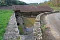
A lovely, relaxing walk along pleasant paths. Along the route, you’ll find a pretty well-and-washhouse and the La Motte washhouse, fed by the River Oisy. A shaded stretch through part of the Trucy Forest.

Details

56688
Creation:
Last update:
Last review:
  • Walking
    Activity: Walking
  • ↔
    Distance: 7.02 mi
  • ◔
    Average duration: 3h 35 
  • ▲
    Difficulty: Easy

  • ⚐
    Back to start: Yes
  • ↗
    Ascent: + 433 ft
  • ↘
    Descent: - 453 ft

  • ▲
    Highest point: 945 ft
  • ▼
    Lowest point: 623 ft

Description of the walk

Start from Fondelin on the D155; there is a car park on the right as you approach from the D957.

(S/E) Head towards the water tower and turn left onto the route to Trucy l’Orgueilleux for about 150 m.

(1) Turn left into Rue du Vivier. Pass a well on your left as you continue along this road until the next junction.

(2) Cross Rue de l’Ancien Tilleul and take the path opposite.

(3) Ignore this side track and head towards the woodland. Carry on, keeping the woodland on your right. This path ends at a section of compacted earth. The first farm buildings of La Motte come into view, followed by a few houses, before you reach a crossroads.

(4) In the centre of the triangle formed by this junction, turn left towards the washhouse, then retrace your steps.

(4) Walk alongside the stream on your left for a few metres and turn onto the hard-surfaced section on the right, leaving the path leading to the property behind you. Cross the Oisy and, at the Fork in the road, turn right, following the property fence. You will reach a cross-path.

(5) Turn right, then, after about 50 metres, turn right again and head down to the Source de l’Oisy.

(6) Take the path alongside the old pumping station to cross the stream. You’ll arrive at the edge of the forest.

(7) Turn left twice in quick succession to take the forest track. Stay on this track, ignoring all side paths, until you reach a cross-forest track and a hunting lodge on the right.

(8) Turn right onto a track that is half tarmac and half gravel to complete the partial crossing of this woodland.

(9) Continue along the main track, which separates a field on the right-hand side from a wooded area on the left. You’ll reach the first houses in Fondelin and the crossroads you passed at the start.

(1) Take the road on the left, then the one on the right to return to the starting point (S/E).

Waypoints

  1. S/E : mi 0 - alt. 942 ft - Car park
  2. 1 : mi 0.15 - alt. 922 ft - Junction common to both outbound and return routes
  3. 2 : mi 0.71 - alt. 915 ft - Junction with the Vignelle road
  4. 3 : mi 1.3 - alt. 817 ft - Junction with a side path
  5. 4 : mi 2.67 - alt. 640 ft - La Motte washhouse
  6. 5 : mi 3.79 - alt. 784 ft - Junction with a side path
  7. 6 : mi 4.33 - alt. 663 ft - Spring of the - Oisy (rivière)
  8. 7 : mi 4.52 - alt. 669 ft - Entrance to the Trucy Forest
  9. 8 : mi 5.49 - alt. 791 ft - Leads onto a track
  10. 9 : mi 6.29 - alt. 807 ft - Exit from the forest
  11. S/E : mi 7.02 - alt. 942 ft - Car park

Notes

The route offers moderate shade; in hot weather, it is best to set off in the cool of the morning.
Remember to bring something to drink; the spring water is refreshing but not safe to drink.

Worth a visit

Clamecy Collegiate Church.

Reviews and comments

4.7 / 5
Based on 2 reviews

Reliability of the description
5 / 5
Ease of following the route
5 / 5
Route interest
4 / 5
benoit58
benoit58

Overall rating : 4.7 / 5

Date of your route : Oct 16, 2021
Reliability of the description : ★★★★★ Very good
Ease of following the route : ★★★★★ Very good
Route interest : ★★★★☆ Good
Very busy route : No

A walk through the countryside and woodland, with a few scenic spots, a surprising washhouse at La Motte and the lovely Oisy spring. A rather nice walk.

Machine-translated

Other walks in the area

For more walks, use our search engine .

The GPS track and description are the property of this route's author. Please do not copy them without permission.