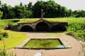
Around the village of Sougères-en-Puisaye

Explore the hamlets on the outskirts of the village of Sougères-en-Puisaye.

Details

44510
Creation:
Last update:
Last review:
  • Walking
    Activity: Walking
  • ↔
    Distance: 4.64 mi
  • ◔
    Average duration: 2h 25 
  • ▲
    Difficulty: Easy

  • ⚐
    Back to start: Yes
  • ↗
    Ascent: + 305 ft
  • ↘
    Descent: - 295 ft

  • ▲
    Highest point: 909 ft
  • ▼
    Lowest point: 679 ft

Photos

Description of the walk

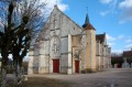
(S/E) From the Place de l’Église, take the road to Druyes for about 600 metres. Pass the cemetery.

(1) Turn left onto the small Pesselières road for 150 metres, then at the waste collection point, turn right into the woodland. Follow this dirt track uphill to the end.

(2) When you reach the road, go straight on and then take the road on the right. Continue along this small tarmac road until you reach the hamlet of Les Billards, then carry on downhill to the right.

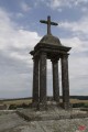
(3) At the junction (with a wayside cross on the left), first turn left then right and head up the small road that runs between the houses. Carry on along this road, ignoring the first road on the left.

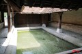
(4) Take the path that branches off to the left. Take the next right and rejoin the road. Carry on to the left, then turn left onto the D125 road from Sougères to Etais-la-Sauvin for about a hundred metres. When you reach the old walled drinking trough, turn left. Continue through the hamlet, going straight on at the first junction and turning right at the second.

(5) At the crossroads, go up the street on the left to cross the village.

(6) After the last houses, take the street on the right, then the stony track on the left and follow it to the five-way junction.

(7) Head down this old Roman road, which is now tarmac-surfaced. At the next road on the right, head towards the village of Sougères (S/E).

Waypoints

  1. S/E : mi 0 - alt. 735 ft - Place de l’Église
  2. 1 : mi 0.34 - alt. 709 ft - Leave the RD73 and head towards Pesselières
  3. 2 : mi 0.75 - alt. 810 ft - Leave the path and take the road that continues
  4. 3 : mi 1.45 - alt. 679 ft - On the left, a wayside cross
  5. 4 : mi 1.69 - alt. 738 ft - Leave the road and take the path on the left
  6. 5 : mi 2.51 - alt. 787 ft - Head up to the left
  7. 6 : mi 2.85 - alt. 863 ft - Head towards the Roman road via the path
  8. 7 : mi 3.56 - alt. 896 ft - To the right, a short stretch along the Roman road
  9. S/E : mi 4.64 - alt. 735 ft - Place de l’Église

Notes

A short family walk, but also a lovely running route. The paths are interesting as they are well-maintained and mostly gravelled.
Ignore any signposts you come across on this route and stick to the route description. The signposts will be useful for other outings.

Worth a visit

Druyes les Belles Fontaines, its springs and its fortified castle.

Reviews and comments

5 / 5
Based on 2 reviews

Reliability of the description
5 / 5
Ease of following the route
5 / 5
Route interest
5 / 5
sabrina89
sabrina89

Overall rating : 5 / 5

Date of your route : Jun 18, 2017
Reliability of the description : ★★★★★ Very good
Ease of following the route : ★★★★★ Very good
Route interest : ★★★★★ Very good

It’s a great activity to do as a family – all you need is a bit of firewood, and with this lovely weather, it was a real treat – definitely worth doing.

Machine-translated

Other walks in the area

For more walks, use our search engine .

The GPS track and description are the property of this route's author. Please do not copy them without permission.