The Water and Wind Route in Clamecy

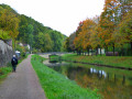
In Clamecy, explore medieval houses, the Nivernais Canal, the River Yonne and more recent developments, such as the wind turbines.

Details

53339
Creation:
Last update:
Last review:
  • Walking
    Activity: Walking
  • ↔
    Distance: 6.66 mi
  • ◔
    Average duration: 3h 25 
  • ▲
    Difficulty: Easy

  • ⚐
    Back to start: Yes
  • ↗
    Ascent: + 420 ft
  • ↘
    Descent: - 427 ft

  • ▲
    Highest point: 883 ft
  • ▼
    Lowest point: 476 ft
  • ⚐ Country: France
  • ⚐ City: Clamecy (Nièvre) (58500)
  • ⚑
    Start/End: N 47.458275° / E 3.520197°
  • Accessible from the train station Gare de Clamecy.
  • ❏
    IGN map(s): Ref. 2622SB
  • Hour-by-hour weather

Description of the walk

Start at Place des Promenades.

(S/E) Turn right at the bakery and head down the street (Rue du Grand Marché). Pass Rue Tour Lourdeau on your right, then take the second small street on the right (a cobbled street with half-timbered houses).
Continue down this street, which winds round several bends, then turn right onto Avenue de la République (at the end of the cobbled street).

(1) Follow the avenue to the left, pass the museum and turn right at the traffic lights. At the bend, turn left onto Rue de l’Abattoir.
Cross the Pont des Anciens Abattoirs opposite, and continue to the second bridge. Do not cross it, but turn left to follow the banks of the Canal du Nivernais as far as lock no. 47.

(2) Cross the bridge over the lock on the right, then follow the River Yonne on your right, skirting the allotments, until you reach a narrow passage. Cross the N151 bridge and follow the canal to the next bridge.

(3) Head up to the left until you reach the road (D144), then turn right and cross the railway bridge.

(4) Turn left onto the path.

(5) Cross the Beuvron and return to the starting point (E).


Carry on to the farm, enter a pine forest; when you reach the end, do not turn right following the yellow markings but walk along the edge of the field. You’ll come out onto a small road; take the path opposite and walk to the Ancienne Ferme de la Varoile.
Head up the path on the left for 50 metres, then turn right; continue uphill for a further 50 metres or so until you reach a main track, then turn left to head back down towards Clamecy.
On reaching Clamecy, cross the bridge and take Rue des Moulins on the right at the foot of the steps opposite the collegiate church.
Walk up the street, past the former Café des Colonnes, continue on and take the steps, which lead out onto Rue du Petit Marché with its arcades.
Reach the top of the street, turn right at the chemist’s, then return to the starting point at Place des Promenades.


Waypoints

  1. S/E : mi 0 - alt. 538 ft - Place des Promenades
  2. 1 : mi 0.22 - alt. 486 ft - At the end of the cobbled street, turn left
  3. 2 : mi 0.69 - alt. 482 ft - Lock Bridge. Follow the - Yonne (l')
  4. 3 : mi 2.02 - alt. 486 ft - On the left, the bridge over the - Canal du Nivarnais
  5. 4 : mi 2.63 - alt. 558 ft - Fork in the road, on the left
  6. 5 : mi 6.37 - alt. 486 ft - Beuvron (rivière) - Affluent de l'Yonne
  7. S/E : mi 6.66 - alt. 538 ft - Place des Promenades

Notes

At the Ancienne Ferme de la Varoile: admire the oldest oak tree in the area.
There’s a lovely view from the top of Feurtiot Hill; on your right are the wind turbines – you can stop for a short break at their base.
Café des Colonnes: a meeting place for insurgents during the 1851 coup d’état.

Worth a visit

Visit the museum which traces the history of the Clamecy log drivers who delivered timber to Paris by forming timber rafts on the River Yonne.

Reviews and comments

4.3 / 5
Based on 3 reviews

Reliability of the description
4 / 5
Ease of following the route
4.3 / 5
Route interest
4.7 / 5
Wanderung89
Wanderung89

Overall rating : 4 / 5

Date of your route : Aug 02, 2020
Reliability of the description : ★★★★☆ Good
Ease of following the route : ★★★★☆ Good
Route interest : ★★★★☆ Good
Very busy route : Yes

With the heatwave easing off, this was a pleasant and easy walk. The paths were well maintained and offered a chance to explore the Clamecy area from a number of vantage points. Highly recommended

Machine-translated

traîné.pattes
traîné.pattes

Overall rating : 5 / 5

Date of your route : Sep 11, 2017
Reliability of the description : ★★★★★ Very good
Ease of following the route : ★★★★★ Very good
Route interest : ★★★★★ Very good

A very enjoyable walk. The description and route are accurate.
Easy to follow.
Highly recommended!

Les Traines Pattes Clamecy

Machine-translated

dededodo
dededodo

Hello, after the Blanchard veal farm, there is indeed a path branching off to the right – about 50 metres at most – which leads into a field. Don’t take that one; stay on the path, turn right, follow it, and you’ll come out onto a path lined with fir trees. Follow that and you’ll arrive at the field. As for the gate, I don’t have any information. Best regards

Machine-translated

POULIN Gérard
POULIN Gérard ★

Hello Serge,
Thank you for your comments; I’ll send the author of this walk a private message to let them know.

Machine-translated

serge91
serge91

Overall rating : 4 / 5

Date of your route : Apr 22, 2014
Reliability of the description : ★★★☆☆ Average
Ease of following the route : ★★★★☆ Good
Route interest : ★★★★★ Very good

A lovely walk; the route description is accurate, apart from a slight issue with the distances: after ‘La Forêt’, when you turn right (onto the D144), the distance is about 500 metres, and after turning left, take the left-hand Fork in the road
After the Varvoille farm, it’s a good 250 metres before turning right and walking about 500 metres uphill to reach the main track with the wind turbines on the right, then take the left-hand fork
We encountered a problem: after the farm (about 20–30 metres) at Le Veau Blanchard, there is no fir wood and the track is blocked (by a secured metal barrier); we took the logging track which goes uphill to the right, then left, and at the end left again to rejoin the route at the point where you have to walk alongside the field.It remains to be seen whether this road closure is temporary or not...

Machine-translated

Other walks in the area

For more walks, use our search engine .

The GPS track and description are the property of this route's author. Please do not copy them without permission.