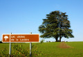
The Montagne des Alouettes as seen from Etais-la-Sauvin

A very pleasant walk in all seasons across the plain and through the woods, climbing to the region’s highest point (363 m). Along the ancient Roman road, discover the old underground limestone quarries, which were used to build the region’s houses and bridges. Magnificent panoramic views stretch out on either side of this road, which once linked Auxerre to Nevers, with Entrains-sur-Nohain as its main junction.

Details

17647
Creation:
Last update:
Last review:
  • Walking
    Activity: Walking
  • ↔
    Distance: 8.33 mi
  • ◔
    Average duration: 4h 15 
  • ▲
    Difficulty: Moderate

  • ⚐
    Back to start: Yes
  • ↗
    Ascent: + 492 ft
  • ↘
    Descent: - 499 ft

  • ▲
    Highest point: 1,175 ft
  • ▼
    Lowest point: 758 ft

Photos

Description of the walk

(S/E) Starting from the car park opposite the town hall, take the first road downhill on the main street towards La Poterie.

(1) When you reach the crossroads, take the signposted path opposite marked ‘La Vallée des Ânes et Route du Puits’ and follow it to the village of Vellery.

(2) Walk up the street that runs through this hamlet. Follow the signs for “La Vallée des Ânes” until you reach a three-way junction.

(3) Take the path that leads into the woodland and continue uphill until you reach the path running at right angles.

(4) Turn right onto the Roman road and follow it to the five-way junction.

(5) Take the path on the right, skirting the woodland and then the fields, until you reach the village of Chauminet.

(6). At the entrance to the village, follow the path on the right and, as you enter the woodland, go straight on. On leaving the woodland, continue towards Vellery and turn left onto the path you started on. Continue along this same path to the village of Étais and return to the car park (S/E).


Waypoints

  1. S/E : mi 0 - alt. 833 ft - Place du Champ de Foire
  2. 1 : mi 0.49 - alt. 804 ft - Leave the road and take the path
  3. 2 : mi 1.71 - alt. 817 ft - Vellery
  4. 3 : mi 2.07 - alt. 873 ft - Leave the signposted path and continue straight on
  5. 4 : mi 3 - alt. 1,175 ft - Roman road junction
  6. 5 : mi 4.28 - alt. 896 ft - Crossroads of the 5 paths
  7. 6 : mi 4.99 - alt. 863 ft - Chauminet
  8. S/E : mi 8.33 - alt. 833 ft - Place du Champ de Foire

Notes

A year-round hike suitable for mountain biking or walking. In summer, don’t forget to take a supply of water. It is essential to take the route guide and the IGN map of the area. If you wish, you can set off from the pond in the village of Vellery, which, during the ploughing season, avoids the monotony of this plain. However, when mountain biking – in my opinion – do not skip any part of the route.
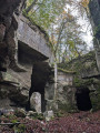
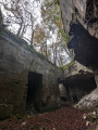
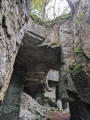
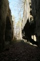
There is interesting flora and fauna throughout the route. There are underground quarries along the Roman road (a small path to the right as you head down the road). Please be aware, however, that these private quarries are no longer in use, so you visit them at your own risk!
This trail follows part of two signposted routes, numbered 27 and 28; you’ll find these signposts from point (1) to point (3).

Worth a visit

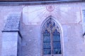
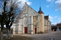
Take a quick look at the sundial on the church in the villageof Etais-la-Sauvin as you pass by.
Visit Clamecy and its collegiate church.
Nearby, the fortified castle of Druyes perched on the hill, the viaduct (bungee jumping available) and the source of the River Druyes.

Reviews and comments

4.1 / 5
Based on 4 reviews

Reliability of the description
4.5 / 5
Ease of following the route
4.3 / 5
Route interest
3.5 / 5
Cyril Drion
Cyril Drion

Overall rating : 4.7 / 5

Date of your route : Nov 01, 2024
Reliability of the description : ★★★★★ Very good
Ease of following the route : ★★★★★ Very good
Route interest : ★★★★☆ Good
Very busy route : No

A brilliant route through fields and woods.
Peace and quiet, the scents of the countryside, mushrooms and stunning quarries.

The quarries are easy to find!
The little path leading to them gives you a quick glimpse of the start of the walls.
They’re situated 300 metres before the right-hand turn at the end of the Roman road.

Thanks to the author.

Machine-translated

jean-michel remolu
jean-michel remolu

Overall rating : 4 / 5

Date of your route : May 26, 2019
Reliability of the description : ★★★★★ Very good
Ease of following the route : ★★★★★ Very good
Route interest : ★★☆☆☆ Disappointing

A lovely route. The round trip through open countryside is a real pleasure.

Machine-translated

POULIN Gérard
POULIN Gérard ★

Hello,
Thank you for your comment on this route. Given the reviews, it would have been better to start from Vellery, as suggested in the description. This cuts out a few kilometres of a rather monotonous stretch at the end of summer, but in spring, the colours are well worth it. I’ll therefore update my description.
As for the quarries, they’re a bit hidden away; but on the single descent along the Roman road, take a small path on the right, carved out of the rock.
What a shame!

Machine-translated

vieux58
vieux58

Overall rating : 3 / 5

Date of your route : Aug 16, 2015
Reliability of the description : ★★★☆☆ Average
Ease of following the route : ★★★☆☆ Average
Route interest : ★★★☆☆ Average

Before Vellery, the route is a bit monotonous, but as soon as you’re in the woods, it’s very pleasant. We couldn’t find the quarries.

Machine-translated

serge91
serge91

Overall rating : 4.7 / 5

Date of your route : Dec 10, 2013
Reliability of the description : ★★★★★ Very good
Ease of following the route : ★★★★☆ Good
Route interest : ★★★★★ Very good

No problems encountered
Just a quick note: to find the old quarries, you need to know the area… Perhaps it would be worth adding that they’re on the right as you go downhill (on the Roman road)
Right at the start of the Roman road, the view is truly superb

At Christmas time, there’s some lovely decorations in Vellery

Machine-translated

Other walks in the area

For more walks, use our search engine .

The GPS track and description are the property of this route's author. Please do not copy them without permission.