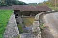
Basseville Rocks in Surgy

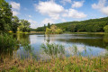
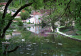
This walk offers the chance to observe a rich variety of flora and fauna. You’ll be able to see the Basseville Rocks and walk alongside the Andryes stream during this walk.
Early in the morning or late in the day, you can spot larks in the fields.

Details

1181162
Creation:
Last update:
Last review:
  • Walking
    Activity: Walking
  • ↔
    Distance: 5.92 mi
  • ◔
    Average duration: 3h 05 
  • ▲
    Difficulty: Easy

  • ⚐
    Back to start: Yes
  • ↗
    Ascent: + 410 ft
  • ↘
    Descent: - 427 ft

  • ▲
    Highest point: 663 ft
  • ▼
    Lowest point: 486 ft
  • ⚐ Country: France
  • ⚐
    Area: Puisaye
  • ⚐ City: Andryes (89480)
  • ⚑
    Start/End: N 47.516849° / E 3.481012°
  • ❏
    IGN map(s): Ref. 2621SB, 2622SB
  • Hour-by-hour weather

Description of the walk

Park near the Bois Joli campsite.

(S/E) Walk down Rue de la Croix la Pelette to reach the Croix de la Pelette.

(1) Immediately take the path on the right through the fields, then carry on straight ahead until you reach theGRP® des Méandres de l’Yonne.

(2) Turn left onto it; it is signposted in red and yellow. Further on, turn left onto the D233. Quickly leave the road by veering to the right, whilst staying on the GRP®. In the fields, follow the signs for the Grottes de l’Ermite. Continue through the forest to the Rochers de Basseville car park.

(3) Take the steps to continue along the Rochers de Basseville path. Be careful not to continue across the car park or onto the D144.

(4) Once you’ve finished the rocky section of the path, carry on along the field track until you reach the entrance to Surgy on the D233.

(5) Turn right into the village of Surgy, then carry on to the junction before the fire station.

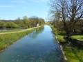
(6) Turn left onto Rue des Trigueres and continue along the path. Walk along the right bank of the Andryes stream. Reach the bridge opposite the hamlet of La Forge.

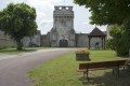
(7) Carry on straight ahead along a straight path to reach the village of Andreys. Continue to the town hall, go up the hill towards the church and walk past the cemetery to reach the car park (S/E).

Waypoints

  1. S/E : mi 0 - alt. 640 ft - Bois Joli car park
  2. 1 : mi 0.25 - alt. 551 ft - Pelette Cross
  3. 2 : mi 1.64 - alt. 653 ft - GRP Méandres ruisseau d’Andryes or - Druyes (rivière)
  4. 3 : mi 2.86 - alt. 486 ft - Basseville Rocks.
  5. 4 : mi 3.45 - alt. 607 ft - End of the ‘Sentier des Roches’ trail
  6. 5 : mi 3.9 - alt. 512 ft - D233 at the entrance to Surgy
  7. 6 : mi 4.03 - alt. 486 ft - Surgy crossroads - Druyes (rivière)
  8. 7 : mi 5.11 - alt. 525 ft - Bridge opposite the hamlet of La Forge
  9. S/E : mi 5.92 - alt. 640 ft - Bois Joli car park

This route passes through a protected area, which may be subject to special regulations:

Worth a visit

There are plenty of views to enjoy.

You’ll see the Basseville rocks on the walk.

You can also visit the Ermite Caves.

Reviews and comments

4 / 5
Based on 3 reviews

Reliability of the description
4.7 / 5
Ease of following the route
4 / 5
Route interest
3.3 / 5
marcus c2
marcus c2

Overall rating : 4 / 5

Date of your route : Jun 13, 2025
Reliability of the description : ★★★★☆ Good
Ease of following the route : ★★★★☆ Good
Route interest : ★★★★☆ Good
Very busy route : No

very pleasant route

Machine-translated

benoit58
benoit58

Overall rating : 4.3 / 5

Date of your route : Sep 24, 2023
Reliability of the description : ★★★★★ Very good
Ease of following the route : ★★★★★ Very good
Route interest : ★★★☆☆ Average
Very busy route : No

12/20. Lovely views from the rocks, a beautiful church in Andryes, though the route is a bit monotonous. Worth doing once.

Machine-translated

henri57
henri57 ★

Hello Vangelos,

Why did you write to us?

Reliability of the route on the map: Average

What are the issues and/or any information that contradicts the description?

Kind regards

Machine-translated

vangelos
vangelos

Overall rating : 3.7 / 5

Date of your route : Aug 20, 2018
Reliability of the description : ★★★★★ Very good
Ease of following the route : ★★★☆☆ Average
Route interest : ★★★☆☆ Average

A lovely mix of open fields and forest trails. However, you can’t really see the rocks. So you need to leave the path and follow the trail that runs along the base of the rocks

Machine-translated

Other walks in the area

For more walks, use our search engine .

The GPS track and description are the property of this route's author. Please do not copy them without permission.