The Valley of the Donkeys

Marked walk No. 28.
A lovely route through woods and open countryside.
This route has been surveyed and marked out by members of the local association “À Travers Champs”. It is fully signposted with yellow signs, black lettering and yellow arrows on a red background.
It can be enjoyed on horseback or by mountain bike.

Details

n°42696
Creation:
Last update:
Last review:
  • Walking
    Activity: Walking
  • ↔
    Distance: 7.65 mi
  • ◔
    Average duration: 3h 45 
  • ▲
    Difficulty: Moderate

  • ⚐
    Back to start: Yes
  • ↗
    Ascent: + 279 ft
  • ↘
    Descent: - 285 ft

  • ▲
    Highest point: 961 ft
  • ▼
    Lowest point: 725 ft

Photos

Description of the walk

(S/E) Starting from the Champ de Foire car park, opposite the cedar trees and the school, cross the main road (D104) using the pedestrian crossing.
In front of the school, turn left, behind the cedar tree, following the fence. Turn right at the corner of the school and follow the dead-end path downhill.
In the fire station courtyard, turn left, go down the grassy path from the playground, continue across the playground towards the fence, until you reach the chicane on the left. Take this, turn left onto the tarmac road, then right until you reach the next junction.

(1) At this point, take the path on the left, ignoring the side paths.

(2) Turn left. When you reach the road, turn right

(3) At the crossroads (farm on the right), take the road on the left up to the top of the village. Ignore the first path on the right, which merges with a farm entrance, and take thesecond path on the right.
Walk for about 500 metres, then turn onto thefirst path on the right which leads into the woods.

(4) Atthe first crossroads in the woods, go straight on, then take thefirst path on the right. Follow this path, ignoring the paths to the right or left, until you reach the edge of the woods. You’ll see a large meadow ahead of you; turn right, then take the next right at the fork. The path leads back into the undergrowth and descends to the junction with the Vellery road.

(5) Cross the road and continue until you reach the entrance to La Poterie.

(6) Walk through this village heading north-east, ignoring all paths and roads on both the left and right.
Carry on to the junction with the next road, follow it for 50 metres, then leave it and turn ontothe first path on the right.

(7) Turn right again. Follow this track through the fields to the bottom of the valley. You’ll reach a cross-track. Turn right to join a small road.

(8) Take this road on the left and carry on. In the wide bend to the left, ignore the track leading off to the right.

(9) Before entering Breuilleron, pass a path on your left and take the path on the right. You’ll see the church at Étais ahead of you. Carry on until you reach a tarmac road.

(10) Turn left onto this section of tarmac road. Before the crossroads, take the footpath on the right to join the main street.
At the junction, head straight ahead towards the church, which you should go round to the left until you reach the Route de la Gare; turn left onto this for 20 metres, then turn right onto Rue Hongroise. At the end of this street, turn right. At the stop sign, turn left, then left again and right to return to the starting point (S/E).

Waypoints

  1. S/E : mi 0 - alt. 833 ft - Place du Champ de Foire
  2. 1 : mi 0.5 - alt. 804 ft - Leave the road and take the stony track
  3. 2 : mi 1.43 - alt. 781 ft - Junction with a side path on the left
  4. 3 : mi 1.88 - alt. 817 ft - The hamlet of Vellery, 100 metres away, features a remarkable tree
  5. 4 : mi 2.35 - alt. 886 ft - Four-way crossroads
  6. 5 : mi 3.56 - alt. 784 ft - Crossing a road
  7. 6 : mi 3.84 - alt. 771 ft - In the hamlet of La Poterie, turn left
  8. 7 : mi 4.62 - alt. 761 ft - At junctions, turn right
  9. 8 : mi 5.3 - alt. 735 ft - Turn left back onto the road
  10. 9 : mi 6.02 - alt. 768 ft - Leave the road and take the path on the right
  11. 10 : mi 6.98 - alt. 794 ft - Leave the path by taking the street on the left
  12. S/E : mi 7.65 - alt. 833 ft - Place du Champ de Foire

Notes

Bring a hat, sunglasses and water if the sun is strong.
This walk is organised bythe Puisaye-Forterre Tourist Office.
The signposting is provided by the association ‘À chacun son chemin en Puisaye-Forterre’ in accordance with the graphic guidelines of the Puisaye-Forterre Community of Communes, as set out in the description, and is numbered 28.
However, the fact that signposting is mentioned means you must set off with at least this description and the accompanying IGN map or the Visorando app.
If you encounter any problems, please complete this questionnaire (it only takes 1 to 2 minutes).
Take care when crossing roads.

Worth a visit

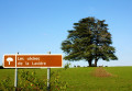
At the checkpoint (3), after passing the farm, take the road opposite for 100 metres to have a look at the old oak tree.

At the waypoint (6), you can leave this walk to shorten it slightly by taking route 27 (Chemin du Puits). The finishing point will be the same.
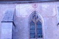
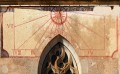
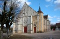
Above the south gate of Étais church, take a look at the painted sundial, then head to the north entrance and the terrace where, from the top of the steps, the rural constable used to announce the news to the villagers.
A few kilometres away, discover the villages of Druyes-les-Belles-Fontaines (fortified castle) and Entrains-sur-Nohain (archaeological sites).

Reviews and comments

5 / 5
Based on 1 review

Reliability of the description
5 / 5
Ease of following the route
5 / 5
Route interest
5 / 5
POULIN Gérard
POULIN Gérard ★

Thank you for your review, charline.franck. Hope to see you in this area soon?

Machine-translated

charline.franck
charline.franck

Overall rating : 5 / 5

Date of your route : Dec 29, 2014
Reliability of the description : ★★★★★ Very good
Ease of following the route : ★★★★★ Very good
Route interest : ★★★★★ Very good

Hello,
a lovely walk through the woods
very well signposted and with lovely scenery
highly recommended

Machine-translated

Other walks in the area

For more walks, use our search engine .

The GPS track and description are the property of this route's author. Please do not copy them without permission.