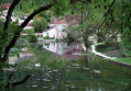
Around Tremblay-en-Forterre

A walk through fields and woods, with lovely views of the Montagne aux Alouettes and the surrounding area.

Details

n°54057
Creation:
Last update:
Last review:
  • Walking
    Activity: Walking
  • ↔
    Distance: 6.35 mi
  • ◔
    Average duration: 3h 00 
  • ▲
    Difficulty: Easy

  • ⚐
    Back to start: Yes
  • ↗
    Ascent: + 112 ft
  • ↘
    Descent: - 102 ft

  • ▲
    Highest point: 886 ft
  • ▼
    Lowest point: 741 ft

Photos

Description of the walk

From the D6, drive through Le Tremblay heading north-east and park at the edge of the village, near number 25.

(S/E) After number 25, take the path on the left and, at the end of the path, turn right, then left, then right.

(1) At the railway line, continue left for about 100 metres, then cross the tracks on the right. Continue to the road, take the path opposite, then

(2) the first path on the right (about 800m) to Les Joux. Carry on straight ahead along the road.

(3) On leaving Les Joux, take the path on the right, cross the road, then carry on straight ahead. At the Fork in the road just after, turn left, and at the small crossroads carry on straight ahead, veering slightly to the right.

(4) At the junction, continue to the left, then turn right and right again to reach the old “Garde Barrière” house.

(5) Carry on straight ahead, first turn right then left, then keep going straight on until you reach the road (the junction known as ‘Les 4 Sapins’).

(6) Take the road on the right for about 1 km,

(7) then take the path on the right, followed by the second on the left. At the junction, turn right to return to the starting point (S/E).

Waypoints

  1. S/E : mi 0 - alt. 820 ft - North-east exit from the village
  2. 1 : mi 0.83 - alt. 801 ft - On the left
  3. 2 : mi 1.41 - alt. 774 ft - On the right
  4. 3 : mi 2.15 - alt. 761 ft - On the right
  5. 4 : mi 3.08 - alt. 764 ft - On the left
  6. 5 : mi 3.67 - alt. 784 ft - Opposite
  7. 6 : mi 5 - alt. 863 ft - On the right
  8. 7 : mi 5.69 - alt. 863 ft - On the right
  9. S/E : mi 6.35 - alt. 823 ft - North-eastern exit from the village

Notes

Please be aware that in hot weather, most of the route is not shaded.
Remember to bring something to keep you hydrated and don’t forget your hat, cap or sombrero.

Worth a visit

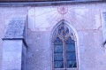
The sundial at the church in the village of Etais-la-Sauvin.
Visit Clamecy, its collegiate church and the Romain Rolland Museum.
The fortified castle at Druyes, the viaduct (bungee jumping available) and the source of the River Druyes.
The medieval castle at Guédelon.

Reviews and comments

5 / 5
Based on 1 review

Reliability of the description
5 / 5
Ease of following the route
5 / 5
Route interest
5 / 5
POULIN Gérard
POULIN Gérard ★

Overall rating : 5 / 5

Date of your route : Mar 24, 2014
Reliability of the description : ★★★★★ Very good
Ease of following the route : ★★★★★ Very good
Route interest : ★★★★★ Very good

A superb route: very sunny at the start, followed by a magnificent stretch through the forest tracks. Highly recommended in all seasons, though in summer it’s best to set off in the morning.
A group that was very pleased with this new route.

Machine-translated

Other walks in the area

For more walks, use our search engine .

The GPS track and description are the property of this route's author. Please do not copy them without permission.