Between the Yonne and the Canal du Nivernais in Clamecy

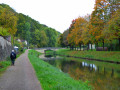
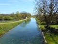
A peaceful walk between the Yonne and the canal, featuring two lovely wash houses.

Details

81554
Creation:
Last update:
Last review:
  • Walking
    Activity: Walking
  • ↔
    Distance: 6.21 mi
  • ◔
    Average duration: 3h 05 
  • ▲
    Difficulty: Easy

  • ⚐
    Back to start: Yes
  • ↗
    Ascent: + 282 ft
  • ↘
    Descent: - 282 ft

  • ▲
    Highest point: 764 ft
  • ▼
    Lowest point: 479 ft

Description of the walk

Start from the Ponts Verts car park opposite the sailing club on Place de l’Abattoir.

(S/E) Facing the River Yonne, turn right onto the small metal bridge, then continue along the Quai du Perthuis, passing under the Bethléem Bridge; at the lock, cross to the left.

(1) Turn right between the canal and the River Yonne and carry on straight ahead.

(2) Pass the campsite and continue between the canal and the River Yonne; after the two locks, you’ll arrive at Chevroche.

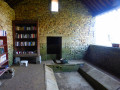
(3) On your left, take a look at the “du Bourg” wash house, then rejoin the road on the right and, immediately after the bridge, take the cycle path on the left.

(4) At the picnic area, turn right then left onto the road (with the wash house on your left). Pass through the hamlet of Cantenot then carry on straight ahead along the Chemin de l’Hermitage.

(5) At the pig pen, take the left-hand Fork in the road into the woods and carry on straight ahead until you reach the road (remember to wear your high-visibility vest).

(6) Follow the D34 to the right for 1.2 km.

(7) Leave the D34 and take the road on the right towards Chevroches and the campsite.
100 metres further on, at the junction with the D215, carry straight on.

(8) At Pont Picot, turn left into Rue de Chevroches:

(9) At the end of the street, turn right, then go down the steps on the right and take Rue des Jeux (almost directly opposite), then at the end, turn left and continue straight on to the car park (S/E).


Waypoints

  1. S/E : mi 0 - alt. 482 ft - Ponts Verts car park. Bridge over the - Beuvron (rivière) - Affluent de l'Yonne
  2. 1 : mi 0.35 - alt. 486 ft - Lock - Yonne (l')
  3. 2 : mi 0.73 - alt. 489 ft - Campsite
  4. 3 : mi 2.59 - alt. 492 ft - Washing house
  5. 4 : mi 2.89 - alt. 495 ft - Picnic area
  6. 5 : mi 3.33 - alt. 581 ft - Pig pen
  7. 6 : mi 3.92 - alt. 748 ft - D34 on the right
  8. 7 : mi 4.74 - alt. 686 ft - Turn right onto the road towards Chevroches (campsite)
  9. 8 : mi 5.25 - alt. 505 ft - Pont Picot - Canal du Nivarnais
  10. 9 : mi 5.81 - alt. 525 ft - Turn right towards the steps
  11. S/E : mi 6.21 - alt. 482 ft - Ponts Verts car park opposite the sailing club

Reviews and comments

4.5 / 5
Based on 2 reviews

Reliability of the description
5 / 5
Ease of following the route
5 / 5
Route interest
3.5 / 5
ludo58
ludo58

Overall rating : 4.3 / 5

Date of your route : Feb 20, 2023
Reliability of the description : ★★★★★ Very good
Ease of following the route : ★★★★★ Very good
Route interest : ★★★☆☆ Average
Very busy route : No

The whole section of the walk along the water’s edge is very pleasant.
However, I don’t see the point of the section between marker 4 and marker 8.
All those kilometres just to ‘end up’ on a 1.2-kilometre stretch of the D34, which is also very busy…

Machine-translated

epiluc91
epiluc91

Overall rating : 4.7 / 5

Date of your route : Oct 27, 2021
Reliability of the description : ★★★★★ Very good
Ease of following the route : ★★★★★ Very good
Route interest : ★★★★☆ Good
Very busy route : No

A lovely, easy walk that’s described very well.

Machine-translated

Other walks in the area

For more walks, use our search engine .

The GPS track and description are the property of this route's author. Please do not copy them without permission.