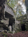
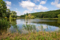
Billy, between woodland and the banks of the Oisy

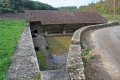
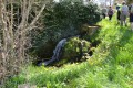
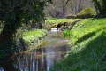
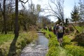
A lovely walk around Billy combining woodland and the banks of the Oisy, as well as the chance to discover a charming wash house.

Details

n°108650
Creation:
Last update:
Last review:
  • Walking
    Activity: Walking
  • ↔
    Distance: 5.23 mi
  • ◔
    Average duration: 2h 40 
  • ▲
    Difficulty: Easy

  • ⚐
    Back to start: Yes
  • ↗
    Ascent: + 312 ft
  • ↘
    Descent: - 285 ft

  • ▲
    Highest point: 876 ft
  • ▼
    Lowest point: 584 ft

Photos

Description of the walk

Start from the car park of the community hall opposite the post office, which is located in the town hall premises.

(S/E) At the foot of the tower, follow the small path to the right which runs alongside the old ramparts; then, after passing between the two houses, turn left along the wash house.

(1) Cross the Oisy, continue along the path until you reach the road (D166). Take this road, turning right for about 500 metres. Pass the first turn-off on the right to reach a second path.

(2) Take this on the right and then the second path on the left. You’ll come to a T-junction.

(3) Turn left. At the edge of the woodland, the path veers to the right. After about 300 metres, you’ll reach a crossroads with four paths.

(4) Turn right and ignore all the paths on the right until you reach the edge of a woodland. Inside the woodland, when you reach a junction with six paths, take the second on the right (not marked on the map).

(5) As you leave the woodland, take the path on the right to continue to the road and reach La Motte.

(6) Take a short detour to the wash house on the left. Turn back and, before you reach the houses, turn left onto a small grassy path which will take you alongside the River Oisy.
When you reach the road (D957), turn right and head towards the Fontaine Saint-Didier.

(7) Turn right and continue along this road until you reach a farm building. Turn left immediately, walk past the building, continue straight on and walk for about 400 metres.

(1) Turn left, then, after the wash house, turn right between the two houses. Follow the path to return to the starting point (S/E).

Waypoints

  1. S/E : mi 0 - alt. 600 ft - Car park at the community hall
  2. 1 : mi 0.27 - alt. 600 ft - Crossing the - Oisy (rivière)
  3. 2 : mi 0.96 - alt. 620 ft - Path on the right
  4. 3 : mi 1.68 - alt. 735 ft - Turn left at the crossroads
  5. 4 : mi 2.35 - alt. 860 ft - Turn left
  6. 5 : mi 2.98 - alt. 781 ft - On the right, as you leave the woodland
  7. 6 : mi 3.94 - alt. 630 ft - Return journey to the wash house - Oisy (rivière)
  8. 7 : mi 4.6 - alt. 610 ft - Saint-Didier Fountain
  9. S/E : mi 5.23 - alt. 600 ft - Car park at the community hall

Notes

Spring and natural water sources – not suitable for drinking. Wetlands in places.

Reviews and comments

4.2 / 5
Based on 2 reviews

Reliability of the description
4 / 5
Ease of following the route
4 / 5
Route interest
4.5 / 5
mojean58
mojean58

Overall rating : 4.3 / 5

Date of your route : Jun 22, 2020
Reliability of the description : ★★★★☆ Good
Ease of following the route : ★★★★☆ Good
Route interest : ★★★★★ Very good
Very busy route : No

A wash house converted into a water feature – a brilliant idea, and lovely to look at

Machine-translated

Other walks in the area

For more walks, use our search engine .

The GPS track and description are the property of this route's author. Please do not copy them without permission.