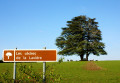
Chemin des Plots

Marked walk No. 27.
A short, family-friendly walking or mountain-biking route that is enjoyable and accessible all year round.
This route has been surveyed and marked out by members of the local association A Travers Champs. It is fully signposted with yellow signs, black lettering and yellow arrows on a red background.

Details

42140
Creation:
Last update:
Last review:
  • Walking
    Activity: Walking
  • ↔
    Distance: 4.05 mi
  • ◔
    Average duration: 2h 00 
  • ▲
    Difficulty: Easy

  • ⚐
    Back to start: Yes
  • ↗
    Ascent: + 121 ft
  • ↘
    Descent: - 125 ft

  • ▲
    Highest point: 896 ft
  • ▼
    Lowest point: 797 ft

Photos

Description of the walk

The route starts from the square opposite the school complex, between the Grande Rue and the Rue du Champ de Foire.
(S/E) Set off along Rue du Champ de Foire heading east and turn right onto Rue de la Vigne (leaving Rue du Potier on your right). At the first junction, turn right and then immediately left onto the small path to reach the hamlet of Les Roubdeaux. In this hamlet, follow the main road to the left until you reach the first crossroads.

(1) Turn left onto the path without crossing the road. When you reach a thick hedge, turn left. Once you reach the road, cross the railway line and continue along this small road until you reach the first path on the left.

(2) Turn onto this track. Carry on until you reach the road, then follow it for 200 metres. Turn left towards Les Plots.

(3) Cross the road to take the track and carry on straight ahead, crossing a second road.

(4) When you reach the village of Montfoin, turn left, walk past the stadium, cross the viaduct over the railway line to reach the junction with the main road, which you must cross. This path will take you to a junction with the D104.

(5) Cross this road and, 50 metres after this junction, take the footpath on the left to return to the village.
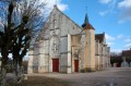
At the end of this footpath, head straight ahead towards the church, which you should walk round, following the walls of the building on the left until you reach Route de la Gare. Turn left for 20 metres, then turn right onto Rue Hongroise. At the end of this street, turn right. At the Stop sign, turn left, then left again and right to return to the starting point (S/E).

Waypoints

  1. S/E : mi 0 - alt. 833 ft - Place du Champ de Foire
  2. 1 : mi 0.57 - alt. 820 ft - Roubdeaux junction
  3. 2 : mi 1.37 - alt. 810 ft - Turn left onto the path
  4. 3 : mi 2.47 - alt. 856 ft - Crossing a road
  5. 4 : mi 2.97 - alt. 896 ft - Montfoin
  6. 5 : mi 3.51 - alt. 804 ft - Crossing a road
  7. S/E : mi 4.05 - alt. 833 ft - Place du Champ de Foire

Notes

The route is quite exposed to the sun, so bring a hat and something to drink.
In Montfoin, two old windmills serve as a reminder that wind was once widely used in this area.
On the church façade, in the alleyway, if you look up, you’ll be delighted to discover the painted sundial.
This walk is organised bythe Puisaye-Forterre Tourist Office.
The route is signposted by the association ‘À chacun son chemin en Puisaye-Forterre’ in accordance with the graphic guidelines of the Puisaye-Forterre Community of Communes, following the direction of the description, and is marked No. 27.
However, as the route is signposted, you must set off with at least this description and the accompanying IGN map or the Visorando app.
If you encounter any problems, please complete this questionnaire (it only takes 1 to 2 minutes).
Take care when crossing roads.

Worth a visit

The village of Druyes-les-Belles-Fontaines.
The town of Clamecy, about twenty kilometres away, is well worth a visit.

Reviews and comments

4.7 / 5
Based on 2 reviews

Reliability of the description
4.5 / 5
Ease of following the route
5 / 5
Route interest
4.5 / 5
Titus89
Titus89

Overall rating : 4.7 / 5

Date of your route : Jun 03, 2026
Reliability of the description : ★★★★★ Very good
Ease of following the route : ★★★★★ Very good
Route interest : ★★★★☆ Good
Very busy route : No

A lovely, pleasant walk. However, the path hadn’t been cleared for about a hundred metres and was partly overgrown with crops between points 4 and 5 after crossing the D104; I wouldn’t have found it if I hadn’t had a map and a compass.

Machine-translated

yasmine58
yasmine58

Overall rating : 4.5 / 5

Date of your route : Aug 19, 2019
Reliability of the description : ★★★★☆ Good
Ease of following the route : Not used / Not applicable
Route interest : ★★★★★ Very good

A lovely walk
At first, I had a bit of trouble finding my way to the hamlet of Les Roubdeaux

Machine-translated

Other walks in the area

For more walks, use our search engine .

The GPS track and description are the property of this route's author. Please do not copy them without permission.