The fields of the Goire Valley

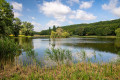
A pleasant walk through fields and woodland, between the Yonne and Nièvre departments, in the heart of the Goire Valley, starting from the village of Andryes. Beautiful scenery and lovely views.

Details

10060567
Creation:
Last update:
Last review:
  • Walking
    Activity: Walking
  • ↔
    Distance: 4.18 mi
  • ◔
    Average duration: 2h 10 
  • ▲
    Difficulty: Easy

  • ⚐
    Back to start: Yes
  • ↗
    Ascent: + 233 ft
  • ↘
    Descent: - 240 ft

  • ▲
    Highest point: 663 ft
  • ▼
    Lowest point: 502 ft
  • ⚐ Country: France
  • ⚐
    Area: Puisaye
  • ⚐ City: Andryes (89480)
  • ⚑
    Start/End: N 47.516725° / E 3.480553°
  • ❏
    IGN map(s): Ref. 2621SB, 2622SB
  • Hour-by-hour weather

Description of the walk

Park near the entrance to the Bois Joli campsite.

(S/E) Take the Route de Villeprenoy towards the village of Andryes. At the Y-junction, turn right. You’ll reach the wayside cross on the left-hand side of the road.

(1) At the Croix La Pelette (the name of the wayside cross), turn right and follow the path opposite, which leads into the fields. At the next junction, turn right again and follow the path that runs alongside the forest. Continue along the same path through the forest (no. 12).

(2) Take the path on the left which runs between numbers 11 and 12 and ends at a cross-path.

(3) At the T-junction, turn left. At the end of the path, as you reach the fields, turn left and follow the edge of the woodland for 200 m.

(4) Cut right and walk across the fields to the next junction, just before Surgie.

(5) Turn left and head down along the edge of the fields, towards the house with the blue shutters. At the bottom, follow the path to the left. At the end of the tree-lined stretch, continue along the path, passing in front of the horse paddock.

(6) Take the first left to head back into the fields.

(7) At the T-junction, turn right. Carry on straight ahead until you reach the 166-metre mark.

(1) Retrace your steps along the path you took on the way out to reach the finish point (S/E).

Waypoints

  1. S/E : mi 0 - alt. 643 ft - Entrance to the Bois Joli campsite
  2. 1 : mi 0.28 - alt. 551 ft - Croix la Pelette
  3. 2 : mi 1.18 - alt. 663 ft - Junction between routes 11 and 12
  4. 3 : mi 1.48 - alt. 620 ft - Cross-country path
  5. 4 : mi 1.87 - alt. 627 ft - Turn right
  6. 5 : mi 2.59 - alt. 548 ft - House with blue shutters. On the left, along the - Druyes (rivière)
  7. 6 : mi 3.6 - alt. 525 ft - Turn left at the fork
  8. 7 : mi 3.7 - alt. 561 ft - T-junction
  9. S/E : mi 4.18 - alt. 643 ft - Entrance to the Bois Joli campsite

Worth a visit

Early in the morning and in the evening, you may come across roe deer and foxes. Skylarks can be seen in the fields.

Reviews and comments

4.3 / 5
Based on 2 reviews

Reliability of the description
4.5 / 5
Ease of following the route
5 / 5
Route interest
3.5 / 5
c1gag
c1gag

Overall rating : 4.3 / 5

Date of your route : Sep 17, 2024
Reliability of the description : ★★★★☆ Good
Ease of following the route : ★★★★★ Very good
Route interest : ★★★★☆ Good
Very busy route : No

a lovely walk in the woods

Machine-translated

cobolo
cobolo

Overall rating : 4.3 / 5

Date of your route : Dec 27, 2021
Reliability of the description : ★★★★★ Very good
Ease of following the route : ★★★★★ Very good
Route interest : ★★★☆☆ Average
Very busy route : No

followed the route to the letter (with the map in my pocket); a short, leisurely walk to aid digestion – not particularly interesting, apart from the pleasure of walking;
Thanks for the info,
cobolo

Machine-translated

Other walks in the area

For more walks, use our search engine .

The GPS track and description are the property of this route's author. Please do not copy them without permission.