


Refine your search for walks in Dinéault
Dinéault walks


 Rosconnec marsh route via the Sant-Dispar Chapel
 Visorando Member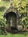
 5.92 mi
 +830 ft
 -830 ft
 3h 25
3h 25
 Moderate
 Departure from Dinéault (Finistère)
From the beautiful green setting where the Sant-Dispar Chapel nestles, flanked by its calvary and fountain, make your way through the woodland to the protected Rosconnec marshes at the confluence of the Aulne and its tributary, the Douffine.These meadows, which flood at spring tides, are protected areas for the aquatic reed warbler, a small passerine measuring 12 to 13 cm in length and weighing 10 to 14 g. This species is one of the birds protected by the European Commission.
The Ménez Hom tour through the Trégarvan Communal Forest
 6.31 mi
+801 ft
-801 ft
3h 35
Moderate
Departure from Dinéault (Finistère)
6.31 mi
+801 ft
-801 ft
3h 35
Moderate
Departure from Dinéault (Finistère)
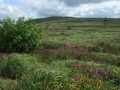
Ménez Hom, the last peak in the Montagnes Noires range, part of the Armorican Massif, rises to 330 m above Douarnenez Bay.
Starting from the summit, this route descends on the west side, then goes around the north side through the Trégarvan Communal Forest and finally climbs back up on the east side.
Beautiful views over Douarnenez Bay and the entire Châteaulin basin where the Aulne river flows.
From the summit of Ménez Hom to the banks of the Aulne via Trégarvan
 11.49 mi
+1,375 ft
-1,365 ft
6h 30
Moderate
Departure from Dinéault (Finistère)
11.49 mi
+1,375 ft
-1,365 ft
6h 30
Moderate
Departure from Dinéault (Finistère)
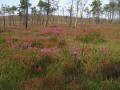
Start at the summit of Ménez-hom (330 m) and descend on the west side with views of Douarnenez Bay.Stroll through pine forests to the banks of the River Aulne in Trégarvan, then return to the summit via the eastern side.
Tour of Ménez Hom from the Sainte-Marie Chapel
 7.17 mi
+850 ft
-869 ft
4h 00
Moderate
Departure from Plomodiern (Finistère)
7.17 mi
+850 ft
-869 ft
4h 00
Moderate
Departure from Plomodiern (Finistère)
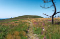
Ménez Hom is the highest hill in the western Montagnes Noires. Its two main peaks, Yelc'h (or Hielc'h according to the IGN map) and Yed, overlook Douarnenez Bay and Brest Harbour.
This route goes around them, along paths that are sometimes very discreet on its slopes and summits, and offers a vast panorama between the Aulne Valley and the Iroise Marine Natural Park.
Around and on the peaks of Ménez-Hom
 7.73 mi
+942 ft
-942 ft
4h 25
Moderate
Departure from Plomodiern (Finistère)
7.73 mi
+942 ft
-942 ft
4h 25
Moderate
Departure from Plomodiern (Finistère)
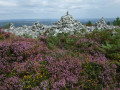
Circular route around Ménez-Hom, the final peak of the Montagnes Noires, via a route through the countryside on the eastern side before beginning the ascent to pass over the two peaks: Le Yed (329m) and then Le Hielc’h (298m).Wide panoramic views over the Aulne Valley and its suspension bridge, the head of Brest harbour and the whole of Douarnenez Bay.Beautiful vegetation comprising open heathland and heather in bloom from June onwards.You can visit the imposing chapel (if open) and its churchyard, which features a calvary dating from 1544.
Circular between the Aulne and the Faou river
 10.11 mi
+1,335 ft
-1,342 ft
5h 50
Moderate
Departure from Rosnoën (Finistère)
10.11 mi
+1,335 ft
-1,342 ft
5h 50
Moderate
Departure from Rosnoën (Finistère)
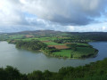
A circular loop between the Aulne in its final meanders before its estuary in the Brest harbour and its last tributary, the Faou river.
Several viewpoints on the left bank of the Aulne with Ménez-Hom, the new Térénez bridge, Landévennec and its abbey.
Shellfish farming on the Faou river is currently limited to the cultivation of Pacific oysters.
Canal route departing from the former station
 6.09 mi
+272 ft
-253 ft
3h 00
6.09 mi
+272 ft
-253 ft
3h 00
 Easy
Departure from Châteaulin (Finistère)
Easy
Departure from Châteaulin (Finistère)
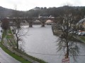
Set off on foot along the former Châteaulin-Carhaix railway line, overlooking the still-canalised Aulne river, continue along an old Roman road, then follow the towpath of the Nantes-Brest Canal to discover the heart of Châteaulin at the end of the route.
Along the Aulne in Châteaulin
 6.72 mi
+318 ft
-299 ft
3h 20
Moderate
Departure from Châteaulin (Finistère)
6.72 mi
+318 ft
-299 ft
3h 20
Moderate
Departure from Châteaulin (Finistère)
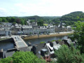
With the River Aulne, in its final stretch before the sea, as our guide, let’s set off to explore Port-Launay, a former river port. Let’s follow the towpath and then climb up to the Notre-Dame Chapel, which offers a view of Châteaulin, before returning to the river.
Châteaulin right-bank route
 3.60 mi
+223 ft
-223 ft
1h 50
Easy
Departure from Châteaulin (Finistère)
3.60 mi
+223 ft
-223 ft
1h 50
Easy
Departure from Châteaulin (Finistère)
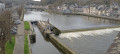
Starting from the old Châteaulin station, this walk combines town streets and dirt tracks, ending on the old railway line with views of the town’s bridges.
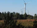
In the woods of Saint-Gildas between the chapel and the wind turbines.
 6.57 mi
+725 ft
-728 ft
3h 40
Moderate
Departure from Cast (Finistère)
6.57 mi
+725 ft
-728 ft
3h 40
Moderate
Departure from Cast (Finistère)
From the clearing surrounded by beech, chestnut and cypress trees, discover the long Saint-Gildas Chapel and, a little further down, its associated fountain, then venture into the Saint-Gildas woods overlooking the Châteaulin valley. Continue through this area where there are numerous wind turbines.The long climb up the old Châteaulin-Quimper Roman road may leave you panting before you reach the bare heights of Ménez Quelc'h.
Currently being revised
Saint-Sébastien route
 6.21 mi
+295 ft
-285 ft
3h 05
Easy
Departure from Port-Launay (Finistère)
6.21 mi
+295 ft
-285 ft
3h 05
Easy
Departure from Port-Launay (Finistère)
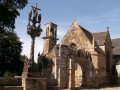
A route through the countryside and along the banks of the Aulne, the final section of the Nantes–Brest Canal which runs through a channel.Discover Saint-Sébastien Chapel.
Sainte-Barbe Chapel and the Ploéven countryside
 6.62 mi
+456 ft
-443 ft
3h 25
Moderate
Departure from Ploéven (Finistère)
6.62 mi
+456 ft
-443 ft
3h 25
Moderate
Departure from Ploéven (Finistère)
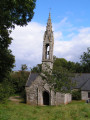
Starting at the 16th-century Sainte-Barbe Chapel, built on a site said to have been founded by monks from across the Channel, the route continues through the Porzay countryside, a mosaic of colours depending on the crops and the season.Along the way, discover the ‘Quenouille de Sainte-Barbe’, an Iron Age stele, no doubt used for Celtic cultural ceremonies.It is also thought to have served as a pillory for tying up those condemned to death who were hanged there.
Circuit du nouveau bourg de Quimerc'h vers Kostalan
 4.52 mi
+554 ft
-571 ft
2h 35
Moderate
Departure from Pont-de-Buis-lès-Quimerch (Finistère)
4.52 mi
+554 ft
-571 ft
2h 35
Moderate
Departure from Pont-de-Buis-lès-Quimerch (Finistère)
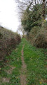
Découvrez la campagne de Quimerc'h à partir du nouveau bourg jusqu'au village typique de Kostalan. Cette promenade offre de beaux points de vues sur le Menez Hom, Rumengol et la rade de Brest. Itinéraire équilibré entre chemins creux, chemins d'exploitation et petites routes tranquilles.
The Leopards’ Route in Le Faou
2.36 mi
+30 ft
-30 ft
1h 05
Easy
Departure from Le Faou (Finistère)
Set off to explore this ‘Petite Cité de Caractère’ with this urban walking route known as the ‘Léopards’!On foot, by bike, on a scooter, or with a pushchair!The route is marked with bronze nails bearing the town’s coat of arms (the leopard) and additional blue signposts.
Saint-Laurent Chapel and Aulne Canal from Saint-Coulitz
 5.83 mi
+449 ft
-479 ft
3h 05
Easy
Departure from Saint-Coulitz (Finistère)
5.83 mi
+449 ft
-479 ft
3h 05
Easy
Departure from Saint-Coulitz (Finistère)
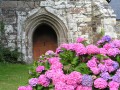
Hike along small roads, paths and towpaths to discover Saint-Coulitz, its religious heritage and the beauty of the surrounding nature.
From Kerolier to Plomodiern via Ménez Hom
 7.63 mi
+1,276 ft
-1,168 ft
4h 35
Moderate
Departure from Saint-Nic (Finistère)
7.63 mi
+1,276 ft
-1,168 ft
4h 35
Moderate
Departure from Saint-Nic (Finistère)
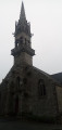
The final stage is the shortest, but it is this one that takes us to the highest point of this tour of Crozon, the Ménez Hom at an altitude of 329 m, from where you can enjoy a sweeping panorama.
Route des fontaines autour de Saint-Nic
 7.20 mi
+584 ft
-554 ft
3h 50
Moderate
Departure from Saint-Nic (Finistère)
7.20 mi
+584 ft
-554 ft
3h 50
Moderate
Departure from Saint-Nic (Finistère)
A countryside route following part of the old Camaret-Châteaulin railway line. Beautiful views over Douarnenez Bay and the western flank of Ménez Hom
From the heights of Saint-Nic to Pentrez Beach
 6.20 mi
+561 ft
-561 ft
3h 20
Easy
Departure from Saint-Nic (Finistère)
6.20 mi
+561 ft
-561 ft
3h 20
Easy
Departure from Saint-Nic (Finistère)
From the small village of Saint-Nic, climb up to the top of the plateau overlooking Douarnenez Bay. Follow a gentle descent to reach Pentrez Beach.
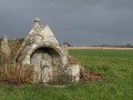
On this route, you’ll pass the Ménez Lié dolmen, the Saint-Côme Chapel and its votive fountain, and finally the fountain near the Saint-Nicaise Church in Saint-Nic.
Ménez-Hom circuit
 7.20 mi
+1,099 ft
-1,073 ft
4h 15
Moderate
Departure from Saint-Nic (Finistère)
7.20 mi
+1,099 ft
-1,073 ft
4h 15
Moderate
Departure from Saint-Nic (Finistère)
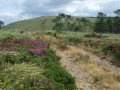
Hike to the summit of Ménez-Hom (330 m), the highest point of the Montagnes Noires in Brittany.
Great views of Douarnenez Bay, the Crozon peninsula and the Aulne maritime.
A mecca for model aircraft enthusiasts.
Circular Rumengol towards Le Cranou
6.38 mi
+568 ft
-574 ft
3h 25
Moderate
Departure from Le Faou (Finistère)
Discover sunken paths, recharge your batteries in the forest, and visit the village of Rumengol and its place of pilgrimage.
Seillou beach - Kergadalen - Térénez bridge - Aulne river
 7.05 mi
+889 ft
-860 ft
4h 00
Moderate
Departure from Rosnoën (Finistère)
7.05 mi
+889 ft
-860 ft
4h 00
Moderate
Departure from Rosnoën (Finistère)
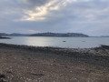
Walk along the banks of the Aulne with views of the Térénez bridge, Térénez Island, the Landévennec boat graveyard, Saint-Guénolé Abbey and Landévennec.
Coastal path of Douarnenez Bay via Pointe de Tal ar Grip
 5.66 mi
+276 ft
-276 ft
2h 50
Moderate
Departure from Plomodiern (Finistère)
5.66 mi
+276 ft
-276 ft
2h 50
Moderate
Departure from Plomodiern (Finistère)
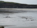
A seaside walk following theGR®®34past Pointe de Tal ar Grip, where the view takes in the long Pentrez Beach. Return via small roads to discover Saint-Sébastien Chapel and its fountain.Finally, rejoin the coastal path you took on the way out and observe how the landscape changes with the tide.
Take care at high tide when crossing part of Pors ar Vag beach!
Route of the old paths in Lopérec
 Local authority
 7.26 mi
+896 ft
-869 ft
4h 05
Moderate
Departure from Lopérec (Finistère)
7.26 mi
+896 ft
-869 ft
4h 05
Moderate
Departure from Lopérec (Finistère)
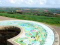
The municipality of Lopérec is set amidst a varied, undulating landscape of hedgerows, featuring woods, moorland and farmland criss-crossed by numerous watercourses.
In 1830, a traveller described Lopérec as follows: “Everywhere, water, foliage, majestic trees, numerous villages, surrounded by lush orchards where apple and cherry trees display their dazzling blossoms in shades of purple and white...”°°
Walk in Landévennec
 2.87 mi
+115 ft
-108 ft
1h 25
Easy
Departure from Landévennec (Finistère)
2.87 mi
+115 ft
-108 ft
1h 25
Easy
Departure from Landévennec (Finistère)
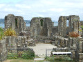
Landévennec is well known for its new Saint-Guénolé Abbey, inaugurated in 1958, which attracts many worshippers, as well as for the ruins of the 10th-century Romanesque abbey church and its museum. The village is located at the confluence of the Aulne and Rivière du Faou rivers and offers a beautiful walk, best enjoyed at high tide.
Kervijen Cove Circuit
 5.75 mi
+328 ft
-325 ft
2h 55
Easy
Departure from Ploéven (Finistère)
5.75 mi
+328 ft
-325 ft
2h 55
Easy
Departure from Ploéven (Finistère)
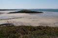
Coastal circuit overlooking the bay of Douarnenez, passing by the Kervijen reed beds.The best time to see the dune flowers is May-June.
State Forest and Maritime Alder in Landévennec
 9.41 mi
+768 ft
-755 ft
5h 00
Moderate
Departure from Landévennec (Finistère)
9.41 mi
+768 ft
-755 ft
5h 00
Moderate
Departure from Landévennec (Finistère)
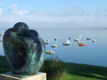
Landévennec, at the end of the peninsula, offers several views of the last meanders of the Aulne before it flows into the sea at Brest harbour.This route, starting from the church and its marine cemetery, first climbs into the national forest and allows you to discover the Sillon des Anglais, a coastal strip of small rocky blocks.The end of the circuit runs along the foreshore where the Aulne meets the Rivière du Faou before reaching the sea.Also worth seeing are the ruins of the old abbey and its museum.
Discover forestry in the Cranou Forest
 10.57 mi
+1,165 ft
-1,161 ft
5h 50
Moderate
Departure from Le Faou (Finistère)
10.57 mi
+1,165 ft
-1,161 ft
5h 50
Moderate
Departure from Le Faou (Finistère)
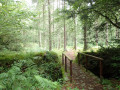
This walk has been organised by three Forestry Management students
We invite you to discover the profession of a forester by following a slide show along a route whose stops will help you understand forest management.
Saint-Nicodème route
 5.11 mi
+243 ft
-217 ft
2h 35
Easy
Departure from Plonévez-Porzay (Finistère)
5.11 mi
+243 ft
-217 ft
2h 35
Easy
Departure from Plonévez-Porzay (Finistère)
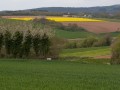
After a walk along the coast, you’ll pass through a marshy area to reach Saint-Nicodème Chapel and its fountain.Return via the countryside overlooking Douarnenez Bay.
Please note:The GR®® is closed between (1) and (2) since March 2021. A study is underway, but there are no signs on site.A possible detour via the hamlet of Le Marroux (mountain bike trail).
Dunes, sea and countryside around Sainte-Anne la Palud
 4.57 mi
+210 ft
-190 ft
2h 15
Easy
Departure from Plonévez-Porzay (Finistère)
4.57 mi
+210 ft
-190 ft
2h 15
Easy
Departure from Plonévez-Porzay (Finistère)
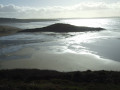
From the Saint-Anne de la Palud sanctuary, the route follows the dune system, the beach and theGR®34coastal path. The route continues along the Kervijen reed beds and returns to the starting point via small country lanes offering views of Douarnenez Bay.
Please note:GR® route closed between (3) and (4) since March 2021. Study underway but no signage on site.
A detour is possible via the hamlet of Le Marroux (mountain bike trail).
Anse de Tréfeuntec route
 6.06 mi
+571 ft
-564 ft
3h 15
Moderate
Departure from Plonévez-Porzay (Finistère)
6.06 mi
+571 ft
-564 ft
3h 15
Moderate
Departure from Plonévez-Porzay (Finistère)
This route can be split into two complementary loops:- the first part follows the coastal path through the "Pointe de Tréfeuntec".- the second crosses the dune belt to reach the chapel "Chapelle Sainte-Anne La Palud".In both cases, beautiful views over the bay "Baie of Douarnenez".
From Tréfeuntec to Trezmalaouen
 5.96 mi
+476 ft
-463 ft
3h 10
Moderate
Departure from Plonévez-Porzay (Finistère)
5.96 mi
+476 ft
-463 ft
3h 10
Moderate
Departure from Plonévez-Porzay (Finistère)
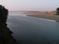
The first part of the route is in the countryside, returning via the coastal path overlooking the bottom of Douarnenez Bay.
Sainte-Marguerite Chapel and Rosmorduc Castle in Logonna-Daoulas
 2.74 mi
+154 ft
-144 ft
1h 25
Easy
Departure from Logonna-Daoulas (Finistère)
2.74 mi
+154 ft
-144 ft
1h 25
Easy
Departure from Logonna-Daoulas (Finistère)
An easy, short walk along the River Camfrout, offering views of the exterior of a pretty castle and the chance to visit a small, beautifully renovated chapel. Discover an Iron Age menhir that was Christianised in the Middle Ages.