Country:

 City:
City:


Download the slideshow, if possible before you head into the forest.
https://drive.google.com/drive/folders/1...
It contains all the necessary information on the route to follow, as well as the forestry points of interest we wanted to share with you.
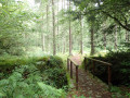
(S/E) From the car park, take the path that leads into the forest on the left, past the picnic tables. You’ll pass through an acidic holly oak-beech woodland (open the slideshow if you haven’t already to find out what this is) and discover the plants found there, the characteristics of which are described in the slideshow – in short, you get the idea.
You’ll then walk amongst some Douglas firs. As you gradually approach the railway line along the path, you’ll reach an area of mixed oak and Scots pine.
(1) Continue down the path until you reach the Scots pines, then turn left and carry on along the path, which becomes a stony track. Follow it to the tarmac road, where you’ll turn right and follow it until you reach the first path on the left, which leads back into the forest.
Along the way, we’ll discuss the link between the forest and agriculture, as we pass through the bocage and the forest edges.
(2) Take this path on the left which leads back into the forest and continue along the path that heads straight up the slope.
We’ll talk about the plantations and protection against wildlife.
Cross the Ruisseau du Faou over a small bridge and enter a stand of Sitka spruce. Walk through it, come out onto the stone forest track and follow it straight ahead to the right until the next bend.
Along the way, we’ll describe the even-aged forest, the compartmentalisation and various challenges of forestry.
Continue along this road, heading uphill to the left, until you reach a junction. Carry on straight ahead, with Sitka spruce on your left and silver fir on your right.
(3) Before reaching the crossroads, you can take a short detour to the right to see the regeneration of the conifers.
Carry on straight ahead until you emerge from the woods, cross the small bridge over the Ruisseau du Faou and arrive at an area resembling heathland. This is, in fact, still the forest but following clear-cutting of the pine trees.
(4) Turn round and head back to the bridge you crossed a short while ago, just before the road emerges from the woods.
Turn off onto the path on the right after the tree marked with a 3. This path is often flooded. You should then walk through the stand of conifers to its left, keeping to the edge.
Here we’ll discuss tree marking and the understorey.
Carry on until you reach two trees marked 4 and 6 on your left, when you’ll have a clear stand of Sitka spruce on your right.
(5) Turn left onto the path between trees 4 and 6 and carry on until you reach the gravel forest track. We’ll be discussing organic trees.
Then follow the road to the right until you reach the Roche Noire Forest House.
Here you can have lunch or wait until later. We can then discuss the purpose of the forest house, hunting, forest management, power lines and low-density plantations.
(6) Continue along the path that extends from the one you arrived on – thesecond on the left – and carry on straight ahead until you reach the wayside shrine.
On this path towards the wayside cross, you’ll come across the entrance to the Cranou Arboretum, marked by a gate and a few large cedars. You can go in and have a stroll before rejoining the route.
(7) Once you reach the wayside cross, take a path that climbs up, passing between the picnic tables on the right. You then need to climb to the top of the path. A short detour from the route leads to the Saint-Conval fountain.
As we climb, we’ll talk about the young oak stands.
(8) Once at the top of the path, take a track heading to the left.
Please note: do not confuse this with the forestry compartment you’ll come to straight away as you emerge from the pine trees marking the top of the path; you need to go a little further on. The path you’re looking for is lined with beech trees on both sides of the slope.
Follow this path until you reach a track on your left leading back through the small oak trees.
Along the way, you’ll learn more about beech and red oak trees.
(9) Turn left and take the narrow path that cuts through the young oak stand and leads you back to the wayside cross. We’ll be discussing the wild cherry.
(10) Once back at the wayside cross, take the first right, which runs alongside it. We’ll talk about oak regeneration and tests on the impact of game.
Then turn onto the first path on the left, a walking trail amongst the oaks. Follow it, heading due south, until you reach a gravel track.
(11) Turn right and go under the railway line.
Carry on to the tarmac road and take it to the right until you reach a car park, where you can enter the ageing plot to find a tree with woodpecker holes.
(12) Exit at the bridge over the River Faou and cross it. Follow a short stretch of road and turn right onto the stony path signposted ‘Sentier des Crêtes’, which follows the left bank of the river. Continue until you reach a path on the left that leads uphill. Along the way, you’ll see wind-felled trees and suckers.
(13) Once you reach this path leading uphill to the left, follow it. You will pass through patches of oak trees, then arrive in a more open area, a stand of Laricio pines.
Follow the path straight on. There will be a short stretch through a mixture of oak and silver fir, followed by the tarmac road.
(14) Cross the Route du Cranou and take the other forest track. Continue straight along this track until you reach the fork at the top of a slope.
Along the way, we’ll discuss watercourse management and timber volume measurement.
(15) Here you can choose to finish the walk by continuing straight on, which will take you back to the car park.
Or, if you wish to continue the walk, take the path on the left and then the gravel track that continues to the left again...
(16) ... until you reach a (very) narrow path on the right under a tree with a drooping knot, as described in the slideshow (on your map, this should be the shortest distance between the path you’re on and the tarmac road to the north).
So take this path and follow it until you come out onto the tarmac road, which you then follow to the junction with the D42A. We’ll finally talk about the oaks!
(17) At the D42A, turn left to return to the Pont Rouge site, cross the bridge over the river again and, at the bend, take the path you’ve already used. Pass under the railway line again.
(11) Carry on straight ahead. We’ll be discussing embankments, water drainage, ivy and the management of forest residues. Look for the tree marked 23 on the right-hand side of the path, which will lead you into the stand; follow a hiking trail that will first take you through a pine forest, then past a young stand of oak trees on your right and older ones on your left. We’ll then discuss formative pruning and thinning.
(18) Turn left at tree 37 and cross the small bridge over the Rivière du Faou, at the foot of an ash tree. After the bridge, continue along the path, passing to the left of tree 36.
You can walk uphill until you leave the plot and reach the tarmac road.
The car park is a little further on, heading down the road to the right. This marks the end of this walk, and we’ll finish with a final word on the mix of red oaks and silver firs lining the road to the left (S/E).

 taking place on part of the route. A sign states that from 23 September 2021 to 26 February 2022, driven hunts are organised on Thursdays and Saturdays, as well as on 10–11, 20–11, 27–11, 20–12, 27–12 2021 and 28 February 2022. It is therefore best to go for a walk outside the hunting season or on Sundays.


 Visorando Member

 Local authority
 Easy
Easy