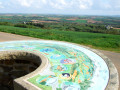
A short circular loop around Rumengol

This short route is, first and foremost, an opportunity to visit Rumengol Church.

Details

n°11538898
Creation:
Last update:
Last review:
  • Walking
    Activity: Walking
  • ↔
    Distance: 2.64 mi
  • ◔
    Average duration: 1h 25 
  • ▲
    Difficulty: Easy

  • ⚐
    Back to start: Yes
  • ↗
    Ascent: + 213 ft
  • ↘
    Descent: - 217 ft

  • ▲
    Highest point: 230 ft
  • ▼
    Lowest point: 59 ft
  • ⚐ Country: France
  • ⚐ City: Le Faou (29590)
  • ⚑
    Start/End: N 48.30212° / W 4.14812°
  • ❏
    IGN map(s): Ref. 0517OT, 0518OT
  • Hour-by-hour weather

Description of the walk

Park in front of the Church of Notre-Dame de Rumengol.

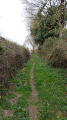
(S/E) Before setting off, take a few moments to visit this church (15th–18th century). On leaving the churchyard, head to the left, walk past the fountain, then take the small grassy path up to the left, facing the Quimerc’h road. Walk past the fire reservoir and through the hamlet of Reun Ar Beuzit. Continue straight ahead along a tree-lined path that descends towards the Faou river, ‘Ster Goz’

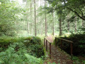
(1) Do not cross the ford. Turn left onto the newly cleared path leading to Toulloudu and its old mill along the old leat.

(2) In the hamlet, turn left to join the D42, which you must cross.

(3) Turn right onto the greenway. Pass the Kergadiou wayside cross, which was restored after it fell during Storm Zeus in March 2017, before reaching the hamlet of Kergadiou.

(4) Turn left onto the sunken lane that runs alongside the Manoir du Bois hill on your right, until you reach a road.

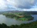
(5) Turn left towards the village of Rulann. Walk through the hamlet and continue on to Rumengol, whilst admiring the sweeping views over the village and the valley. After passing the Diwan school, cross the D42 (Caution: busy road) and turn right onto the Chemin de l’Évêque, which leads to the fenced area of land surrounding the church of Notre-Dame de Rumengol, then to the car park (S/E).

Waypoints

  1. S/E : mi 0 - alt. 154 ft - Église Notre-Dame (Rumengol)
  2. 1 : mi 0.47 - alt. 89 ft - The Ster Goz river, near the - Faou (fleuve)
  3. 2 : mi 0.9 - alt. 79 ft - Toulloudu Mill
  4. 3 : mi 1.14 - alt. 95 ft - D42 road
  5. 4 : mi 1.35 - alt. 82 ft - Kergadiou
  6. 5 : mi 2.13 - alt. 92 ft - Route de Rulann
  7. S/E : mi 2.64 - alt. 154 ft - Église Notre-Dame (Rumengol)

Worth a visit

Reviews and comments

3.7 / 5
Based on 2 reviews

Reliability of the description
4 / 5
Ease of following the route
3 / 5
Route interest
4 / 5
claire et yves
claire et yves

Overall rating : 4.3 / 5

Date of your route : May 07, 2024
Reliability of the description : ★★★★☆ Good
Ease of following the route : ★★★★★ Very good
Route interest : ★★★★☆ Good
Very busy route : No

A nice route. After the river, the path was well-maintained but very, very damp, so there was a lot of mud in various places; of course, it had rained beforehand, so that’s to be expected.

Machine-translated

MineJames
MineJames
• Edited:

Overall rating : 1 / 5

Date of your route : Jun 04, 2023
Reliability of the description : Not used / Not applicable
Ease of following the route : ★☆☆☆☆ Very disappointing
Route interest : Not used / Not applicable
Very busy route : No

The path hadn’t been maintained. Shortly after setting off on the walk, when we reached the point where we had to head downhill to get to the river, we had to turn back. Undergrowth, stinging nettles… blocked our way.
What a let-down!

Machine-translated

Other walks in the area

For more walks, use our search engine .

The GPS track and description are the property of this route's author. Please do not copy them without permission.