From Kerolier to Plomodiern via Ménez Hom

The final stage is the shortest, but it is this one that takes us to the highest point of this tour of Crozon, the Ménez Hom at an altitude of 329 m, from where you can enjoy a sweeping panorama.

This walk is part of a multi-day hike: Le tour (ou presque) de la Presqu'Ile de Crozon

Details

23351328
Creation:
Last update:
Last review:
  • Walking
    Activity: Walking
  • ↔
    Distance: 7.63 mi
  • ◔
    Average duration: 4h 35 
  • ▲
    Difficulty: Moderate

  • ⚐
    Back to start: No
  • ↗
    Ascent: + 1,276 ft
  • ↘
    Descent: - 1,168 ft

  • ▲
    Highest point: 1,079 ft
  • ▼
    Lowest point: 194 ft
  • ⚐ Country: France
  • ⚐ City: Saint-Nic (29550)
  • ⚑
    Start: N 48.206898° / W 4.279158°
  • ⚑
    End: N 48.181313° / W 4.23298°
  • ❏
    IGN map(s): Ref. 0517OT, 0518OT
  • Hour-by-hour weather

Photos

Description of the walk

Start from Kerolier (Kerklaudy guesthouse).

No signposting

(S) With your back to the house, head right along the D63. Immediately turn right onto Route de Cosquer.

Yellow markings

Head uphill and continue straight on along the road (ignore an arrow pointing to the right onto the path you took the previous day). Then ignore two small roads on the right. Pass through the hamlet of Stanquélen and arrive at a T-junction. Turn right here and climb steadily.

Yellow + Red and Yellow markings

(1) Take thefirst road on the left, towards Kergoat-Côme, and follow theGRP®® Tour de la Presqu’île de Crozon. Before a ‘Dead End’ sign, head down to the right onto a stony path. Ignore a grassy path on the right. After a metal gate on the right-hand side, ignore a turn-off on the left. At the T-junction (not shown on IGN maps), turn left and head downhill.

Yellow markings

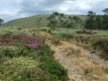
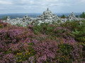
(2) At the junction (houses), keep to the right (let theGRP®® head off to the left). Shortly afterwards, when the road bends left, turn right onto the Chemin de Yun Ven towards Ménez Hom. The tarmac quickly gives way to a grassy path which then becomes stony. Climb at a steady pace; the landscape gradually changes to heathland with heather and gorse.

(3) Cross the D887 with care and follow the path opposite which climbs up into the moorland. At thefirst junction (signpost, elevation 206), take a narrow path on the right through the grass and continue climbing.

Red and yellow markings

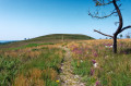
(4) At the next junction (signpost), go straight on and rejoin the GRP®®. Soon, the slope becomes steeper, with wooden steps to aid the ascent. At the top of this steep section, continue straight ahead on a stony path (follow the markings) and ignore all side paths. Climb gently in this way to the summit (a platform that may once have been an orientation table).

(5) Continue straight on, following the markings and keeping to the ropes. Pass a triangulation point and continue in the same direction along theGRP®®. Descend along a good stony path. At a fork in the road, keep left and follow a few hairpin bends through the heathland.

(6) At the next junction (signpost), take a path on the right and continue downhill. The moorland gradually becomes dotted with small pine trees in pine woods.

(7) At a T-junction, follow a stony path to the right. Descend gently to a copse. Pass a chain, come out onto a road and follow it to the right.

(8) At the “give way” sign, first turn right then left to cross (carefully) a road and join a path that leads into a wood. Climb gently. When you reach a lodge on the left, continue along a small road.

(9) Just before a main road (the D887), at a junction, go straight on along a path running parallel to the road (signposted VTT5). At the Fork in the road that appears after a few dozen metres, turn right.

(10) Cross the D887 with care and head down the small road opposite. At the ‘give way’ sign, first turn right then left to follow a small, shaded road downhill.

No signposting

(11) Further on, at a junction, turn left and leave theGRP®®. Pass through the hamlet of Gorre Ribl, ignore a dead-end on the left and head slightly downhill. Pass through a residential area and climb slightly. At the Stop sign, go straight on and you will immediately reach another junction.

(12) Turn left here and you will soon reach the church at Plomodiern (E).

Waypoints

  1. S : mi 0 - alt. 194 ft - Kerolier - Kerklaudy Guesthouse
  2. 1 : mi 1.15 - alt. 561 ft - Crossroads - GRP junction
  3. 2 : mi 2.14 - alt. 377 ft - Coathérel
  4. 3 : mi 2.86 - alt. 597 ft - Crossing the D887
  5. 4 : mi 3.27 - alt. 830 ft - Crossroads
  6. 5 : mi 3.56 - alt. 1,076 ft - Ménez Hom
  7. 6 : mi 4.07 - alt. 883 ft - Junction
  8. 7 : mi 4.54 - alt. 679 ft - T-junction
  9. 8 : mi 5.45 - alt. 509 ft - Cross the D47
  10. 9 : mi 5.85 - alt. 636 ft - Crossroads before the D887
  11. 10 : mi 5.9 - alt. 630 ft - Crossing the D887
  12. 11 : mi 6.76 - alt. 335 ft - Crossroads
  13. 12 : mi 7.57 - alt. 299 ft - Rue de Ster an Allé x Rue de la Place
  14. E : mi 7.63 - alt. 305 ft - Église Saint-Mahouarn (Plomodiern)

Notes

Equipment:
Hiking boots are essential. Rain gear: rain poncho, rucksack cover, etc. Protection against the cold or sun, depending on the season and your sensitivity. Walkers using walking poles are asked to use poles with rubber tips so as not to damage the paths in the moorland.

Route and guidance:
- Please respect the ropes marking the edges of the paths at the summit of Ménez Hom, to protect this sensitive natural environment.
- A detailed map is required (at the very least the one accompanying this description) or a route map on a smartphone.

Facilities along the route:
No water points identified along the route.
In Plomodiern: bars, restaurants and a bakery near the church (E); a chemist’s at the junction of Rue de la Place and the D63, slightly south-west of (12).

Accommodation on arrival (E):
A few hotels in the village of Plomodiern or the surrounding area, which can be found in the Yellow Pages or using your favourite search engine.

To get back home:
- BreizhGo bus, line 37 towards Camaret (connection to Brest) or Quimper station. The bus stops are located along the D63; the one for Camaret is on the right-hand side of Rue de la Place when coming from (12), and the one for Quimper is on the other side of the D63, opposite the pharmacy. The bus timetable (check the BreizhGo website) allows you to plan a return journey directly at the end of the stage if you wish.
- Taxi.

Hike completed by the author on 22 August 2022.

Worth a visit

- Beautiful moorland scenery between (2) and (7).
- Sweeping views from the summit of Ménez Hom, particularly over Douarnenez Bay, Pointe du Raz and Cap de la Chèvre.
- Plomodiern Church (16th–17th–19th centuries) (E).
- Past the church and along Rue du Ménez Hom, Plomodiern cemetery, where the grave of Guillaume Seznec (1878–1954) is located.

Reviews and comments

3.3 / 5
Based on 1 review

Reliability of the description
4 / 5
Ease of following the route
3 / 5
Route interest
3 / 5
User 22543625

Overall rating : 3.3 / 5

Date of your route : Sep 07, 2025
Reliability of the description : ★★★★☆ Good
Ease of following the route : ★★★☆☆ Average
Route interest : ★★★☆☆ Average
Very busy route : No

Hello,
two comments about this hike.
The first is to make it more interesting: after point 8, direct hikers to Ste Marie du Ménez Hom, which is a tourist site not to be missed.
The second comment is to inform hikers: if, like me, you are camping, please note that there is no campsite in the village of Plomodiern. If you search for campsites in Plomodiern, you will find some, but they are all on the coast, 5 km from the village and therefore from the 937 bus stop. This makes them incompatible with a morning departure from Plomodiern.
And finally, PLEASE NOTE that the BreizhGo bus numbers have changed:
934 instead of 34 for Brest to Camaret and return
937 instead of 37 for Camaret to Quimper and return
Best regards

Machine-translated

Other walks in the area

For more walks, use our search engine .

The GPS track and description are the property of this route's author. Please do not copy them without permission.