Route of the old paths in Lopérec

The municipality of Lopérec is set amidst a varied, undulating landscape of hedgerows, featuring woods, moorland and farmland criss-crossed by numerous watercourses.
In 1830, a traveller described Lopérec as follows: “Everywhere, water, foliage, majestic trees, numerous villages, surrounded by lush orchards where apple and cherry trees display their dazzling blossoms in shades of purple and white...”°°

Details

30186371
Creation:
Last update:
Last review:
  • Walking
    Activity: Walking
  • ↔
    Distance: 7.26 mi
  • ◔
    Average duration: 4h 05 
  • ▲
    Difficulty: Moderate

  • ⚐
    Back to start: Yes
  • ↗
    Ascent: + 896 ft
  • ↘
    Descent: - 869 ft

  • ▲
    Highest point: 899 ft
  • ▼
    Lowest point: 174 ft
  • ⚐ Country: France
  • ⚐ City: Lopérec (29590)
  • ⚑
    Start/End: N 48.277399° / W 4.048526°
  • ❏
    IGN map(s): Ref. 0517OT, 0518OT
  • Hour-by-hour weather

Photos

Description of the walk

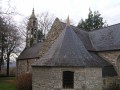
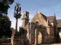
On leaving the village, park near Saint-Pérec Church.

(S/E) Head towards Brasparts via the D121, passing the grocery shop and then the cemetery. Shortly afterwards, turn left in front of the last houses in the village. The path leads onto a quiet, tree-lined country road.

(1) Turn left and follow the road to Draounen.

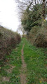
(2) Turn left towards Coat Santélan. A sunken lane, much like those that once criss-crossed the countryside, gives the impression of stepping back in time. You’ll come to a crossroads.

(3) Turn left and continue to the junction with the D21. Turn left onto this road and carry on to the Kervez crossroads.

(4) Take the road on the right. Shortly after the old school, turn left and head down towards the Bois du Dalguern. Follow a sunken track, once used by schoolchildren and by all those who attended the fairs at Brasparts, Sizun and Hanvec.

(5) At the first junction, keep left and at the second, turn right to head back up towards Spernéger.

(6) At the end of the track, turn left onto the tarmac road to cross the Spernéger farm and continue on to Breuil Braz.

(7) At the crossroads in Breuil Braz, follow the signposts and turn left onto a track leading up towards the Crével hills. This woodland track was once an important route.

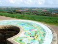
(8) Once at the top, head up to the right. Pass by the site of a vanished village called Rome. The site overlooks the Cranou State Forest, whose oak trees were used to build the King’s ships at the port of Brest. From the ridge of the path, there is a sweeping panorama to the south of the department: the Aulne valley, the expanse of the Monts d’Arrée and the Montagnes Noires, with their iconic peaks – Montagne Saint-Michel on one side and Ménez Hom on the other.
(Off the route: before the D21, 700 m to the right, the ruined church of the Old Village of Quimerc’h, abandoned in the late 19th century; on the D21, 250 m to the left, a viewpoint).

(9) Cross the D21 and take the Route de Kerguelfen opposite. About 150 metres after the water tower, turn left onto a sunken lane leading to Guern Ar Born. After the village, continue straight on to reach Kroaz Kervinic.

(10) Cross at the junction and take the village road opposite to return to the village of Lopérec, passing near the Saint-Pérec Fountain (S/E).


Waypoints

  1. S/E : mi 0 - alt. 180 ft - Church Square in Lopérec
  2. 1 : mi 0.39 - alt. 174 ft - Crossroads towards Draounen
  3. 2 : mi 1.52 - alt. 302 ft - Turn-off towards Coat Santélan
  4. 3 : mi 1.95 - alt. 469 ft - T-junction
  5. 4 : mi 2.31 - alt. 400 ft - Kervez Crossroads
  6. 5 : mi 2.62 - alt. 384 ft - Junction on a sunken lane
  7. 6 : mi 3.17 - alt. 597 ft - Road junction
  8. 7 : mi 4.13 - alt. 633 ft - Breuil-Braz crossroads
  9. 8 : mi 4.69 - alt. 738 ft - T-junction
  10. 9 : mi 5.72 - alt. 614 ft - Crossroads on the D21
  11. 10 : mi 6.75 - alt. 338 ft - Kroaz Hent Kervinic
  12. S/E : mi 7.26 - alt. 180 ft - Church Square in Lopérec

Notes

County roads: take care when crossing and walking along them.
Lopérec has been awarded the ‘Communes du Patrimoine Rural de Bretagne’ (Brittany Rural Heritage Towns) label.

Park an Dour i lin (field of water for flax)
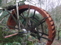
You’ll be walking alongside a site with a history closely linked to water.
There is also a wash house and a fountain here. In the past, flax and hemp from the local area or Haut-Léon were retted here. This involved keeping the flax and hemp stalks – stripped of their leaves and seeds – just below the surface of the water, in order to dissolve the pectin that binds the fibres to the wood.

The village of Lopérec
Many of the village’s buildings were once occupied by traders and craftsmen catering to the needs of the local population: bakers, tobacconists, grocers, haberdashers, saddlers, wheelwrights, clockmakers…
As part of the regeneration of the present-day village, many of these old buildings have been renovated by the local council and are now used as shops, homes, and community and voluntary organisation halls.

Worth a visit

Reviews and comments

4.5 / 5
Based on 2 reviews

Reliability of the description
5 / 5
Ease of following the route
4 / 5
Route interest
4.5 / 5
philthiet
philthiet

Overall rating : 4.7 / 5

Date of your route : Oct 07, 2024
Reliability of the description : ★★★★★ Very good
Ease of following the route : ★★★★☆ Good
Route interest : ★★★★★ Very good
Very busy route : No

A lovely walk from the Finistère walking guide; signposting is sometimes missing
Lovely views of the lush green Odet

Machine-translated

ALEFOURN
ALEFOURN

Overall rating : 4.3 / 5

Date of your route : Jul 30, 2023
Reliability of the description : ★★★★★ Very good
Ease of following the route : ★★★★☆ Good
Route interest : ★★★★☆ Good
Very busy route : No

Some really lovely views; one slight downside is that at one point the path turns into a stream – it’s best to wear sturdy footwear as it’s slippery (hike taken at the end of July).

Machine-translated

Other walks in the area

For more walks, use our search engine .

The GPS track and description are the property of this route's author. Please do not copy them without permission.