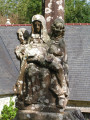
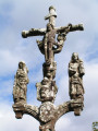
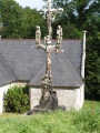
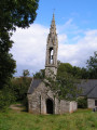
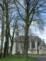
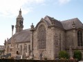
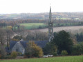
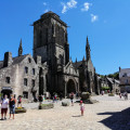
Sainte-Barbe Chapel and the Ploéven countryside

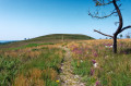
Starting at the 16th-century Sainte-Barbe Chapel, built on a site said to have been founded by monks from across the Channel, the route continues through the Porzay countryside, a mosaic of colours depending on the crops and the season.
Along the way, discover the ‘Quenouille de Sainte-Barbe’, an Iron Age stele, no doubt used for Celtic cultural ceremonies.
It is also thought to have served as a pillory for tying up those condemned to death who were hanged there.

Details

2855569
Creation:
Last update:
Last review:
  • Walking
    Activity: Walking
  • ↔
    Distance: 6.62 mi
  • ◔
    Average duration: 3h 25 
  • ▲
    Difficulty: Moderate

  • ⚐
    Back to start: Yes
  • ↗
    Ascent: + 456 ft
  • ↘
    Descent: - 443 ft

  • ▲
    Highest point: 315 ft
  • ▼
    Lowest point: 79 ft
  • ⚐ Country: France
  • ⚐ City: Ploéven (29550)
  • ⚑
    Start/End: N 48.15387° / W 4.182654°
  • ❏
    IGN map(s): Ref. 0518OT
  • Hour-by-hour weather

Photos

Description of the walk

At the junction with the D63 in Ploéven, follow the sign for Cast. The chapel is signposted on the right.

YellowPR®® markings.

(S/E) From the chapel, head towards the road to Cast, turn right and walk uphill to the stele known as the ‘Fuseau de Sainte-Barbe’, dating from the Iron Age (450 BC).

(1) Ignore the road on the left and turn left onto a tree-lined path which follows the route of an ancient Roman road. Pass the hamlet of Gorré an Dreff and head down to the Kerharo stream.

(2) Continue following the stream on your right, between fields and meadows. After about 600 m, turn left at a right angle onto a farm track and, at the top (elevation 65), turn right to join a small road at the Coatmeur farm.

No signposts.

(3) At the farm buildings, turn right and follow the small road downhill. Cross the bridge over the Kerharo Stream (boundary between the municipalities of Ploéven and Plomodiern) and pass Moulin Launay on your right, a former mill converted into a lodge.

(4) At the crossroad, turn left and continue between the fields to the junction after Sant Jili Uhellan, a large farm.

(5) Turn left to head back down towards the Kerharo Stream and return to the village of Ploéven. Carry on, passing close to the houses at Kergoulouarn Izella (lower) and then Huella (upper), until you reach a crossroad.

(6) Turn left and follow this small road, which passes under a power line. Ignore the small roads on the left leading to farms and arrive at the crossroads at the hamlet of Ty Bleïz (the ‘wolf’s house’).

YellowPR®® signposting.

(7) Follow thePR®® markings to the right and head straight up to the crossroads at the Croix de Kerhant (1874).

(8) Cross the Route de Cast and continue towards Kerrien (equestrian centre), walking alongside the farm buildings of the Kerhant farm. Turn left towards Barvédel and continue along a wide track between the fields. You’ll reach the road leading to Pen ar Hoat.

(9) Cross the road and continue along the path between the farm plots to the 16th-century Sainte-Barbe Chapel and its 17th-century calvary (S/E).

Waypoints

  1. S/E : mi 0 - alt. 213 ft - Sainte-Barbe Chapel in Ploéven
  2. 1 : mi 0.35 - alt. 276 ft - Memorial stone
  3. 2 : mi 1.12 - alt. 135 ft - Kerharo Stream
  4. 3 : mi 2.19 - alt. 141 ft - Coatmeur Farm
  5. 4 : mi 2.64 - alt. 141 ft - Turn left onto the road
  6. 5 : mi 3.31 - alt. 144 ft - Junction after Sant Jili Uhellan
  7. 6 : mi 4.21 - alt. 210 ft - Turn left at the fork
  8. 7 : mi 4.98 - alt. 138 ft - Crossroads at the hamlet of Ty Bleïz
  9. 8 : mi 5.64 - alt. 253 ft - Kerhant Crossroads
  10. 9 : mi 6.33 - alt. 282 ft - Road towards Pen ar Hoat
  11. S/E : mi 6.62 - alt. 210 ft - Sainte-Barbe Chapel in Ploéven

Notes

Please note: there is limited parking near the chapel
Inspired bythe PR®® route known as the “Circuit de Sainte-Barbe”.
This route alternates between quiet country lanes and footpaths.

Route of heritage interpretation (brochure available from the town hall).

Worth a visit

Always be cautious and plan ahead when you're outdoors. Visorando and the author of this route cannot be held responsible for any accidents occurring on this route.

The GR® and PR® markings are the intellectual property of the Fédération Française de Randonnée Pédestre.

Reviews and comments

3 / 5
Based on 2 reviews

Reliability of the description
3 / 5
Ease of following the route
4 / 5
Route interest
2 / 5
FLOCH
FLOCH ★

I’m sorry you were disappointed.
I’m not sure what you mean by ‘proper hikers’.
Hiking routes can vary greatly: not everyone who goes hiking is looking for the same thing.
“Long and boring 👹” seems out of place in a hiking review to me. You might not like a route, but you should still respect the person who suggested it.

Machine-translated

Vee
Vee

Overall rating : 3 / 5

Date of your route : Aug 20, 2022
Reliability of the description : ★★★★☆ Good
Ease of following the route : ★★★★☆ Good
Route interest : ★☆☆☆☆ Very disappointing
Very busy route : No

A word of warning to serious hikers: give this one a miss!! The walk is mainly along the road… Long and boring 👹

Machine-translated

FLOCH
FLOCH ★

Thank you for your reply
In point 1, I specified that you should keep to the left of the road to take the path.
I’ve added the following to the practical information: “Please note: there’s little space to park near the chapel”.
Kind regards

Machine-translated

moineau29
moineau29

Hello,
Yes, the map and the description seemed fine to me, but I still managed to get lost – though it doesn’t matter! I had a lovely breath of fresh air. At the memorial stone, I took the road on the left as indicated. I think I went the wrong way because, looking at your map again at the memorial, there are two paths: the first one, which is the right one, and the second one, which I took. As a result, Gorré an Dreff was on the right rather than on the left, and that’s when I lost my bearings! Perhaps a bit more detail could be added here? But it might also just be a lapse in concentration on my part.
However, I can’t see any sign mentioning the lack of parking near the chapel.
Have a lovely day
Kind regards,

Machine-translated

FLOCH
FLOCH ★

Thank you for this review
I’ve added that there’s not much space to park near the chapel, but I can’t see any other options.
As for the description, I can’t see what further details could be added.
You did, however, rate the route on the map as ‘good’.
With the map and the description, I think it’s hard to get lost.
If you have any specific details to improve the description, I’d be happy to hear them and can include them.

Kind regards.

Machine-translated

moineau29
moineau29

Overall rating : 3 / 5

Date of your route : May 31, 2021
Reliability of the description : ★★☆☆☆ Disappointing
Ease of following the route : ★★★★☆ Good
Route interest : ★★★☆☆ Average
Very busy route : No

I was really looking forward to this walk, but I got lost almost straight away (at the memorial stone). The directions aren’t clear enough, or are incomplete, or don’t match the route properly.
It turned out to be a walk through the countryside without seeing anything of interest...
Starting point at the chapel: yes, but there’s nowhere to park! It would be a good idea to suggest parking elsewhere, or to start the walk from a different location.

Machine-translated

Other walks in the area

For more walks, use our search engine .

The GPS track and description are the property of this route's author. Please do not copy them without permission.