


Refine your search for walks in Darnius
Darnius walks


 Circular lake tour and Mirador de la Tortuga from Darius
 Visorando Member
 6.63 mi
 +850 ft
 -814 ft
 3h 45
3h 45
 Moderate
 Departure from Darnius (Girona)
A fairly easy walk with varied scenery. There are no signposts on the paths, but the routes are fairly straightforward, so there’s little chance of getting lost. The walk starts in Darnius, with the first section through woodland, a stop at an11th-century chapel (unfortunately closed to the public), a walk along the lake, then back towards Darnius, with the option of climbing up to the Mirador de la Tortuga (a 15-minute ‘detour’) which offers a stunning panoramic view of the lake and the surrounding mountains.
Agullana and the bunker
 Association / Club / Walk leader3.50 mi
+453 ft
-453 ft
2h 00
Association / Club / Walk leader3.50 mi
+453 ft
-453 ft
2h 00
 Easy
Departure from Agullana (Girona)
Easy
Departure from Agullana (Girona)
This walk takes about an hour and a half to two hours including time to explore the bunker. The whole walk is very easy.
A unique and spectacular megalithic trail starting from Cantallops
 10.74 mi
+512 ft
-512 ft
5h 25
Moderate
Departure from la Jonquera (Girona)
10.74 mi
+512 ft
-512 ft
5h 25
Moderate
Departure from la Jonquera (Girona)
A magnificent and unique route. Countless dolmens and menhirs. A stunning landscape of granite boulders, reminiscent of the Sidobre site in the Tarn, though with very different vegetation.
All this with the option of a break in the village of Capmany.
No particular difficulty apart from the length: the paths are flat and often wide, yet charming nonetheless. You need to pay attention to the route to avoid missing any megaliths. (Some of the blue markings are misleading).
The Jonquère area isn’t just home to hideous supermarkets: it boasts beautiful natural scenery.
I’ve tried to mark all the dolmens on the map, but there are so many that I’m bound to have missed some: please do help with the survey – thank you.
Las Illas in Amélie-les-Bains
10.60 mi
+3,015 ft
-4,170 ft
7h 30
 Difficult
Departure from Maureillas-las-Illas (Pyrénées-Orientales)
Difficult
Departure from Maureillas-las-Illas (Pyrénées-Orientales)
Third day of this crossing of the Albères.This is the greenest part of the route as it is mainly through forest.You will pass by the highest point of Roc de France (Roca de Frausa) with a magnificent panorama over a large part of the Eastern Pyrenees and Canigou (Canigó).
Salt del Fito
2.44 mi
+764 ft
-755 ft
1h 35
Moderate
Departure from la Jonquera (Girona)
In Le Perthus, we go to buy alcohol, but that's not all...
Discover this beautiful circular route that passes by the stunning Fito Waterfall (Salt del Fito) and offers beautiful panoramic views of Bellegarde Fort and Canigou.
Best done after it has rained so you can enjoy the waterfall and river.
Salt de Fito Waterfall in Le Perthus
 5.26 mi
+1,490 ft
-1,509 ft
3h 45
Difficult
Departure from la Jonquera (Girona)
5.26 mi
+1,490 ft
-1,509 ft
3h 45
Difficult
Departure from la Jonquera (Girona)
In Au Perthus, we’ll be buying some alcohol, but that’s not all… Discover this lovely circular route that takes you past the stunning Fito Waterfall (Salt de Fito) and offers beautiful views of the Spanish Empordà and Mont Canigou. Best done after it’s rained so you can enjoy the waterfall and the river. The route can be shortened; you can simply head to the waterfall: there’s a tricky section – a short but very steep climb.
The Fort de Bellegarde and the Panissars site from Le Perthus
8.64 mi
+1,549 ft
-1,552 ft
5h 20
Moderate
Departure from Le Perthus (Pyrénées-Orientales)
An easy hike from Le Perthus offering views of the Spanish valley towards La Jonquera. Part of the route follows the border and takes you past military buildings from yesteryear (fort and redoubt) as well as the Roman site of Panissars, including the remains of the Via Domitia.
Circular walk to Fort de Bellegarde from Le Perthus
4.18 mi
+627 ft
-604 ft
2h 30
Easy
Departure from Le Perthus (Pyrénées-Orientales)
A walk along the GR®10 through Le Perthus, passing the Fontaine de Pedres Blanques, then a short climb towards the Col dels Miquelets, descending via the Roman ruins of Panissars and skirting the Fort de Bellegarde. Le Perthus is a town, part of which lies in Spain (El Portús).
Puig Neulós from Sant Martí de l'Albère
 8.39 mi
+2,339 ft
-2,333 ft
5h 55
Moderate
Departure from L'Albère (Pyrénées-Orientales)
8.39 mi
+2,339 ft
-2,333 ft
5h 55
Moderate
Departure from L'Albère (Pyrénées-Orientales)
The ascent to Puig Neulós follows the ridge line from St-Martin de l’Albère (Sant Martí).The route then passes by the Tanyareda refuge, L’Espagne and the Coll de l’Ullat.Old paths, some marked and some unmarked, and the GR®10 are all part of this beautiful hike.This hike can be a complementary variation on my hike: La Tanyareda
La Tanyareda - Puig Neulós - Pou de Neu - Coll de l'Ullat
 6.95 mi
+2,152 ft
-2,159 ft
5h 05
Moderate
Departure from L'Albère (Pyrénées-Orientales)
6.95 mi
+2,152 ft
-2,159 ft
5h 05
Moderate
Departure from L'Albère (Pyrénées-Orientales)
This is an 8-shaped hike, which allows you to adapt it to suit your preferences.
This hike uses both theGR®10and lesser-known paths.
The France-Spain border ridge offers beautiful landscapes on both sides.
Passage at Puig Neulós, Pou de Neu (Spain), Chalet de l'Albères (Coll de l'Ullat).
Roc de Frausa - Col del Pou de la Neu - Pic de Les Salines from Pla Bulat
 11.23 mi
+4,117 ft
-4,117 ft
7 hrs
11.23 mi
+4,117 ft
-4,117 ft
7 hrs
 Very difficult
Departure from Céret (Pyrénées-Orientales)
Very difficult
Departure from Céret (Pyrénées-Orientales)
A challenging but safe hike along the France-Spain border ridge.
The ridge passages should be avoided in strong winds.
Short detour into Spain to visit the church and refuge at Les Salines.
Classified as very difficult due to its length and elevation gain.
This hike can be adapted to suit your ability and the weather (see Practical Information).
Modification of the description. See practical information 28 April 2021 *
The descent from (5) to Coll de Cirerers (5) is prohibited.
Albanya Gorges to Bertran Bridge and Castel del Serrat
5.45 mi
+584 ft
-558 ft
3h 00
Moderate
Departure from Albanyà (Girona)
A magnificent hike in the Catalan hinterland, an hour from Rosas. The path is poorly marked, but it's a fairly easy and very enjoyable hike. The gorges and river are superb. Enjoy!
Puig Sant Cristau via the Col de Llinas
 3.50 mi
+1,634 ft
-1,617 ft
3h 00
Moderate
Departure from L'Albère (Pyrénées-Orientales)
3.50 mi
+1,634 ft
-1,617 ft
3h 00
Moderate
Departure from L'Albère (Pyrénées-Orientales)
This route will take you via the Col de Llinas to Puig Sant Cristau and its chapel, offering magnificent 360° panoramic views.
Puig d'Orella and Sant Cristau from Saint-Jean de l'Albère
 5.96 mi
+2,156 ft
-2,149 ft
4h 35
Moderate
Departure from L'Albère (Pyrénées-Orientales)
5.96 mi
+2,156 ft
-2,149 ft
4h 35
Moderate
Departure from L'Albère (Pyrénées-Orientales)
Circular hike with several passes and a ridge trail.
From the Chapel of Sant Cristau and Puig d'Orella, two very beautiful 360° landscapes.
See practical information.
GPX track required.
From Coll de l'Ullat to Puig Neulós via the GR®10.
 4.14 mi
+1,043 ft
-1,043 ft
2h 50
Moderate
Departure from L'Albère (Pyrénées-Orientales)
4.14 mi
+1,043 ft
-1,043 ft
2h 50
Moderate
Departure from L'Albère (Pyrénées-Orientales)
Circular route starting from the Col de l'Ullat, which leads along the ridge to the Pic du Néoulous with remarkable panoramic views on both sides of the Côte Vermeille, on the French side and on Spanish territory, not to mention the eastern Pyrenees. Return via an easy route. Definitely worth doing in good weather, but the wind can be strong on the ridge up to the summit.
Pilon de Belmaig from Pujol del Mig
 9.54 mi
+2,720 ft
-2,707 ft
6h 45
Moderate
Departure from Amélie-les-Bains-Palalda (Pyrénées-Orientales)
9.54 mi
+2,720 ft
-2,707 ft
6h 45
Moderate
Departure from Amélie-les-Bains-Palalda (Pyrénées-Orientales)
An easier way to climb this pleasant summit in Vallespir is from Arles-sur-Tech.
(!) Access to the start of the hike is impossible by car: the road has been closed since 9 November 2024. Situation unchanged on 9 November 2025.
Puig de Garces, Pla Bulat and the orientation table in Céret
 5.47 mi
+1,709 ft
-1,690 ft
4h 00
Difficult
Departure from Céret (Pyrénées-Orientales)
5.47 mi
+1,709 ft
-1,690 ft
4h 00
Difficult
Departure from Céret (Pyrénées-Orientales)
A short hike up to Puig de Garces (674 m), a hill overlooking Céret. A circular route passing through Pla de Bulat, then descending via a path leading past the orientation table. Return via the Route du Balcon de Céret.
Roc de Sant Salvador from Montalbà d'Amélie
 7.06 mi
+2,605 ft
-2,598 ft
5h 30
Very difficult
Departure from Amélie-les-Bains-Palalda (Pyrénées-Orientales)
7.06 mi
+2,605 ft
-2,598 ft
5h 30
Very difficult
Departure from Amélie-les-Bains-Palalda (Pyrénées-Orientales)
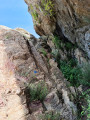
A very beautiful circular with a variety of trails. An exceptional view from the rock over Roussillon, the Canigou massif and Spain. The hike is particularly technical with many difficult passages. You must pay close attention to the trail. Access to the peak itself is reserved for experienced hikers: there is a 5-metre descent that is extremely difficult to navigate without a rope. With these warnings in mind, this is one of the most beautiful hikes in Vallespir.Visorando app recommended.
Roc Sant Salvador - France-Spain border from Montalbà d'Amélie
 8.56 mi
+3,560 ft
-3,560 ft
7h 00
Difficult
Departure from Amélie-les-Bains-Palalda (Pyrénées-Orientales)
8.56 mi
+3,560 ft
-3,560 ft
7h 00
Difficult
Departure from Amélie-les-Bains-Palalda (Pyrénées-Orientales)
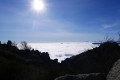
This is a very difficult hike due to the steep incline on certain sections.Passage through Collada Sant Marti, Roc de la Sentinella, and Coll de la Dona Morta.A good sense of direction and the GPX track are essential. But your efforts will be rewarded by the magnificent scenery.NOTE: the final ascent of Roc Salvador is reserved for experienced hikers who are not prone to vertigo.Shortcut possible from Coll Cerdà ⁴. The climb to Roc can be avoided ².
The Chapel of Saint-Philippe and La Font Sant Martí in Le Boulou
 2.76 mi
+381 ft
-390 ft
1h 35
Easy
Departure from Le Boulou (Pyrénées-Orientales)
2.76 mi
+381 ft
-390 ft
1h 35
Easy
Departure from Le Boulou (Pyrénées-Orientales)
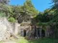
Short hike with a slight incline on the first part of the route.
From the Pont du Diable in Céret to the Château d'Aubiry
 4.49 mi
+823 ft
-840 ft
2h 45
Easy
Departure from Céret (Pyrénées-Orientales)
4.49 mi
+823 ft
-840 ft
2h 45
Easy
Departure from Céret (Pyrénées-Orientales)
A short, easy family walk that takes you from the beautiful Pont du Diable bridge in Céret to the Château d'Aubiry and its grounds. The imposing Canigou massif dominates the Têt valley in the distance. The château was built by Jean Bardou (founder of the JOB brand) for one of his children.
The Chemin de Vivès and the Sentier du Liège from Saint-Jean-Pla-de-Corts
 9.25 mi
+1,181 ft
-1,178 ft
5h 15
Moderate
Departure from Saint-Jean-Pla-de-Corts (Pyrénées-Orientales)
9.25 mi
+1,181 ft
-1,178 ft
5h 15
Moderate
Departure from Saint-Jean-Pla-de-Corts (Pyrénées-Orientales)
From Saint-Jean-Pla-de-Corts, these two marked trails lead up to Vivès and then Llauro*.E beautiful hike on wide, comfortable paths and tracks, which can be split into two.The markings are visible in the direction described.The return from Llauro is along a ridge path and then from the (12) along a DFCI track.Not recommended for those who do not like tracks and wide paths.Fortunately, the landscape makes up for this monotony.
The starting point is accessible by "€1 bus" from Perpignan or Argelès via Le Boulou, for example.
Circular route from Saint-Jean-Pla-de-Corts to Sant Ferriol
7.79 mi
+951 ft
-945 ft
4h 25
Moderate
Departure from Saint-Jean-Pla-de-Corts (Pyrénées-Orientales)
A pleasant hike starting from Saint-Jean-Pla-de-Corts, especially during the mimosa season, to reach the Hermitage of Sant Ferriol via the Serra del Mas d'en Janet ridge. On the way back, visit the exterior of Aubiry Castle. Several viewpoints over Céret and the Canigou massif.
Tracks, paths and dirt trails, with a tarmac road on the return journey. No difficulties along the route.
Mimosa circular in Céret
 7.14 mi
+1,079 ft
-1,079 ft
4h 15
Moderate
Departure from Reynès (Pyrénées-Orientales)
7.14 mi
+1,079 ft
-1,079 ft
4h 15
Moderate
Departure from Reynès (Pyrénées-Orientales)
This is a pleasant route in the foothills of Vallespir, above Reynes, where you can enjoy the scent and colour of the mimosas in mid-February and the cork oak forests (suberaies). There are several viewpoints offering views of the Sant-Ferriol Chapel, the town of Céret, the Tech Valley and the Canigou Massif.
Saint-Paul circular
2.60 mi
+492 ft
-489 ft
1h 40
Easy
Departure from Reynès (Pyrénées-Orientales)
A short walk around the Chapel and the Mas de Sant-Pau. Beautiful panoramic views of Reynes and Céret.
First part along the tarmac road (very little traffic) then along the paths.
Circular around the ponds of Saint-Jean-Pla-de-Corts
3.90 mi
+62 ft
-62 ft
1h 50
Easy
Departure from Le Boulou (Pyrénées-Orientales)
A pleasant walk for the whole family around the ponds. Water activities available in summer, tree-top adventure course, meeting place for anglers.
Sant Joan d'Albera and Coll de Sant Joan from Montesquieu-des-Albères
 8.74 mi
+3,474 ft
-3,461 ft
7h 05
Difficult
Departure from Montesquieu-des-Albères (Pyrénées-Orientales)
8.74 mi
+3,474 ft
-3,461 ft
7h 05
Difficult
Departure from Montesquieu-des-Albères (Pyrénées-Orientales)
A fairly long circular walk in the Albères.
A good sense of direction is essential, as the route, which is marked with cairns in places, is signposted in different colours.
New signposts have been installed. Unfortunately, the signs have been removed in some places.
Accessible by public transport, bus for €1, see practical information.
The six fountains and the Coll de l'Espinassa from Montesquieu-des-Albères
 6.84 mi
+1,827 ft
-1,841 ft
4h 45
Moderate
Departure from Montesquieu-des-Albères (Pyrénées-Orientales)
6.84 mi
+1,827 ft
-1,841 ft
4h 45
Moderate
Departure from Montesquieu-des-Albères (Pyrénées-Orientales)
A beautiful, steady climb to Coll de l'Espinassa (Espinàs). It is entirely possible to follow the track to the large picnic area in order to maintain a constant gradient.There are no fewer than six working fountains on the way to the pass (10). Then there is a very steep descent to the picnic area passed on the way there (6). And a pleasant return to the village.During the hike, sheltered from the tramontane wind, there are views of the Roussillon plain, Les Aspres and Canigou.
The GPX track is necessary on this route given the paths taken, which are not necessarily maintained.It is possible to do this hike in the opposite direction, starting from the Trois Vents fountain (6), so that the return trip along the track is less steep. The aim of the hike is to reach the Coll de l'Espinàs (10), and the return journey can simply be made by the same route.
Sant Cristau from Montesquieu via Espinassa and the Mary Fort Gardens
 7.14 mi
+2,808 ft
-2,789 ft
5h 45
Difficult
Departure from Montesquieu-des-Albères (Pyrénées-Orientales)
7.14 mi
+2,808 ft
-2,789 ft
5h 45
Difficult
Departure from Montesquieu-des-Albères (Pyrénées-Orientales)
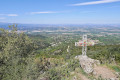
A beautiful paved path and another very steep path lead up to the track leading to Coll and the Espinassa fountain. From Coll de Llinàs, there is a beautiful climb to Sant Cristau.
The return route passes by the Font de Sant Cristau, a beautiful forest and a cross. To give your knees a rest, the rest of the descent is via a track and a path passing through the abandoned gardens of Mary Fort.
During the hike, there are views of the Roussillon plain, Canigou, etc.
Former talc mine from Pont de Reynès
6.92 mi
+1,775 ft
-1,788 ft
4h 45
Moderate
Departure from Reynès (Pyrénées-Orientales)
An easy hike through the woods on good paths, mostly signposted, which will take you to the
remains of the old talc mine.
Circular loop of the Coll d'en Ric via a ridge line from Amélie-les-Bains
 8.15 mi
+2,933 ft
-2,923 ft
6h 20
Difficult
Departure from Amélie-les-Bains-Palalda (Pyrénées-Orientales)
8.15 mi
+2,933 ft
-2,923 ft
6h 20
Difficult
Departure from Amélie-les-Bains-Palalda (Pyrénées-Orientales)
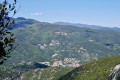
This is a challenging hike due to the elevation gain and short distance. This hike is only suitable for people who are used to walking off the beaten track. The scenery is spectacular, as numerous gaps in the fairly low vegetation offer views of the surrounding wooded mountains. In addition, the border ridge is clearly visible throughout the ascent. The Roc de France is in sight. The return journey is via stage 39 of the Haute Route Pyrénéenne.
Montalba d'Amélie and the Engracia Chapel from Amélie-les-Bains
 8.27 mi
+2,641 ft
-2,615 ft
6h 05
Difficult
Departure from Amélie-les-Bains-Palalda (Pyrénées-Orientales)
8.27 mi
+2,641 ft
-2,615 ft
6h 05
Difficult
Departure from Amélie-les-Bains-Palalda (Pyrénées-Orientales)
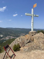
This hike takes place in the woods, but offers beautiful views of the Vallespir (Roc Saint-Sauveur) and Canigou. Avoid when it is too hot.
Coll de Paracolls via little-known paths
 6.80 mi
+3,048 ft
-3,048 ft
5h 45
Moderate
Departure from Amélie-les-Bains-Palalda (Pyrénées-Orientales)
6.80 mi
+3,048 ft
-3,048 ft
5h 45
Moderate
Departure from Amélie-les-Bains-Palalda (Pyrénées-Orientales)
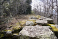
This hike will introduce you to built heritage, remarkable places and unmarked paths.
The numerous terraces still present on the southern slope prove that human activity was significant.
This hike requires a minimum sense of direction. The GPX track is necessary from (7) to (10).
This 11 km hike with an elevation gain of 905 m is very steep (see elevation diagram).
Puig d’Orella, Coll de l’Ullat, Casot d’en Lic from Laroque-des-Albères
 7.76 mi
+3,035 ft
-3,035 ft
6h 15
Difficult
Departure from Laroque-des-Albères (Pyrénées-Orientales)
7.76 mi
+3,035 ft
-3,035 ft
6h 15
Difficult
Departure from Laroque-des-Albères (Pyrénées-Orientales)
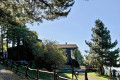
All in all, a fairly challenging hike in places due to the steep gradient.
At Puig d’Orella, a beautiful viewpoint awaits you.
At Coll de l’Ullat, the view is also lovely and a welcoming chalet bar-restaurant awaits you.
At Casot d’en Lic, you can see information boards about the flora of the Albères.
See practical information regarding the Ribera de Roca section following heavy rain.
Around Amélie-les-Bains
 4.99 mi
+1,430 ft
-1,434 ft
3h 30
Moderate
Departure from Amélie-les-Bains-Palalda (Pyrénées-Orientales)
4.99 mi
+1,430 ft
-1,434 ft
3h 30
Moderate
Departure from Amélie-les-Bains-Palalda (Pyrénées-Orientales)
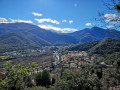
This route will allow you to explore the surroundings of Amélie-les-Bains, namely Montbolo, where there is an orientation table, and Palalda, a village with a medieval feel.
Puig dels Quatre Termes via Collada de l'Orri from La Farga (Sorède)
 10.33 mi
+3,474 ft
-3,448 ft
7 hrs
Very difficult
Departure from Sorède (Pyrénées-Orientales)
10.33 mi
+3,474 ft
-3,448 ft
7 hrs
Very difficult
Departure from Sorède (Pyrénées-Orientales)
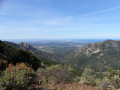
A challenging hike offering a variety of landscapes.The path along the border ridge offers views of the coastline below and the peaks in the distance.This hike is classified as very difficult because the climb is steep and you will have to cross torrents.The return journey is also steep and you will need to pay close attention to the cairns and old yellow markings.Note: This hike should only be attempted when there is no rain or thunderstorm forecast. (1)A sense of direction is necessary. The GPX track is necessary. Remember to download the track and map before setting off.
The castle of Ultrera and Notre-Dame du Château from the Valley of the Tortoises
7.04 mi
+1,624 ft
-1,608 ft
4h 40
Moderate
Departure from Sorède (Pyrénées-Orientales)
A hike starting from La Vallée des Tortues in Sorède, which passes through the suburbs of Sorède and leads to the Sant Ferriol de la Pave Chapel, then up to the heights of the Albères to the ruins of the Château d'Ultrera, before descending slightly to the old Himalaya solar oven and then on to the Hermitage of Notre-Dame du Château, where a break is a must. The return via the Pont de la Resclosa bridge takes you back to the valley and its wildlife park, which is well worth a visit.
The Hermitage of Notre-Dame du Château and the Roc de les Medes from Sorède
 6.87 mi
+1,946 ft
-1,946 ft
4h 50
Moderate
Departure from Sorède (Pyrénées-Orientales)
6.87 mi
+1,946 ft
-1,946 ft
4h 50
Moderate
Departure from Sorède (Pyrénées-Orientales)
From the village of Sorède, head towards the Vallée Heureuse. Park in the mandatory car parks at Parc au Tortues on the left as you go up.
Do not underestimate this hike, especially the approach to Roc de les Medes, which requires a little attention.
There are many forks in the road, so I recommend using the GPX track to avoid unnecessary backtracking.
Route in the Biological Reserve *
The ascent and descent take place in two very different forests.
 Ascent to Pic du Néoulous
20.05 mi
+3,796 ft
-3,776 ft
3 hrs
Moderate
Departure from Sorède (Pyrénées-Orientales)
E-MTB route, only on DFCI trails, with no technical difficulty. The goal is to reach Pic du Néoulous, the highest point of the Albères mountain range, to admire a superb view covering both Spain and the Côte Vermeille coastline.
The Pic des Quatre Termes and the Massane Forest Nature Reserve
 12.49 mi
+4,754 ft
-4,731 ft
9h 55
Difficult
Departure from Sorède (Pyrénées-Orientales)
12.49 mi
+4,754 ft
-4,731 ft
9h 55
Difficult
Departure from Sorède (Pyrénées-Orientales)
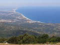
Discover the Massane Forest Nature Reserve, one of the few examples of ancient forest in France, with magnificent views of the Roussillon plain and the Côte Vermeille.
The Massane Tower from La Vall
 4.31 mi
+1,795 ft
-1,795 ft
3h 35
Moderate
Departure from Sorède (Pyrénées-Orientales)
4.31 mi
+1,795 ft
-1,795 ft
3h 35
Moderate
Departure from Sorède (Pyrénées-Orientales)
Almost the entire hike is in the shade, under a forest of cork oak trees.
The slope is quite steep in the first part. The effort is rewarded by a beautiful 360° view from the tower.
Moderator's addition on 17/05/2021: Do not rely solely on the map; please read the warnings in the description and reviews
It is risky to venture onto the road to La Vall (parking problems, traffic restrictions, etc.).
Since 05/05/2023: it is no longer permitted to use this access road between 10 a.m. and 5 p.m. due to the risk of fire.