Salt de Fito Waterfall in Le Perthus

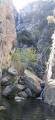
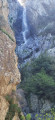
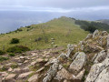
In Au Perthus, we’ll be buying some alcohol, but that’s not all… Discover this lovely circular route that takes you past the stunning Fito Waterfall (Salt de Fito) and offers beautiful views of the Spanish Empordà and Mont Canigou. Best done after it’s rained so you can enjoy the waterfall and the river. The route can be shortened; you can simply head to the waterfall: there’s a tricky section – a short but very steep climb.

Details

73174019
Creation:
Last update:
Last review:
  • Walking
    Activity: Walking
  • ↔
    Distance: 5.26 mi
  • ◔
    Average duration: 3h 45 
  • ▲
    Difficulty: Difficult

  • ⚐
    Back to start: Yes
  • ↗
    Ascent: + 1,490 ft
  • ↘
    Descent: - 1,509 ft

  • ▲
    Highest point: 2,008 ft
  • ▼
    Lowest point: 886 ft

Photos

Description of the walk

For free parking, drive through the whole of Le Perthus coming from France. At the customs barrier, turn left onto the small road that goes uphill, go through a tunnel and park. 

(S/E) Take the track that climbs southwards alongside the motorway, then veers off to the left. 

(1) When you reach a hairpin bend to the left, leave the track and continue straight on along the footpath: follow the signpost. You’ll come to a junction of footpaths. 

(2) Carry on straight ahead, leaving the return path on your left. You’ll reach the junction with the path leading to El Salt del Fitonell (another waterfall). 

(3) Keep left to continue the route along the Llobregat d’Emporda. 

(4) Cross the footbridge and enjoy the view of El Salt de Fito, an impressive waterfall. Then begin a steep climb to reach the ruins of the San Pere Chapel, of which very little remains. 

(5) Head south again, then turn left a few dozen metres further on. A GPS will be very useful due to the numerous junctions in the area. Join a track near the ruins of Mas Nou. 

(6) Head left, then turn right at the hairpin bend. Follow the path as it winds its way, keeping a general northerly direction. 

(7) From this point onwards, the path is not maintained: follow the GPX file carefully, heading towards the ruined farmhouse, where you’ll join a cross-country track. Turn left to follow this track towards the Collada del Pla del Arca, which marks the border between France and Spain. 

(8) A few dozen metres before reaching it, take the track on the left, reach a lovely viewpoint over the river and continue to the junction with another track. 

(9) Turn left and walk for about 200 m to reach a three-way junction in the track. Take the right-hand fork, pass the ruins of an old sheepfold and continue until you rejoin the track you left earlier on its western section. 

(10) Turn left to follow it, walk for about 400 m, then turn left again to rejoin the outbound route. 

(2) Head to the right and retrace your steps in the opposite direction to return to the car park (S/E). 

Waypoints

  1. S/E : mi 0 - alt. 925 ft - Free car park
  2. 1 : mi 0.3 - alt. 978 ft - Start of the path
  3. 2 : mi 0.53 - alt. 1,204 ft - Junction of the circular loop
  4. 3 : mi 0.69 - alt. 1,296 ft - Salt del Fitonell junction
  5. 4 : mi 0.98 - alt. 1,286 ft - Footbridge, El Salt del Fito
  6. 5 : mi 1.54 - alt. 1,886 ft - San Pere Chapel, ruins
  7. 6 : mi 2.17 - alt. 2,008 ft - Mas Nou, ruins
  8. 7 : mi 2.79 - alt. 1,936 ft - End of maintained path
  9. 8 : mi 3.31 - alt. 1,955 ft - Junction, track on the left
  10. 9 : mi 3.9 - alt. 1,680 ft - Trail junction, turn left
  11. 10 : mi 4.46 - alt. 1,447 ft - Back on the track, turn left
  12. S/E : mi 5.26 - alt. 892 ft - Arrival

Notes

There’s no water, so bring your water bottles. 

Sturdy footwear is essential.

Worth a visit

(3) There is another waterfall, called El Salt del Fitonell, which can be reached by following the path on the right. I haven’t been there myself and I look forward to hearing your feedback. 

Reviews and comments

4.5 / 5
Based on 3 reviews

Reliability of the description
4.5 / 5
Ease of following the route
4.3 / 5
Route interest
4.7 / 5
User 4151644

Overall rating : 4 / 5

Date of your route : May 01, 2026
Reliability of the description : ★★★★☆ Good
Ease of following the route : ★★★★☆ Good
Route interest : ★★★★☆ Good
Very busy route : No

We didn’t miss any markings at point 7, but just after the waterfall and at the start of the steep climb, there are chains on the left that aren’t easy to spot; the path quickly heads off into the wilderness before dropping back down to where you can see the chains. In any case, you have to go through this scree section, which has very old and barely visible markings.

Machine-translated

MERIT Michel
MERIT Michel

Overall rating : 5 / 5

Date of your route : Dec 24, 2025
Reliability of the description : ★★★★★ Very good
Ease of following the route : ★★★★★ Very good
Route interest : ★★★★★ Very good
Very busy route : No

Thank you for this beautiful and enjoyable hike.
We passed by the Fitonell waterfall, which was a warm-up for the more technical sections to come, with a beautiful view of the gorges.

Machine-translated

Vejapi
Vejapi

Overall rating : 4.5 / 5

Date of your route : May 12, 2025
Reliability of the description : Not used / Not applicable
Ease of following the route : ★★★★☆ Good
Route interest : ★★★★★ Very good
Very busy route : No

A challenging hike involving a 200-metre climb, during which we had to hold on to the chains fixed to the rock face; a very impressive waterfall; and, along the route, a ruined chapel and numerous ruined farmhouses.

Machine-translated

Other walks in the area

For more walks, use our search engine .

The GPS track and description are the property of this route's author. Please do not copy them without permission.