Following the River Tech from Amélie-les-Bains to Arles-sur-Tech

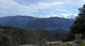
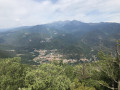
Following the GRP® Ronde du Canigou trail, you’ll follow the River Tech. There are fords along the route, as well as wash houses and chapels. You’ll enjoy views of Fort les Bains and Annibal Waterfall. You’ll find a few picnic tables along the way, and the walk ends at Arles-sur-Tech Abbey.

Details

n°108354221
Creation:
Last update:
Last review:
–
  • Walking
    Activity: Walking
  • ↔
    Distance: 3.38 mi
  • ◔
    Average duration: 1h 50 
  • ▲
    Difficulty: Average

  • ⚐
    Back to start: No
  • ↗
    Ascent: + 358 ft
  • ↘
    Descent: - 190 ft

  • ▲
    Highest point: 961 ft
  • ▼
    Lowest point: 696 ft

Description of the walk

You can park in Amélie-les-Bains, in the spa centre car park on Place Raymond Pinède, then leave a car at the end point at Arles-sur-Tech Abbey for the return journey.

(S) Set off towards the Chapelle l’Escaldador, heading north-east along the river.

(1) At the junction, turn left, then immediately right. Walk past a wash house. Cross the D115 carefully, then cross the bridge over the River Tech.

(2) After the bridge, turn left onto Boulevard de la Petite Provence, following the river. Pass a bridge on your left, and continue straight on along the GRP® Ronde du Canigou until you reach Rue du 11 Novembre.

(3) Turn right until you reach the D115, follow it carefully to the left, and cross the Pont de la Baillie.

(4) Leave the D115 and turn right onto Rue de la Mas d’en Draguines. Walk past the sports hall, then turn left onto Rue Batllia d’Avall until you reach a sharp left-hand bend.

(5) Go straight on and cross the bridge over the River Tech. Stay on the main road. Cross Avenue de Las Indis and continue straight ahead.

(6) Turn left onto Rue du Barrí d’Avall, then veer right and walk alongside the Arles-sur-Tech cemetery and the secondary school, continuing on the left to reach the Abbey of Sainte-Marie d’Arles-sur-Tech (E).

Waypoints

  1. S : mi 0 - alt. 781 ft - Thermal Centre car park, Place Raymond Pinède
  2. 1 : mi 0.27 - alt. 722 ft - Avenue du Vallespir
  3. 2 : mi 0.42 - alt. 719 ft - After the bridge over the - Tech (fleuve)
  4. 3 : mi 2.11 - alt. 830 ft - 11 November Street
  5. 4 : mi 2.3 - alt. 856 ft - La Batille Road - Tech (fleuve)
  6. 5 : mi 2.71 - alt. 938 ft - Wide bend
  7. 6 : mi 3.1 - alt. 915 ft - Rue du Barrí d’Avall
  8. E : mi 3.38 - alt. 945 ft - Near Sainte-Marie Abbey in Arles-sur-Tech

Notes

  • Water point at the Arles-sur-Tech cemetery
  • Picnic tables after the (4).

Worth a visit

  1. Sainte-Marie Abbey, Arles-sur-Tech.
  2. Washing houses.
  3. Chapel.
  4. Annibal Waterfall.
  5. Amélie-les-Bains spa resort.

Other walks in the area

For more walks, use our search engine .

The GPS track and description are the property of this route's author. Please do not copy them without permission.