


 Country:

 City:
City:


At km 4.1, you may sometimes have to make a return trip: the water level (3 metres below maximum capacity) may force you to turn back and take the road (very quiet, no cars encountered) before heading back towards the lake a few hundred metres further on. In late summer, the lower water level of the lake will likely allow you to walk along its shore from this point onwards.
Circular lake tour and Mirador de la Tortuga from Darius


A fairly easy walk with varied scenery. There are no signposts on the paths, but the routes are fairly straightforward, so there’s little chance of getting lost. The walk starts in Darnius, with the first section through woodland, a stop at an11th-century chapel (unfortunately closed to the public), a walk along the lake, then back towards Darnius, with the option of climbing up to the Mirador de la Tortuga (a 15-minute ‘detour’) which offers a stunning panoramic view of the lake and the surrounding mountains.
Details
Creation:
Last update:
Last review:
–
–
-
 Activity: Walking
 -
 Distance: 6.63 mi
 -
 Average duration: 3h 45
 -
 Difficulty: Moderate
 -
-
 Back to start: Yes
 -
 Ascent: + 850 ft
 -
 Descent: - 814 ft
 -
-
 Highest point: 988 ft
 -
 Lowest point: 505 ft
Waypoints
- S/E : mi 0 - alt. 627 ft - Darnius
- 1 : mi 1.63 - alt. 909 ft - Crossroads
- 2 : mi 1.86 - alt. 869 ft - Ermitage
- 3 : mi 2.97 - alt. 528 ft - Lake
- 4 : mi 5.21 - alt. 866 ft - Viewpoint
- S/E : mi 6.63 - alt. 636 ft - Darnius
Notes
Other walks in the area
Agullana and the bunker
 Association / Club / Walk leader3.50 mi
+453 ft
-453 ft
2h 00
Association / Club / Walk leader3.50 mi
+453 ft
-453 ft
2h 00
 Easy
Easy
 Departure from Agullana (Girona)
This walk takes about an hour and a half to two hours including time to explore the bunker. The whole walk is very easy.
A unique and spectacular megalithic trail starting from Cantallops
 Visorando Member
 10.74 mi
+512 ft
-512 ft
5h 25
Moderate
Departure from la Jonquera (Girona)
10.74 mi
+512 ft
-512 ft
5h 25
Moderate
Departure from la Jonquera (Girona)
A magnificent and unique route. Countless dolmens and menhirs. A stunning landscape of granite boulders, reminiscent of the Sidobre site in the Tarn, though with very different vegetation.
All this with the option of a break in the village of Capmany.
No particular difficulty apart from the length: the paths are flat and often wide, yet charming nonetheless. You need to pay attention to the route to avoid missing any megaliths. (Some of the blue markings are misleading).
The Jonquère area isn’t just home to hideous supermarkets: it boasts beautiful natural scenery.
I’ve tried to mark all the dolmens on the map, but there are so many that I’m bound to have missed some: please do help with the survey – thank you.
Las Illas in Amélie-les-Bains
10.60 mi
+3,015 ft
-4,170 ft
7h 30
 Difficult
Departure from Maureillas-las-Illas (Pyrénées-Orientales)
Difficult
Departure from Maureillas-las-Illas (Pyrénées-Orientales)
Third day of this crossing of the Albères.This is the greenest part of the route as it is mainly through forest.You will pass by the highest point of Roc de France (Roca de Frausa) with a magnificent panorama over a large part of the Eastern Pyrenees and Canigou (Canigó).
Salt del Fito
2.44 mi
+764 ft
-755 ft
1h 35
Moderate
Departure from la Jonquera (Girona)
In Le Perthus, we go to buy alcohol, but that's not all...
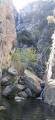
Discover this beautiful circular route that passes by the stunning Fito Waterfall (Salt del Fito) and offers beautiful panoramic views of Bellegarde Fort and Canigou.
Best done after it has rained so you can enjoy the waterfall and river.
Salt de Fito Waterfall in Le Perthus
 5.26 mi
+1,490 ft
-1,509 ft
3h 45
Difficult
Departure from la Jonquera (Girona)
5.26 mi
+1,490 ft
-1,509 ft
3h 45
Difficult
Departure from la Jonquera (Girona)
In Au Perthus, we’ll be buying some alcohol, but that’s not all… Discover this lovely circular route that takes you past the stunning Fito Waterfall (Salt de Fito) and offers beautiful views of the Spanish Empordà and Mont Canigou. Best done after it’s rained so you can enjoy the waterfall and the river. The route can be shortened; you can simply head to the waterfall: there’s a tricky section – a short but very steep climb.
The Fort de Bellegarde and the Panissars site from Le Perthus
8.64 mi
+1,549 ft
-1,552 ft
5h 20
Moderate
Departure from Le Perthus (Pyrénées-Orientales)
An easy hike from Le Perthus offering views of the Spanish valley towards La Jonquera. Part of the route follows the border and takes you past military buildings from yesteryear (fort and redoubt) as well as the Roman site of Panissars, including the remains of the Via Domitia.
Circular walk to Fort de Bellegarde from Le Perthus
4.18 mi
+627 ft
-604 ft
2h 30
Easy
Departure from Le Perthus (Pyrénées-Orientales)
A walk along the GR®10 through Le Perthus, passing the Fontaine de Pedres Blanques, then a short climb towards the Col dels Miquelets, descending via the Roman ruins of Panissars and skirting the Fort de Bellegarde. Le Perthus is a town, part of which lies in Spain (El Portús).
Albanya Gorges to Bertran Bridge and Castel del Serrat
5.45 mi
+584 ft
-558 ft
3h 00
Moderate
Departure from Albanyà (Girona)
A magnificent hike in the Catalan hinterland, an hour from Rosas. The path is poorly marked, but it's a fairly easy and very enjoyable hike. The gorges and river are superb. Enjoy!
For more walks, use our search engine .
The GPS track and description are the property of this route's author. Please do not copy them without permission.

