


Refine your search for walks in Charbonnier-les-Mines
Charbonnier-les-Mines walks


 Exploring Charbonnier-les-Mines, extended version
 Visorando Member
 3.51 mi
 +174 ft
 -203 ft
 1h 45
1h 45
 Easy
Easy
 Departure from Charbonnier-les-Mines (Puy-de-Dôme)
Three walks, of gradually increasing lengths, have been created on the initiative of the Charbonnier-les-Mines Youth Town Council (CMJ).
These walks were created to enable everyone, from the very young to the elderly, to discover or rediscover the village and to enjoy a simple, natural activity in a remarkable setting.
Three colours of waymarkers have been used – green, blue and red – from the shortest to the longest route.
Along the way, you’ll discover some truly beautiful scenery, including the Allagnon – that famous river home to trout and a few salmon – the remains of the castle, the vestiges of the mining past and the even older remains of the Gallo-Romans.
From the ‘Gueules Noires’ to the ‘Bateliers’
 5.93 mi
+436 ft
-413 ft
3h 05
Easy
Departure from Brassac-les-Mines (Puy-de-Dôme)
5.93 mi
+436 ft
-413 ft
3h 05
Easy
Departure from Brassac-les-Mines (Puy-de-Dôme)
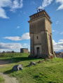
This varied walk illustrates the link between coal mining and its transport on the ‘sapinières’ (timber-tracked wagons) that travelled as far as Paris.
The Lempdes Hills
 5.22 mi
+584 ft
-574 ft
2h 55
Easy
Departure from Lempdes-sur-Allagnon (Haute-Loire)
5.22 mi
+584 ft
-574 ft
2h 55
Easy
Departure from Lempdes-sur-Allagnon (Haute-Loire)
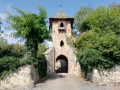
Landscapes on the edge of the Lembron valley and at the start of the Allagnon Gorges, a landscape of plateaus and plains in the Limagne region, punctuated by the villages of Lempdes and Moriat.
Montcelet route
 2.77 mi
+568 ft
-568 ft
1h 45
Easy
Departure from Vichel (Puy-de-Dôme)
2.77 mi
+568 ft
-568 ft
1h 45
Easy
Departure from Vichel (Puy-de-Dôme)
An easy, short walk through woods, farmland and pastures, ideal for families.
Climb the tower to enjoy a 360° panorama, with views of the Céréalier, the Livradois, and the peaks of Usson and Nonette.
As you climb the tower, you will discover the remains of the ancient fortress and the villages it protected.
Saint-Gervazy Circular
5.88 mi
+771 ft
-771 ft
3h 20
Easy
Departure from Vichel (Puy-de-Dôme)
A walk around Montcelet, through woods and pastures, with views of the Puys de Dôme, the Puy de Nonette and the hills and pastures of the Lembron.
The Montfaucon Rock
 5.44 mi
+1,112 ft
-1,086 ft
3h 30
5.44 mi
+1,112 ft
-1,086 ft
3h 30
 Moderate
Departure from Jumeaux (Puy-de-Dôme)
Moderate
Departure from Jumeaux (Puy-de-Dôme)
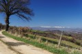
A loop on the first hills of Livradois, to the knoll of La Grive and then to the Montfaucon rock, which overlooks the mining basin and offers a beautiful view of Nonette, Ysson, Montcelet, the Sancy massif and the Cézallier.
Between the mining basin and farmland in Livradois
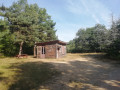 4.27 mi
+558 ft
-558 ft
2h 25
Easy
Departure from Vézézoux (Haute-Loire)
4.27 mi
+558 ft
-558 ft
2h 25
Easy
Departure from Vézézoux (Haute-Loire)
This walk is a transition between the flat landscapes of the former mining basin and the forest landscapes of Livradois.
It was from the woods of these forests that sapinières (single-use wooden boats) transported coal, wine and hemp to Paris.
Chambezon - Le Caure
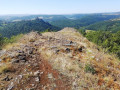 4.37 mi
+909 ft
-909 ft
2h 50
4.37 mi
+909 ft
-909 ft
2h 50
 Difficult
Departure from Chambezon (Haute-Loire)
Difficult
Departure from Chambezon (Haute-Loire)
A physically demanding route halfway down the descent into the valley, offering magnificent views of the Alagnon Valley and Léotoing Castle.
From Vergongheon to the Allier via Rilhac
6.09 mi
+167 ft
-167 ft
2h 55
Easy
Departure from Vergongheon (Haute-Loire)
Vergongheon is situated on a plateau overlooking the Allier valley. This is why fortified houses, topped with towers, were built in the villages of Rilhac and Lubières, enabling the monitoring of traffic in the valley. The remains of these structures can be seen in Rilhac and Lubières.
Around the Puy du Joux
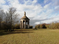 4.35 mi
+200 ft
-200 ft
2h 10
Easy
Departure from Le Breuil-sur-Couze (Puy-de-Dôme)
4.35 mi
+200 ft
-200 ft
2h 10
Easy
Departure from Le Breuil-sur-Couze (Puy-de-Dôme)
A Sunday stroll to explore the village of Le Breuil-sur-Couze in the first part of the walk, followed by a walk through the surrounding countryside, with views of the volcanic peaks of Nonette and Usson, in the second part.
GPS recommended
Circular route in the Val d'Allier from the medieval village of Nonette
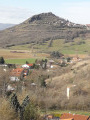 6.15 mi
+820 ft
-843 ft
3h 30
Easy
Departure from Nonette (Puy-de-Dôme)
6.15 mi
+820 ft
-843 ft
3h 30
Easy
Departure from Nonette (Puy-de-Dôme)
The starting point for the hike, the village of Nonette is perched on a volcanic hill overlooking a circular bend in the Allier River. After climbing to the top of the ancient volcano to enjoy a 360° view of the Lembron and the Val d'Allier, this former dyke, on which Gallo-Roman remains have been discovered, will guide you along the route dotted with pretty villages rich in culture and history.
Watermills and dovecotes in Auzon
 4.18 mi
+719 ft
-702 ft
2h 35
Moderate
Departure from Auzon (Haute-Loire)
4.18 mi
+719 ft
-702 ft
2h 35
Moderate
Departure from Auzon (Haute-Loire)
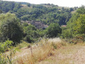
A walk that allows you to discover the mills and dovecotes near Auzon, admire the forests of holm oaks and conifers, and experience the transition between the landscapes of the Cé Valley and those of the mining basin!
The Val d’Allier in Auzon
 4.77 mi
+591 ft
-571 ft
2h 40
Easy
Departure from Auzon (Haute-Loire)
4.77 mi
+591 ft
-571 ft
2h 40
Easy
Departure from Auzon (Haute-Loire)
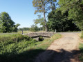
A walk to discover Auzon’s industrial past and its present-day agricultural and forestry resources.
Plum Picking around Auzon
 5.73 mi
+935 ft
-909 ft
3h 25
Moderate
Departure from Auzon (Haute-Loire)
5.73 mi
+935 ft
-909 ft
3h 25
Moderate
Departure from Auzon (Haute-Loire)
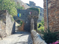
On this walk, you will discover both the landscapes of the volcanic mountains of western Auvergne and the small hamlets that bring life to these somewhat deserted areas.
Notre-Dame de Mailhat
 5.29 mi
+453 ft
-423 ft
2h 50
Easy
Departure from Lamontgie (Puy-de-Dôme)
5.29 mi
+453 ft
-423 ft
2h 50
Easy
Departure from Lamontgie (Puy-de-Dôme)
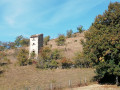
A stroll through peaceful countryside, a succession of fields, vegetable gardens and orchards, with the Pic de Nonette as a backdrop, and a visit to the pretty villages of Orsonnette and Mailhat (featuring a listed 12th-century church).
The Serre Cross
 2.35 mi
+449 ft
-446 ft
1h 30
Easy
Departure from Léotoing (Haute-Loire)
2.35 mi
+449 ft
-446 ft
1h 30
Easy
Departure from Léotoing (Haute-Loire)
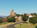
This route allows you to admire the village of Léotoing and the ruins of its castle, and to discover the Alagnon valley, the Cézaliers mountains and the castle of Torsiac.
Via Bard and Letz
 6.33 mi
+728 ft
-719 ft
3h 35
Moderate
Departure from Madriat (Puy-de-Dôme)
6.33 mi
+728 ft
-719 ft
3h 35
Moderate
Departure from Madriat (Puy-de-Dôme)
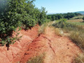
A walk around the villages and hamlets near Boudes and its Valley of the Saints, the red clay fields and a saltwater spring known to the Romans!
Ribeyre stream
 5.76 mi
+837 ft
-846 ft
3h 20
Easy
Departure from Bansat (Puy-de-Dôme)
5.76 mi
+837 ft
-846 ft
3h 20
Easy
Departure from Bansat (Puy-de-Dôme)
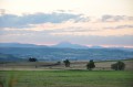
This circular route follows the Ruisseau de la Ribeyre valley.
Most of the route is through woodland.
The best viewpoint is just before the access to the D24.
The Fairy Chimneys of Boudes
3.45 mi
+518 ft
-502 ft
2h 00
Easy
Departure from Boudes (Puy-de-Dôme)
The Sentier des Cheminées de Fées trail leads to a dry forest with a series of viewpoints overlooking geological formations: fairy chimneys, cirques and multicoloured cliffs.
The Valley of the Saints (fairy chimney trail)
 3.03 mi
+394 ft
-394 ft
1h 45
Moderate
Departure from Boudes (Puy-de-Dôme)
3.03 mi
+394 ft
-394 ft
1h 45
Moderate
Departure from Boudes (Puy-de-Dôme)
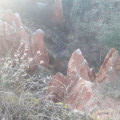
Boudes, its vineyards and the Vallée des Saints, known as the Colorado of Lembron.
The village of Saint-Héran, the Source de Bard and the Auvergne ‘Colorado’
 6.85 mi
+945 ft
-942 ft
4h 00
Moderate
Departure from Boudes (Puy-de-Dôme)
6.85 mi
+945 ft
-942 ft
4h 00
Moderate
Departure from Boudes (Puy-de-Dôme)
A beautiful route through the Auvergne countryside starting from Boudes, known for its vineyards. This walk will take you to Saint-Hérent, a small village perched on a rocky outcrop with a magnificent Romanesque church. You’ll then discover the Source de Bard, gushing from the bowels of the earth, as well as the Vallée des Saints – also known as the ‘Auvergne Colorado’ – with its stunning variety of colours and rock formations.
Old Valley of Saints Trail and Pic de l'Avoiron tower
 5.36 mi
+650 ft
-643 ft
3h 00
Easy
Departure from Boudes (Puy-de-Dôme)
5.36 mi
+650 ft
-643 ft
3h 00
Easy
Departure from Boudes (Puy-de-Dôme)
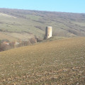
This walk between Boudes and Saint-Hérent allows you to discover the landscapes around the Pic de l'Avoiron and get closer to the Vallée des Saints.
If you approach the old entrance to the Vallée des Saints, you will find that it is now closed.
Lorlanges, paths and castles
 Association / Club / Walk leader
 6.20 mi
+545 ft
-571 ft
3h 20
Easy
Departure from Lorlanges (Haute-Loire)
6.20 mi
+545 ft
-571 ft
3h 20
Easy
Departure from Lorlanges (Haute-Loire)
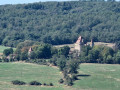
A lovely walk along good paths, offering a close-up view of the castles of Védrines and Vernassal, and a distant view of Léotoing Castle.
This is a variation on the “castles walk” (Respirando No. 497 and Visorando No. 1363868), which takes you closer to Védrines Castle and offers an extended view of Léotoing Castle at the start of the route.
The castles in Lorlanges
 6.01 mi
+568 ft
-597 ft
3h 15
Easy
Departure from Lorlanges (Haute-Loire)
6.01 mi
+568 ft
-597 ft
3h 15
Easy
Departure from Lorlanges (Haute-Loire)
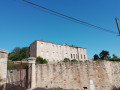
A walk through farmland and forests, along a stream, with views of the châteaux of Védrines, Vernassal and Léotoing.
The Vernassal Stream
 5.96 mi
+554 ft
-561 ft
3h 15
Easy
Departure from Léotoing (Haute-Loire)
5.96 mi
+554 ft
-561 ft
3h 15
Easy
Departure from Léotoing (Haute-Loire)
This pleasant route, partly through woodland along the stream or across farmland, offers views of Torsiac Castle in the foreground and then Léotoing Castle.
In the background lies the Alagnon valley.
The forgotten mineral waters of Clémensat
 6.77 mi
+866 ft
-853 ft
3h 50
Moderate
Departure from Azérat (Haute-Loire) (Haute-Loire)
6.77 mi
+866 ft
-853 ft
3h 50
Moderate
Departure from Azérat (Haute-Loire) (Haute-Loire)
A walk through woodland, vineyards, farmland and orchards in the plains and mountains of Livradois.
Around La Chapelle-sur-Usson
 3.46 mi
+551 ft
-574 ft
2h 05
Easy
Departure from La Chapelle-sur-Usson (Puy-de-Dôme)
3.46 mi
+551 ft
-574 ft
2h 05
Easy
Departure from La Chapelle-sur-Usson (Puy-de-Dôme)
A short walk through a peaceful, rural setting that provides the perfect backdrop to this village and its chapel.
The Ruisseau du Bois Noir
 8.63 mi
+1,450 ft
-1,476 ft
5h 15
Moderate
Departure from Azérat (Haute-Loire) (Haute-Loire)
8.63 mi
+1,450 ft
-1,476 ft
5h 15
Moderate
Departure from Azérat (Haute-Loire) (Haute-Loire)
A very beautiful walk starting above the village of Azérat and leading to Saint-Hilaire via the valley of the Ruisseau du Bois Noir. Most of the route runs through woodland, with a stunning view of the Sancy massif from Saint-Hilaire.
Between castles and Bacchus
 4.62 mi
+830 ft
-827 ft
2h 50
Easy
Departure from Villeneuve (Puy-de-Dôme) (Puy-de-Dôme)
4.62 mi
+830 ft
-827 ft
2h 50
Easy
Departure from Villeneuve (Puy-de-Dôme) (Puy-de-Dôme)
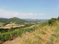
A walk through the farmland of the villages of Villeuneuve-Lembron and Chalus and the vineyards of the village of Boudes.
A route through woods, plateaus and vineyards.
Villeneuve Lembron
3.95 mi
+486 ft
-505 ft
2h 15
Easy
Departure from Villeneuve (Puy-de-Dôme) (Puy-de-Dôme)
An easy and enjoyable walk for lovers of chestnuts and wild cherries.
The Pic d'Usson
 7.10 mi
+879 ft
-883 ft
4h 00
Easy
Departure from Saint-Rémy-de-Chargnat (Puy-de-Dôme)
7.10 mi
+879 ft
-883 ft
4h 00
Easy
Departure from Saint-Rémy-de-Chargnat (Puy-de-Dôme)
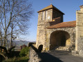
A walk around and through the village of Usson. The climb to the peak (639 m) offers a 360° panoramic view of the Chaîne des Puys, the Sancy massif and the Livradois-Forez mountains.A statue of the Virgin Mary dating from 1893 stands at the summit.
Circular route on the right bank of the Allier river starting from Allevier.
3.96 mi
+331 ft
-351 ft
2h 05
Easy
Departure from Azérat (Haute-Loire) (Haute-Loire)
Starting from Allevier, the route climbs through fields and villages, then enters the woods. Throughout the route, you will have a splendid view of the Sancy, Cézallier, Cantal and Margeride mountains.
The Orgues de Chadecol
 5.73 mi
+748 ft
-755 ft
3h 15
Moderate
Departure from Blesle (Haute-Loire)
5.73 mi
+748 ft
-755 ft
3h 15
Moderate
Departure from Blesle (Haute-Loire)
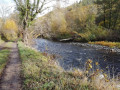
A hike to discover the site of Chadecol, inhabited 10,000 years ago by the first farmers and herders.
A walk to admire the basalt columns of Chadecol, the Allagnon valley and the village of Blesle.
La Ferme du Bos
 4.69 mi
+860 ft
-860 ft
2h 55
Easy
Departure from Blesle (Haute-Loire)
4.69 mi
+860 ft
-860 ft
2h 55
Easy
Departure from Blesle (Haute-Loire)
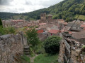
This walk begins in the woods along a stream, leading to a former 17th-century fortified castle that has now been converted into a farm. You’ll discover magnificent views over the valleys surrounding the charming village of Blesle.
Around Solignat via Les Tremoux
 4.58 mi
+502 ft
-512 ft
2h 35
Easy
Departure from Solignat (Puy-de-Dôme)
4.58 mi
+502 ft
-512 ft
2h 35
Easy
Departure from Solignat (Puy-de-Dôme)
An easy walk through rolling countryside offering beautiful views, sometimes over wide valleys with gentle slopes dotted with splashes of colour—reflecting the variety of crops—and sometimes over ancient volcanoes, small hills scattered across the landscape.