Country:

 City:
City:


To reach the starting point, take exit 18 (Brassac-les-Mines) off the A75. At the roundabout, take thefirst road on the right, towards Charbonnier-les-Mines. Continue straight on along Avenue de la République until you reach the roundabout in front of the local school; park in one of the nearby car parks and cross the road to reach the library.
Signposting: Red
(S/E) Opposite the library, turn right, then turn left twice (going round the school and the town hall). At the junction with Avenue de la République, turn left; then, at the roundabout, cross over and turn right onto Avenue Jean Jaurès. Follow this road untilthe second set of junctions.
(1) Turn left into Rue Germinal, then take thesecond street on the left, Rue de Montagnat. Follow this street, turning right then left; ignore the next two junctions and turn sharply right at thethird. You will come to a Y-junction.
(3) Take the street furthest to the right, Rue de la Source, and continue along this street, which curves to the left, until you reach the ‘Stop’ sign at the junction with Rue Jean Monnet.
Carry on straight ahead until you reach Avenue de la République. Turn left onto it, then immediately right onto Chemin de la Chaux. Continue along this track; at the junction with the track leading to the plant treatment centre, turn left and carry on until you reach the junction with Chemin des Laquais (bench on the left).
(4) Turn right onto Chemin du Rivasset, continue along this lane and pass the square house. The lane bends twice to the left and winds its way between the houses. You will reach the junction with Rue du Bouquet.
(5) Carry on straight ahead to reach Place du Premier Mai. Turn right and, after about twenty metres, turn left into a narrow lane that runs between the houses. At the end of the lane, turn right, cross Avenue de la République, then head up to the left along Chemin Bellevue until you reach Rue du Château.
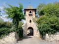
(6) Follow this street until you reach the gate.
(7) Return to the previous junction.
(6) Walk down the street on the left until you reach Chemin de l’Allagnon. Turn left, walk down Chemin de l’Allagnon, pass under the castle ruins, and continue to the river. Just before the river, turn left and follow the river to the bridge over the D76.
(8) Walk alongside the road for a few metres, then take the small path on the left. Head up towards the Carreau de la Mine. When you reach the plateau near the children’s playground, go round it on the left, rejoin the street and walk past the small car park. Turn right onto Rue du Puits Saint-Alexandre, then turn left into the Les Acacias housing estate. Turn right after the first building, head uphill towards the children’s playground and pass to the right of the playground.
(9) After the playground, take the path on the right, between the gardens of the two houses, and join Rue Victor Hugo. Turn left onto it, then left onto Avenue de la République, and then right onto Rue du Marché. Pass to the right of the church, then head up Rue Léon Blum on the right until you reach the car park opposite the library (S/E).

 Visorando Member

 Moderate
 Difficult