Country:

 City:
City:


Starting point: A75, exit 17. From Saint-Germain-Lembron, head towards Lempdes-sur-Allagnon on the D909 (formerly the N9); after 3.5 km, turn right towards Vichel; car park at the church.
Yellow signposting for Saint-Gervazy (sometimes yellow and red)
(S/E) With your back to the start sign, take the street on the left, then the first on the left, Rue de la Croix Vieille. Continue straight on through the village; at the three-way junction, turn right onto a stone path (Chemin de Colange). Walk past the picnic area and carry on straight ahead to the village of Collanges, ignoring the paths branching off to the left and right.
(1) Walk straight through the village of Collanges until you reach the junction with the Grande Rue, then turn left. At the three-way junction before the cemetery, take the road on the right called Côte de Coing, ignore the path on the left and, at the three-way junction, turn left.
(2) At the junction, turn left and continue, ignoring the paths on the left and right, until you reach the D141.
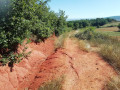
(3) Turn right and follow the D141 carefully as far as the village of Saint-Gervazy. In the village, take the first path on the left, Chemin du Moncelet, and carry on straight ahead.
(4) At the junction, turn left. After 100 m, head up to the right along a forest track.
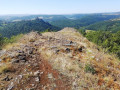
(5) At La Chaux, cross the plateau towards the ruins of the Montcelet tower.
(6) At the junction, take the grassy path on the right and follow the yellow-and-red markings to the woods. Carry on straight ahead, ignoring the paths on the left which climb to the top of the Montcelet hill. After the woods, cross the meadow and continue along the path that leads downhill.
(7) At the junction, turn right and follow the path down to the village of Vichel and the car park (S/E).

 Visorando Member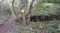

 Average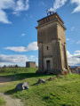
 Difficult