Country:

 City:
City:


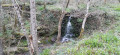
After passing through the village of Azérat, continue for one kilometre towards Saint-Hilaire. Park on the lay-by at the junction with the Route de Chazelle.
(S/E) Start the walk by heading towards Chazelle for 400 metres, until you reach the first path on the left.
(1) Follow this track and continue until you reach the D163. Cross the road carefully and carry on straight ahead.
(2) At this track, turn right until you reach a small tarmac road.
(3) Carry on uphill to Triozon. Walk along the hamlet and take the first path on the left.
(4) Walk down the track to the stream and cross it. Continue to the right along the path that runs alongside it, then cross the stream again after a few dozen metres and follow it on the right-hand side until you reach a crossroads. There is a sign pointing towards Saint-Hilaire and Bouzerat.
(5) Follow the signs for Saint-Hilaire and Bouzerat. Walk through the village until you reach a fork in the path with a grassy island in the middle, near a cross.
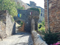
(6) Turn left. After a few metres, head for the path on the left (yellow markings). Continue on to Saint-Hilaire. Reach the church by going up to the left of the war memorial.
(7) Go round the church on the right, then go back down the steps and carry on straight ahead until you reach the edge of the village.
(8) Ignore the turn-off to the left and take the path that continues along the road (steep slope). Cross the stream and head uphill to Le Solier.
(9) Carry on straight ahead through Solier, pass a wash house and continue along the path through the meadows, ignoring the paths on either side. At the fork beneath a power line, carry on straight ahead until you reach a junction.
(10) Carry on straight ahead (yellowPR® markings) until you reach a T-junction.
(11) Turn right onto thePR® “Les Bitoux” and follow it until you reach the second track on the left.
(12) Turn onto this track, heading downhill towards Clémensat, and very soon turn left again. Continue downhill to Clémensat.
(13) Turn sharply right (yellowPR® “Les eaux minérales” signposting), pass Azérat, continue along the road to the junction at the 479-metre mark and turn left.
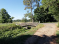
(14) Cross the Ruisseau de Chastan. Take the opportunity to visit the mineral spring, then continue towards Triozon.
(3) At the hairpin bend, rejoin the route you took earlier. Head down to the right, cross the stream and find the path you took on the way there on the left.
(2) Carry on straight ahead and head for the junction with the Route de Chazelle (S/E).


 A really lovely, challenging hike – I found it quite tough, with some steep climbs and descents, and some lovely stretches through the woodland along the stream. I was very pleased with this hike.
 Visorando Member

 Easy
Easy