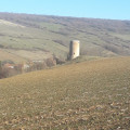
The hillsides of Saint-Gervazy, Pinatelle

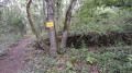
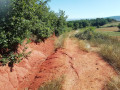
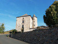
After walking through the fields to reach the beautiful castle of Saint-Gervazy, return via a path through the woodland.

Details

n°56385721
Creation:
Last update:
Last review:
  • Walking
    Activity: Walking
  • ↔
    Distance: 3.97 mi
  • ◔
    Average duration: 2h 10 
  • ▲
    Difficulty: Easy

  • ⚐
    Back to start: Yes
  • ↗
    Ascent: + 397 ft
  • ↘
    Descent: - 381 ft

  • ▲
    Highest point: 1,850 ft
  • ▼
    Lowest point: 1,473 ft

Description of the walk

Park in the town hall car park or on the adjacent streets.

(S/E) From the car park, head downhill to the right along the Grand Rue and, at the Fork in the road, head towards the cemetery and carry on until you come to a dirt track on the left.

(1) Take this track; at the first junction, take the path leading at a right angle to the left, between the copse and the edge of the fields, then ignore a path on the left leading towards the D141 and continue along the path that descends.

(2) The track turns left; follow it until you reach the D141.

(3) Follow it to the right, pass the town hall of Saint-Gervazy and arrive at the bridge over the Volave.

(4) Turn right to cross the small bridge over the Volave, then turn left onto Chemin du Closel, which runs alongside the river, and head towards the castle, which is well worth a look.

(5) Facing the castle, cross the Volane again and turn left onto the Grand Rue, continuing until the junction at the first bridge.

(4) Take the path that climbs to the right, keeping north at each fork. In the woods, the path becomes a track before returning to the plain.

(6) Continue due north until you emerge onto the Grand Rue in Collanges. Turn right, then left to return to the car park (S/E).
Waypoints

  1. S/E : mi 0 - alt. 1,552 ft - Town Hall Square
  2. 1 : mi 0.2 - alt. 1,499 ft - Dirt track junction
  3. 2 : mi 1 - alt. 1,503 ft - Turn left at the fork
  4. 3 : mi 1.72 - alt. 1,650 ft - D141
  5. 4 : mi 2.09 - alt. 1,627 ft - Bridge over the Volave
  6. 5 : mi 2.21 - alt. 1,631 ft - Castle
  7. 6 : mi 3.4 - alt. 1,690 ft - Path across the plain
  8. S/E : mi 3.97 - alt. 1,552 ft - Town Hall Square

Worth a visit

Stroll along the main street of Saint-Gervazy to admire the beautiful, well-restored houses and the castle.
On your return to the Collanges car park, continue downhill, then turn right to admire the castle and its adjoining chapel.

Reviews and comments

5 / 5
Based on 1 review

Reliability of the description
5 / 5
Ease of following the route
5 / 5
Route interest
5 / 5
REDONDIE ARLETTE
REDONDIE ARLETTE

Overall rating : 5 / 5

Date of your route : Sep 23, 2024
Reliability of the description : ★★★★★ Very good
Ease of following the route : ★★★★★ Very good
Route interest : ★★★★★ Very good
Very busy route : No

Our group really enjoyed this walk and the return journey through the beautiful forest

Machine-translated

Other walks in the area

For more walks, use our search engine .

The GPS track and description are the property of this route's author. Please do not copy them without permission.