Country:

 City:


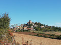


Park in the car park in front of Villeneuve-Lembron Castle.
Signposting: Yellow
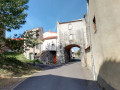
(S/E): With your back to the château, head right towards the church, then take the street on the left (Rue de Chandèze) and follow it onto a wider path further on.
(1) At the fork in the road, stay on the widest path and continue straight on. When you reach the top of the path (elevation 642), take the path opposite which leads down towards Boudes.
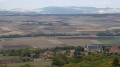
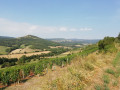
(2) When you reach the first row of vines, turn left and take the path running along the ridge above the Boudes vineyards.
(3) Go down the first tarmac track on the right, towards the village, then at Boudes, turn left onto the tarmac road (D48) and continue along the Route de Saint-Germain.
(4) After the car park in Boudes, turn left and head up the path between the houses. Take the first path on the right and follow it gradually uphill.
(5) At the crossroads, turn left towards the village of Chalus.
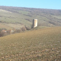
(6) At the junction with the D125, head up to the right towards the castle. At the junction of three streets, take the middle one and turn left at the end. Walk past the cemetery, then head straight down to the road.
(7) Turn right, walk past the farm, and continue straight on towards the Sainte-Madeleine Chapel.
(8) At the chapel, turn left, then turn right into the path through the fields. At the first junction, carry on straight ahead and, at the second, turn left. After 100 metres, take the path on the right.
(9) At the fork in the road, turn left and follow the stone wall. At the crossroads (elevation 495), take the track suitable for vehicles, slightly to the right. Turn right into Rue de la Mouleire, then right again into Rue de la Dame Jaune to reach the car park at the entrance to Villeneuve (S/E).

 Visorando Member

 Moderate