Around the Puy du Joux

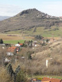
A Sunday stroll to explore the village of Le Breuil-sur-Couze in the first part of the walk, followed by a walk through the surrounding countryside, with views of the volcanic peaks of Nonette and Usson, in the second part.
GPS recommended

Details

1606342
Creation:
Last update:
Last review:
  • Walking
    Activity: Walking
  • ↔
    Distance: 4.35 mi
  • ◔
    Average duration: 2h 10 
  • ▲
    Difficulty: Easy

  • ⚐
    Back to start: Yes
  • ↗
    Ascent: + 200 ft
  • ↘
    Descent: - 200 ft

  • ▲
    Highest point: 1,476 ft
  • ▼
    Lowest point: 1,276 ft

Photos

Description of the walk

Start: A75, exit 17 towards Le Breuil-sur-Couze, on the D726 Rue du Moulin des Prés.
Car park opposite the primary school.

(S/E) From the car park, head due south to join the D726, which you’ll follow for a few hundred metres towards the town centre. Walk past the fountain and the church, then after 300m turn right onto Rue du Rampeau.

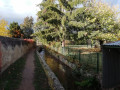
(1) At the end of the street, turn left twice, then shortly afterwards, turn right onto the path running alongside the railway line.

(2) At the end, turn left towards the level crossing. Cross it, then continue straight ahead onto Allée de la Source.
At the cross (hydroxylase spring), keep to the right and continue along the wide path until you reach the road.

(3) Turn right onto this road – this is Allée du Pré des Granges.
Just before the railway line, turn left onto Allée Sainte-Mère-Église and, at the end of it, turn right onto Allée de Chavroche until you reach the crossroads (Saint-Verny cross).

(4) Head up Chemin des Treize Vents to the left. On the slope, at a widening in the path (before the bench), take the small path on the right and climb up to the Madone des Treize Vents (Notre-Dame de la Paix).
Exit at the top of the meadow, turn left and rejoin the road on the right. Walk past a farm, then under the power line, and follow the path as it bends to the right.
Carry on straight ahead, pass the Lembron service area on the A75 and continue towards the footbridge over the A75.

(5) Cross the footbridge; at the end, turn right, walk alongside the A75 for 500m, then pass under the motorway again.

(6) After 500m, the path turns left, then after 100m to the right, and after 300m, when you can see the D726, take the path on the right. You will reach the railway line.

(7) Carry on to return to the Croix de Verny crossroads.

(4) Stay on the path until you reach the footbridge. Cross it and carry on straight ahead along the dirt track.
Turn into the first path on the left, between ancient walls and gardens, and head towards Rue de la Tour.
Turn left to reach Place de la République.

Turn left onto Route d’Issoire and, after 200 metres, you’ll reach the car park where you started (S/E).


Waypoints

  1. S/E : mi 0 - alt. 1,276 ft - Car park opposite the primary school.
  2. 1 : mi 0.28 - alt. 1,283 ft - Junction with Rue du Rampeau
  3. 2 : mi 0.52 - alt. 1,289 ft - Level crossing
  4. 3 : mi 0.84 - alt. 1,299 ft - Route to the right
  5. 4 : mi 1.24 - alt. 1,296 ft - Croix Saint-Verny
  6. 5 : mi 2.29 - alt. 1,437 ft - Footbridge over the A75
  7. 6 : mi 2.88 - alt. 1,312 ft - Turn left at the fork
  8. 7 : mi 3.79 - alt. 1,289 ft - Junction with the railway line
  9. S/E : mi 4.35 - alt. 1,276 ft - Car park opposite the primary school.

Reviews and comments

3.7 / 5
Based on 5 reviews

Reliability of the description
3.8 / 5
Ease of following the route
4.4 / 5
Route interest
3 / 5
mick15
mick15

Overall rating : 4.7 / 5

Date of your route : Feb 24, 2024
Reliability of the description : ★★★★★ Very good
Ease of following the route : ★★★★★ Very good
Route interest : ★★★★☆ Good
Very busy route : No

a lovely walk, a magnificent statue of the Virgin Mary – a shame it’s not well maintained,

Machine-translated

J.Ph ALEXIS
J.Ph ALEXIS
• Edited:

Overall rating : 4.7 / 5

Date of your route : Dec 23, 2023
Reliability of the description : ★★★★★ Very good
Ease of following the route : ★★★★★ Very good
Route interest : ★★★★☆ Good
Very busy route : No

As a group, we explored a large part of this very well-signposted route. In fact, we extended it to 9.5 km instead of the original 7.7 km. We enjoyed this easy route, the village of Le Breuil-sur-Couze, and the various views over Nonette, Le Broc, Usson … etc. The only drawback might be the noise from the motorway. It is a lovely route through the plains. Parking at the starting point is easy to find and there is plenty of space near the school.

Machine-translated

Marion VR
Marion VR ★

The route may have been altered after setting off to avoid crossing private property.

Machine-translated

Marion VR
Marion VR ★

Hello JeffK, thank you for your message. I’ll be in touch with you to find out more.

Machine-translated

JeffK
JeffK

Overall rating : 2.7 / 5

Date of your route : Aug 10, 2023
Reliability of the description : ★★★★☆ Good
Ease of following the route : ★★★☆☆ Average
Route interest : ★☆☆☆☆ Very disappointing
Very busy route : No

Pathetic… that’s the only word that springs to mind.
First of all, the section between the start and point 1 is blocked off by a landowner who has put up numerous crosses (poorly made, like practically all the signposting) and ‘private property’ signs; then, after passing through the village and its housing estates (of no interest whatsoever), you climb up towards a small religious monument… So far, so good. After that, the route follows tracks through harvested fields before reaching the A75 motorway, which you have to cross and then follow for a long distance before crossing it again (via an underpass) and resuming the route through the fields.
The signposting is poorly done and non-existent for the most part.
Apparently, this route is managed by a local authority, which ought to review its management of the paths.

Machine-translated

olivier duport
olivier duport

Overall rating : 2 / 5

Date of your route : Sep 21, 2020
Reliability of the description : ★☆☆☆☆ Very disappointing
Ease of following the route : ★★★★☆ Good
Route interest : ★☆☆☆☆ Very disappointing
Very busy route : No

This walk is just awful 😡
Avoid it at all costs. The paths are utterly dreary; you walk through a completely uninteresting residential area and then follow… the A75 motorway 🛣!!

It’s a nightmare (pollution, noise, a lifeless landscape) and this walk quickly turns into a trial.
The best thing would be to close this so-called ‘hiking trail’ for good – it’s not a proper one.

Machine-translated

paulrod
paulrod

Overall rating : 4.7 / 5

Date of your route : Nov 27, 2018
Reliability of the description : ★★★★☆ Good
Ease of following the route : ★★★★★ Very good
Route interest : ★★★★★ Very good

a lovely walk that takes you to new places

Machine-translated

Other walks in the area

For more walks, use our search engine .

The GPS track and description are the property of this route's author. Please do not copy them without permission.