Between castles and Bacchus

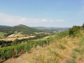
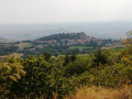
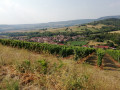
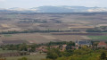
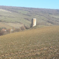
A walk through the farmland of the villages of Villeuneuve-Lembron and Chalus and the vineyards of the village of Boudes.
A route through woods, plateaus and vineyards.

Details

n°1347801
Creation:
Last update:
Last review:
  • Walking
    Activity: Walking
  • ↔
    Distance: 4.62 mi
  • ◔
    Average duration: 2h 50 
  • ▲
    Difficulty: Easy

  • ⚐
    Back to start: Yes
  • ↗
    Ascent: + 830 ft
  • ↘
    Descent: - 827 ft

  • ▲
    Highest point: 2,149 ft
  • ▼
    Lowest point: 1,660 ft

Photos

Description of the walk

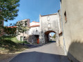
Park in the car park in front of the château.
Yellow markings at the start, then none thereafter.

(S/E): With your back to the castle, head right towards the church, then take the street on the left and follow a wider path (yellow markings).

(1) At the Fork in the road, stay on the widest path and continue straight ahead.

(2) When you reach the top of the path, take the path opposite which leads down towards Boudes (yellow markings)

(3) When you reach the first row of vines, turn left and take the path running along the ridge above the Boudes vineyards. Do not follow the yellow markings (there are no further markings).
As soon as the path is blocked by a vineyard, head back up the hairpin bend on the left (no markings).

(4) Take the first path on the right, heading up towards the pastures until you reach a riding centre

(5) Turn left and follow a wide path. If the path is blocked by wire fencing at the level of the power line, climb onto the dry-stone wall (0.75m high) on the left and cross the plot (easy).

(2) Back at this junction, take the small path leading down to the right (no signposting). You’ll pass a burial mound (covered in vegetation).

(6) After the burial mound, turn left, then left again to rejoin the path you started on.

(1) Head back down, following the yellow markings, to the starting point (S/E).

Waypoints

  1. S/E : mi 0 - alt. 1,736 ft - Château Villeneuve-Lembron car park
  2. 1 : mi 0.34 - alt. 1,867 ft - Crossroads at the end of the circular loop
  3. 2 : mi 0.69 - alt. 2,106 ft - At the top of the plateau
  4. 3 : mi 1.11 - alt. 1,781 ft - Front rows of vines
  5. 4 : mi 2.11 - alt. 1,841 ft - First path on the right (towards the top of the plateau)
  6. 5 : mi 2.48 - alt. 1,991 ft - Equestrian Centre
  7. 6 : mi 4.04 - alt. 1,952 ft - After the burial mound
  8. S/E : mi 4.62 - alt. 1,732 ft - Château Villeneuve-Lembron car park

Worth a visit

Reviews and comments

4.3 / 5
Based on 3 reviews

Reliability of the description
4.3 / 5
Ease of following the route
4 / 5
Route interest
4.7 / 5
User 21406696

Overall rating : 5 / 5

Date of your route : Sep 29, 2026
Reliability of the description : ★★★★★ Very good
Ease of following the route : ★★★★★ Very good
Route interest : ★★★★★ Very good
Very busy route : Yes

A brilliant walk, lovely scenery.

Machine-translated

User 286175

Overall rating : 3.7 / 5

Date of your route : Apr 22, 2026
Reliability of the description : ★★★★☆ Good
Ease of following the route : ★★★☆☆ Average
Route interest : ★★★★☆ Good
Very busy route : No

Best avoided in wet weather (sticky ground)

Machine-translated

pierre5205
pierre5205

This section isn’t signposted; in practice, as soon as you reach the vineyards, turn left and stay along the top of the vineyards until you have to turn left and head back up the hill.

Machine-translated

Martine F
Martine F

Overall rating : 4.3 / 5

Date of your route : Aug 27, 2018
Reliability of the description : ★★★★☆ Good
Ease of following the route : ★★★★☆ Good
Route interest : ★★★★★ Very good

We got a bit lost in the vineyards above Boudes, but we found our way back quite quickly.

Thank you for this lovely walk.

Machine-translated

Other walks in the area

For more walks, use our search engine .

The GPS track and description are the property of this route's author. Please do not copy them without permission.